
The Cayman Trough is a complex transform fault zone pull-apart basin which contains a small spreading ridge, the Mid-Cayman Rise, on the floor of the western Caribbean Sea between Jamaica and the Cayman Islands. It is the deepest point in the Caribbean Sea and forms part of the tectonic boundary between the North American Plate and the Caribbean Plate. It extends from the Windward Passage, going south of the Sierra Maestra of Cuba toward Guatemala. The transform continues onshore as the Motagua Fault, which cuts across Guatemala and extends offshore under the Pacific Ocean, where it intersects the Middle America Trench subduction zone.

The South Shetland Trough is an undersea trough located north of the South Shetland Islands. It is the remnant of a subduction zone where the defunct Phoenix Plate, now part of the Antarctic Plate, subducted under the Antarctic Peninsula and the South Shetland Islands.

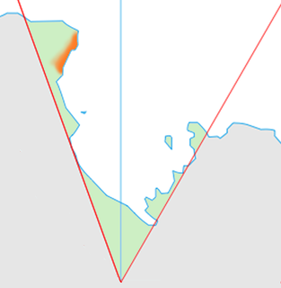
Bransfield Strait or Fleet Sea is a body of water about 100 kilometres (60 mi) wide extending for 300 miles (500 km) in a general northeast – southwest direction between the South Shetland Islands and the Antarctic Peninsula.

The Rockall Trough is a deep-water bathymetric feature to the northwest of Scotland and Ireland, running roughly from southwest to northeast, flanked on the north by the Rockall Plateau and to the south by the Porcupine Seabight. At the northern end, the channel is bounded by the Wyville-Thomson Ridge, named after Charles Wyville Thomson, professor of zoology at the University of Edinburgh and driving force behind the Challenger Expedition. At the southern end, the trough opens into the Porcupine abyssal plain. The Rockall Basin is a large sedimentary basin that lies beneath the trough. Both are named after Rockall, a rocky islet lying 301.4 km west of St Kilda.
Cape Adare is a prominent cape of black basalt forming the northern tip of the Adare Peninsula and the north-easternmost extremity of Victoria Land, East Antarctica.
Astapenko Glacier is a glacier, 11 miles (18 km) long, draining the north and northeast slopes of Stanwix Peak in the Bowers Mountains and flowing east-northeast to Ob' Bay, situated in Victoria Land, Antarctica. It was mapped by the United States Geological Survey from surveys and from U.S. Navy air photos, 1960–62, and named by the Advisory Committee on Antarctic Names for Pavel D. Astapenko, Soviet IGY observer, a Weather Central meteorologist at Little America V in 1958. The glacier lies on the Pennell Coast, a portion of Antarctica lying between Cape Williams and Cape Adare.

Adare Seamounts, also known as Adare Mountains, are the seamounts in Balleny Basin named in association with Adare Peninsula and Cape Adare. Name approved by the Advisory Committee on Undersea Features, June 1988.
Adélie Valley, also variously known as Adilie Valley, Dumont d'Urville Trough or Adélie Trough, is a drowned fjord on the continental margin of East Antarctica. Named in association with this long named portion of Wilkes Land on the Antarctic coast. Name approved by the Advisory Committee on Undersea Features in December 1971.
Ainley Peak is a prominent peak, 1,240 metres (4,070 ft) high, located 3 miles (5 km) southwest of Post Office Hill in east Ross Island. Named after David G. Ainley, Point Reyes Bird Observatory, Stinson Beach, California, a United States Antarctic Program ornithologist who studied penguin and skua populations at Cape Crozier and McMurdo Sound in six seasons, 1969–70 to 1983–84.
The Lazarev Trough is an undersea trough off the coast of Antarctica. It was named for the Russian polar explorer Admiral Mikhail P. Lazarev, commanding officer of the sloop Mirnyy during the Bellingshausen expedition of 1819–1821. The name, proposed by Dr. G. Agapova of the Geological Institute of the Russian Academy of Sciences, was approved by the Advisory Committee for Undersea Features in August 1985.
The Borchgrevink Coast is that portion of the coast of Victoria Land between Cape Adare and Cape Washington. The name was recommended by New Zealand Antarctic Place-Names Committee in 1961 after Carsten Borchgrevink, a member of Henrik Johan Bull's expedition to this area, 1894–95, and leader of the British Antarctic Expedition, 1898–1900, the first to winter on the continent, at Cape Adare.
Cape Williams is an ice-covered cape which is the termination of Buell Peninsula at the east side of the terminus of Lillie Glacier at the lower ends of George Glacier and Zykov Glacier. The peninsula is 15 nautical miles (28 km) long and is situated at the extremity of the Pennell Coast portion of Victoria Land, lying between Cape Williams and Cape Adare. It was discovered in February 1911 when the Terra Nova of the British Antarctic Expedition, 1910–13, explored the area westward of Cape North, and it was named for William Williams, Chief Engine-room Artificer on the Terra Nova.
Balleny Trough is an undersea trough named in association with the Balleny Islands. The name was approved by the Advisory Committee for Undersea Features in February 1972.
Barnett Glacier is a large glacier in the Anare Mountains that flows east along the south side of Tapsell Foreland into Smith Inlet, northern Victoria Land, Antarctica. It was mapped by the United States Geological Survey (USGS) from surveys and from U.S. Navy air photos, 1960–63, and named by the Advisory Committee on Antarctic Names after Donald C. Barnett, USGS topographic engineer, a member of USGS Topo East and West, 1962–63, in which the expedition extended geodetic control from the area of Cape Hallett to the Wilson Hills and from the foot of Beardmore Glacier through the Horlick Mountains. The glacier lies on the Pennell Coast, a portion of Antarctica lying between Cape Williams and Cape Adare.
Bowers Canyon is an undersea canyon west of Iselin Bank in the Ross Sea. It was named in association with Bowers Glacier by the Advisory Committee for Undersea Features in April 1980.
Dubinin Trough is an undersea trough named for Soviet Captain A.I. Dubinin, leader of the 1957 Antarctic expedition. The name was proposed by Dr. G. Agapova of the Geological Institute of the Russian Academy of Sciences, and was approved by the Advisory Committee for Undersea Features in August 1985.
Falkenhof Glacier is a tributary glacier 7 nautical miles (13 km) long, flowing west from the vicinity of Tricorn Mountain to enter Snakeskin Glacier northwest of Mount Clarke, Antarctica. It was named by the Advisory Committee on Antarctic Names for Jack J. Falkenhof, a United States Antarctic Research Program meteorologist at South Pole Station, 1963.
Hespérides Trough is an undersea trough named for the Spanish research vessel Hespérides. The name was approved by the Advisory Committee on Undersea Features in November 1995.

Hofmann Trough is a submarine bank in the Weddell Sea. It is named for Walther Hofmann (1920–1993), a cartographer/photogrammetrist on polar expeditions. The name proposed by Dr. Heinrich Hinze of the Alfred Wegener Institute for Polar and Marine Research, Bremerhaven, Germany, and was approved by the Advisory Committee for Undersea Features in June 1997.

The Adare Basin is a geologic structural basin located north-east of Cape Adare of Antarctica, for which its named, and north of the western Ross Sea. The Adare Basin is an extensional rift basin located along a seafloor spreading center that forms the failed arm of the Tertiary spreading ridge separating East and West Antarctica, known as the West Antarctic Rift System and similar in structure to the East Africa Rift System. Centrally located in the Adare Basin is the Adare Trough. The extension of this rift system is recorded in a series of magnetic anomalies which run along the seafloor at the extinct, north–south trending, Adare spreading axis. The Adare spreading system continues unbroken into the Northern Basin underlying the adjacent Ross Sea continental shelf.