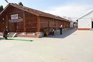
Dantewada District, also known as Dantewara District or Dakshin Bastar District, is a district in the Indian state of Chhattisgarh. Dantewada is the district headquarters. The district is part of Bastar Division. Until 1998, Dantewada District was a tehsil of the larger Bastar District.

Janjgir–Champa district is a district in the Indian state of Chhattisgarh. The district headquarters of the district Janjgir–Champa, Janjgir, is the city of Maharaja Jajawalya Dev of the Kalachuri dynasty. Earlier a part of the Bilaspur district, Jangir was carved out in 1998 to a separate district of its own, and ran to a political controversy about the name of the freshly minted district, which it carries to date as the name "Janjgir–Champa". Inhabitants are generally migrants from nearby villages.

Korba District is an administrative district of Chhattisgarh state in central India. The headquarter of this district is Korba.
Madhira is a municipality situated in the Khammam district of the Indian state of Telangana, falling within the Madhira Assembly Constituency. This area is located in the Madhira mandal of Khammam division and is positioned approximately 230 kilometers east of the state capital, Hyderabad. Additionally, it is situated 53 kilometers from the district headquarters Khammam and is bordered by Andhra Pradesh state on three sides.
Mhowgaon is a Nagar Panchayat under Sub Division Dr. Ambedkar Nagar (Mhow) in Indore district in the Indian state of Madhya Pradesh. The total geographical area of Mhowgaon nagar panchayat is 13.5 km2 and it is the smallest city by area in the sub district. The population density of the city is 2309 persons per km2. Mhowgaon is divided into 15 wards for which elections are held every 5 years. Among them, Mhowgaon Ward No. 2 is the most populous ward with a population of 3440 and Mhowgaon Ward No. 15 is the least populous ward with a population of 957. Mhowgaon Nagar Panchayat has total administration over 6,373 houses to which it supplies basic amenities like water and sewerage. It is also authorized to build roads within Nagar Panchayat limits and impose taxes on properties coming under its jurisdiction.
Peth or Peint is the smallest tehsil of Nashik subdivision of Nashik district in Maharashtra, India. It belongs to Northern Maharashtra region. It belongs to Nashik Division. Peth is a Taluka headquarter. It is located 54 km to the West of Nashik District headquarters. It is also called as Peint. Pin code of Peth is 422208 and postal head office is Peth.

Nokha is a nagar panchayat town and corresponding community development block in Rohtas district in the Indian state of Bihar. As of 2011, the population of the town of Nokha was 27,302 in 4,381 households. The rural population of Nokha block was 146,025, thus bringing the total block population 173,327. The economic situation of this region is mainly dependent on parboiled rice processed by number of rice mills in this area.
Tikota is a taluka in the southern state of Karnataka, India. It is located in the Bijapur District.
Sihaul is a village with population of about 11,000 in the sub-district of Satar Kataiya, where it ranks as the third most populous village. The sub-district forms a part of Saharsa district in the state Bihar, India. The geographical area of the village is 9 km2 (3.5 sq mi) and it is the third biggest village by area in the sub-district. Population density of the village is 1287 persons per km2.

Bijapur District, formerly known as Birjapur, is one of the 27 districts of the state of Chhattisgarh in central India. It is one of the two new districts created on May 11, 2007. As of 2011 it is the second least populous district of Chhattisgarh, after Narayanpur. It is the second-least literate district in India, with a literacy rate of at 41.58%, according to the 2011 census.
Manakawad is a village in Dharwad district of Karnataka, India.
Anda is a village located in Durg Tehsil of Durg district in the Indian state of Chhattisgarh. The village population is estimated to be at 4,169.
Baloke is a village situated in the Barnala district, Punjab, India. As of the 2011 census, it had a population of 1,303 persons.
Bhor Garh is a census town in North West district in the Indian territory of Delhi. It is a Saini majority village while Rajputs are slightly lesser than Sainis.
Alaginal is a village in the southern state of Karnataka, India. It is located in the Bijapur taluk of Bijapur district.
Darya Pur Kalan (1329) is a village in North West district in the Indian territory of Delhi.
Bankauli is a census town in North West district in the Indian territory of Delhi.
Arjunagi is a village in the southern state of Karnataka, India. It is located in the Bijapur taluk of Bijapur district.
Aaded is a village in the central state of Chhattisgarh, India. It is located in the Bijapur taluk of Bijapur district.
Bhogamguda is a village in the central state of Chhattisgarh, India. It is located in the Bijapur taluk of Bijapur district.


