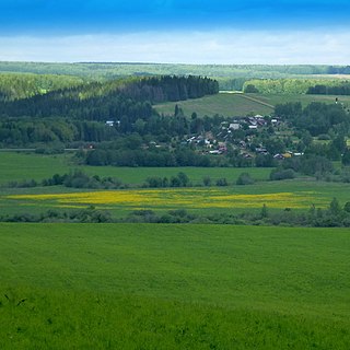
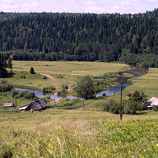
Perm Oblast was a federal subject of Russia until November 30, 2005. On December 1, 2005 it was merged with Komi-Permyak Autonomous Okrug to form Perm Krai.
| Perm Oblast, Russia | |
|---|---|
| As of November 30, 2005: [1] | |
| # of districts (районы) | 27 |
| # of cities/towns (города) | 24 |
| # of urban-type settlements (посёлки городского типа) | 38 |
| # of selsovets (сельсоветы) | 446 |
| As of 2002: [2] | |
| # of rural localities (сельские населённые пункты) | 3,253 |
| # of uninhabited rural localities (сельские населённые пункты без населения) | 322 |
- Urban-type settlements under the federal government management:
- Zvyozdny (Звёздный)
- Cities and towns under the oblast's jurisdiction:
- Perm (Пермь) (administrative center)
- city districts:
- Dzerzhinsky (Дзержинский)
- Industrialny (Индустриальный)
- Kirovsky (Кировский)
- Leninsky (Ленинский)
- Motovilikhinsky (Мотовилихинский)
- Ordzhonikidzevsky (Орджоникидзевский)
- Sverdlovsky (Свердловский)
- city districts:
- Alexandrovsk (Александровск)
- Urban-type settlements under the town's jurisdiction:
- Vsevolodo-Vilva (Всеволодо-Вильва)
- Yayva (Яйва)
- with 5 selsovets under the town's jurisdiction.
- Urban-type settlements under the town's jurisdiction:
- Berezniki (Березники)
- with 1 selsovet under the city's jurisdiction.
- Chaykovsky (Чайковский)
- with 10 selsovets under the town's jurisdiction.
- Chusovoy (Чусовой)
- Urban-type settlements under the town's jurisdiction:
- Kalino (Калино)
- Komarikhinsky (Комарихинский)
- Lyamino (Лямино)
- Skalny (Скальный)
- Verkhnechusovskiye Gorodki (Верхнечусовские Городки)
- with 6 selsovets under the town's jurisdiction.
- Urban-type settlements under the town's jurisdiction:
- Dobryanka (Добрянка)
- Urban-type settlements under the town's jurisdiction:
- Polazna (Полазна)
- with 18 selsovets under the town's jurisdiction.
- Urban-type settlements under the town's jurisdiction:
- Gremyachinsk (Гремячинск)
- Urban-type settlements under the town's jurisdiction:
- Shumikhinsky (Шумихинский)
- Usva (Усьва)
- Yubileyny (Юбилейный)
- Urban-type settlements under the town's jurisdiction:
- Gubakha (Губаха)
- Urban-type settlements under the town's jurisdiction:
- Shirokovsky (Широковский)
- Ugleuralsky (Углеуральский)
- Urban-type settlements under the town's jurisdiction:
- Kizel (Кизел)
- Urban-type settlements under the town's jurisdiction:
- Severny-Kospashsky (Северный-Коспашский)
- Shakhta (Шахта)
- Tsentralny-Kospashsky (Центральный-Коспашский)
- Yuzhny-Kospashsky (Южный-Коспашский)
- Urban-type settlements under the town's jurisdiction:
- Krasnokamsk (Краснокамск)
- Urban-type settlements under the town's jurisdiction:
- Overyata (Оверята)
- with 6 selsovets under the town's jurisdiction.
- Urban-type settlements under the town's jurisdiction:
- Kungur (Кунгур)
- Lysva (Лысьва)
- with 13 selsovets under the town's jurisdiction.
- Solikamsk (Соликамск)
- Perm (Пермь) (administrative center)
- Districts:
- Bardymsky (Бардымский)
- with 17 selsovets under the district's jurisdiction.
- Beryozovsky (Берёзовский)
- with 12 selsovets under the district's jurisdiction.
- Bolshesosnovsky (Большесосновский)
- with 14 selsovets under the district's jurisdiction.
- Chastinsky (Частинский)
- with 11 selsovets under the district's jurisdiction.
- Cherdynsky (Чердынский)
- Chernushinsky (Чернушинский)
- Towns under the district's jurisdiction:
- Chernushka (Чернушка)
- with 18 selsovets under the district's jurisdiction.
- Towns under the district's jurisdiction:
- Gornozavodsky (Горнозаводский)
- Towns under the district's jurisdiction:
- Gornozavodsk (Горнозаводск)
- Urban-type settlements under the district's jurisdiction:
- Biser (Бисер)
- Kusye-Alexandrovsky (Кусье-Александровский)
- Medvedka (Медведка)
- Novovilvensky (Нововильвенский)
- Pashiya (Пашия)
- Promysla (Промысла)
- Sarany (Сараны)
- Stary Biser (Старый Бисер)
- Tyoplaya Gora (Тёплая Гора)
- with 1 selsovet under the district's jurisdiction.
- Towns under the district's jurisdiction:
- Ilyinsky (Ильинский)
- Karagaysky (Карагайский)
- with 16 selsovets under the district's jurisdiction.
- Kishertsky (Кишертский)
- with 14 selsovets under the district's jurisdiction.
- Krasnovishersky (Красновишерский)
- Towns under the district's jurisdiction:
- Krasnovishersk (Красновишерск)
- with 11 selsovets under the district's jurisdiction.
- Towns under the district's jurisdiction:
- Kungursky (Кунгурский)
- with 26 selsovets under the district's jurisdiction.
- Kuyedinsky (Куединский)
- with 22 selsovets under the district's jurisdiction.
- Nytvensky (Нытвенский)
- Towns under the district's jurisdiction:
- Nytva (Нытва)
- Urban-type settlements under the district's jurisdiction:
- Novoilyinsky (Новоильинский)
- Uralsky (Уральский)
- with 11 selsovets under the district's jurisdiction.
- Towns under the district's jurisdiction:
- Ochyorsky (Очёрский)
- Okhansky (Оханский)
- Towns under the district's jurisdiction:
- Okhansk (Оханск)
- with 8 selsovets under the district's jurisdiction.
- Towns under the district's jurisdiction:
- Oktyabrsky (Октябрьский)
- Urban-type settlements under the district's jurisdiction:
- Oktyabrsky (Октябрьский)
- Sars (Сарс)
- with 22 selsovets under the district's jurisdiction.
- Urban-type settlements under the district's jurisdiction:
- Ordinsky (Ординский)
- with 14 selsovets under the district's jurisdiction.
- Osinsky (Осинский)
- Towns under the district's jurisdiction:
- Osa (Оса)
- with 13 selsovets under the district's jurisdiction.
- Towns under the district's jurisdiction:
- Permsky (Пермский)
- Urban-type settlements under the district's jurisdiction:
- Yugo-Kamsky (Юго-Камский)
- with 29 selsovets under the district's jurisdiction.
- Urban-type settlements under the district's jurisdiction:
- Sivinsky (Сивинский)
- with 11 selsovets under the district's jurisdiction.
- Solikamsky (Соликамский)
- with 14 selsovets under the district's jurisdiction.
- Suksunsky (Суксунский)
- Urban-type settlements under the district's jurisdiction:
- Suksun (Суксун)
- with 14 selsovets under the district's jurisdiction.
- Urban-type settlements under the district's jurisdiction:
- Uinsky (Уинский)
- with 13 selsovets under the district's jurisdiction.
- Usolsky (Усольский)
- Vereshchaginsky (Верещагинский)
- Towns under the district's jurisdiction:
- Vereshchagino (Верещагино)
- with 13 selsovets under the district's jurisdiction.
- Towns under the district's jurisdiction:
- Yelovsky (Еловский)
- with 10 selsovets under the district's jurisdiction.
- Bardymsky (Бардымский)