Tyoplaya Gora

Last updated • 1 min readFrom Wikipedia, The Free Encyclopedia
Tyoplaya Gora
Тёплая Гора
Location of Tyoplaya Gora
Tyoplaya Gora
Russia administrative location map.svg
Red pog.svg
Tyoplaya Gora
Location of Tyoplaya Gora
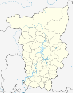
Outline Map of Perm Krai.svg
Red pog.svg
Tyoplaya Gora
Tyoplaya Gora (Perm Krai)
Coordinates: 58°31′N59°04′E / 58.517°N 59.067°E / 58.517; 59.067
Country Russia
Federal subject Perm Krai
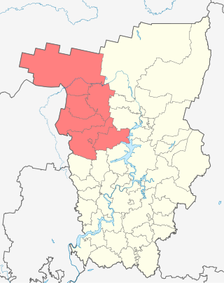
Administrative district Gornozavodsky District
Founded1880 OOjs UI icon edit-ltr-progressive.svg
Urban-type settlement status since1928
Population
  Total3,306
  Estimate 
(2018) [2]
2,826 (−14.5%)
Time zone UTC+5 (MSK+2   OOjs UI icon edit-ltr-progressive.svg [3] )
Postal code(s) [4]
618870 OOjs UI icon edit-ltr-progressive.svg
OKTMO ID57614406051

Tyoplaya Gora (Russian: Тёплая Гора́) is an urban locality (an urban-type settlement) in Gornozavodsky District of Perm Krai, Russia, located on the western slopes of the Ural Mountains, on the Koyva River, 14 kilometers (8.7 mi) from the border with Sverdlovsk Oblast. Population: 3,306(2010 Census); [1] 3,860(2002 Census); [5] 4,558(1989 Census). [6]

Contents

History

In 1884, Count Shuvalov built the Teplogorský Ironworks. [7] The first factory settlement appeared somewhat earlier. [8] The settlement got its name from the Teplyaya mountain. The first settlers so-called the new "warm" place. [9]

Tyoplaya Gora station in the early 20th century Stantsiia Teplaia Gora, Permskaia zheleznaia doroga.jpg
Tyoplaya Gora station in the early 20th century

In 1912 the first and the only Russian blast furnace with an elliptical profile of that time was built here. At the mines of Krestovozdvizhensky fields, near to settlement, in 1829 the first diamond in Russia has been found, gold and platinum were extracted industrial way.

Before the construction, Gornozavodskoy Uralian line in 1879 all finished goods of plants Biser, Teplyaya Gora and Kusye-Alexandrovsk were fused by barges to Koyva and Chusovaya to the Kama.

Settlement status – from August 27, 1928. [8]

In 1956 plant was transformed to casting-mechanical.

Since December 1987, the crushed stone plant began to work.

Transportation

A paved road connects Tyoplaya Gora with Gornozavodsk and Kachkanar.In addition to standard roads for motor vehicles, this region is also well connected by railway.

Related Research Articles

<span class="mw-page-title-main">Komi-Permyak Okrug</span> Territory in Perm Krai, Russia

Komi-Permyak Okrug, or Permyakia is a territory with special status within Perm Krai, Russia. Its administrative center is the town of Kudymkar. Population: 116,157 (2010 Census); 136,076 (2002 Census); 159,689 (1989 Census).

Pavlovsky is an urban locality in Ochyorsky District of Perm Krai, Russia. Population: 3,191 (2010 Census); 3,408 (2002 Census); 3,834 (1989 Census).

<span class="mw-page-title-main">Usolye, Usolsky District, Perm Krai</span> Town in Perm Krai, Russia

Usolye is a town and the administrative center of Usolsky District in Perm Krai, Russia, located on the right bank of the Kama River, opposite of the city of Berezniki and 190 kilometers (120 mi) north of Perm, the administrative center of the krai. As of the 2010 Census, its population was 5,694.

<span class="mw-page-title-main">Kishertsky District</span> District in Perm Krai, Russia

Kishertsky District is an administrative district (raion) of Perm Krai, Russia; one of the thirty-three in the krai. Municipally, it is incorporated as Kishertsky Municipal District. It is located in the southeast of the krai. The area of the district is 1,400 square kilometers (540 sq mi). Its administrative center is the rural locality of Ust-Kishert. Population: 12,777 (2010 Census); 15,093 (2002 Census); 17,957 (1989 Census). The population of Ust-Kishert accounts for 32.9% of the district's total population.
<span class="mw-page-title-main">Oktyabrsky District, Perm Krai</span> District in Perm Krai, Russia

Oktyabrsky District is an administrative district (raion) of Perm Krai, Russia; one of the thirty-three in the krai. Municipally, it is incorporated as Oktyabrsky Municipal District. It is located in the southeast of the krai. The area of the district is 3,444 square kilometers (1,330 sq mi). Its administrative center is the urban locality of Oktyabrsky. Population: 30,441 (2010 Census); 36,463 (2002 Census); 39,253 (1989 Census). The population of the administrative center accounts for 32.3% of the district's total population.

<span class="mw-page-title-main">Polazna</span> Urban-type settlement in Perm Krai, Russia

Polazna is an urban locality under the administrative jurisdiction of the Town of Dobryanka in Perm Krai, Russia, located on the east bank of Kama Reservoir, 45 kilometers (28 mi) north of Perm and 25 kilometers (16 mi) south of Dobryanka. Population: 12,753 (2010 Census); 13,303 (2002 Census); 12,113 (1989 Census).

Overyata is an urban locality under the administrative jurisdiction of the Town of Krasnokamsk in Perm Krai, Russia, located 26 kilometers (16 mi) west of Perm. Population: 4,634 (2010 Census); 4,622 (2002 Census); 4,955 (1989 Census).

<span class="mw-page-title-main">Uralsky, Perm Krai</span> Work settlement in Perm Krai, Russia

Uralsky is an urban locality in Nytvensky District of Perm Krai, Russia, located on the right bank of the Kama River. Population: 8,014 (2010 Census); 8,929 (2002 Census); 9,017 (1989 Census).

Kuyeda is a rural locality and the administrative center of Kuyedinsky District of Perm Krai, Russia. Population: 9,551 (2010 Census); 9,809 (2002 Census); 9,613 (1989 Census).

<span class="mw-page-title-main">Suksun</span> Urban-type settlement in Perm Krai, Russia

Suksun is an urban locality and the administrative center of Suksunsky District of Perm Krai, Russia, located on the left bank of the Sylva River, 150 kilometers (93 mi) from the city of Perm. Population: 8,022 (2010 Census); 8,495 (2002 Census); 8,882 (1989 Census).

Oktyabrsky is an urban locality and the administrative center of Oktyabrsky District of Perm Krai, Russia. Population: 9,845 (2010 Census); 10,039 (2002 Census); 8,961 (1989 Census).

Vsevolodo-Vilva is an urban locality in Perm Krai, Russia. Population: 2,827 (2010 Census); 3,629 (2002 Census); 4,448 (1989 Census).

Novovilvensky is an urban locality in Gornozavodsky District of Perm Krai, Russia. Population: 177 (2010 Census); 421 (2002 Census); 1,066 (1989 Census).

Shirokovsky is an urban locality in Gubakha Urban Okrug, Perm Krai, Russia. Population: 3,322 (2010 Census); 1,869 (2002 Census); 1,610 (1989 Census).

Medvedka is an urban locality in Gornozavodsky District of Perm Krai, Russia. Population: 370 (2010 Census); 816 (2002 Census); 1,008 (1989 Census).

Ugleuralsky is an urban locality in Perm Krai, Russia. Population: 5,352 (2010 Census); 10,428 (2002 Census); 11,108 (1989 Census).

Pashiya is an urban locality in Gornozavodsky District of Perm Krai, Russia. Population: 3,898 (2010 Census); 4,245 (2002 Census); 5,317 (1989 Census).

Sarany is an urban locality in Gornozavodsky District of Perm Krai, Russia. Population: 1,097 (2010 Census); 1,255 (2002 Census); 1,351 (1989 Census).

Lyamino is an urban locality in Perm Krai, Russia. Population: 4,598 (2010 Census); 5,127 (2002 Census); 5,577 (1989 Census).

Skalny is an urban locality in Chusovoy Urban Okrug, Perm Krai, Russia. Population: 1,853 (2010 Census); 2,122 (2002 Census); 5,951 (1989 Census).

References

  1. 1 2 Russian Federal State Statistics Service (2011). Всероссийская перепись населения 2010 года. Том 1 [2010 All-Russian Population Census, vol. 1]. Всероссийская перепись населения 2010 года [2010 All-Russia Population Census] (in Russian). Federal State Statistics Service.
  2. "26. Численность постоянного населения Российской Федерации по муниципальным образованиям на 1 января 2018 года". Federal State Statistics Service. Retrieved January 23, 2019.
  3. "Об исчислении времени". Официальный интернет-портал правовой информации (in Russian). June 3, 2011. Retrieved January 19, 2019.
  4. Почта России. Информационно-вычислительный центр ОАСУ РПО. (Russian Post). Поиск объектов почтовой связи (Postal Objects Search) (in Russian)
  5. Russian Federal State Statistics Service (May 21, 2004). Численность населения России, субъектов Российской Федерации в составе федеральных округов, районов, городских поселений, сельских населённых пунктов – районных центров и сельских населённых пунктов с населением 3 тысячи и более человек [Population of Russia, Its Federal Districts, Federal Subjects, Districts, Urban Localities, Rural Localities—Administrative Centers, and Rural Localities with Population of Over 3,000](XLS). Всероссийская перепись населения 2002 года [All-Russia Population Census of 2002] (in Russian).
  6. Всесоюзная перепись населения 1989 г. Численность наличного населения союзных и автономных республик, автономных областей и округов, краёв, областей, районов, городских поселений и сёл-райцентров [All Union Population Census of 1989: Present Population of Union and Autonomous Republics, Autonomous Oblasts and Okrugs, Krais, Oblasts, Districts, Urban Settlements, and Villages Serving as District Administrative Centers]. Всесоюзная перепись населения 1989 года [All-Union Population Census of 1989] (in Russian). Институт демографии Национального исследовательского университета: Высшая школа экономики [Institute of Demography at the National Research University: Higher School of Economics]. 1989 via Demoscope Weekly.
  7. Ros. Akad. Nauk, Ural. Otd-nie, In-t Istorii i Archeologii (2001). Metallurgičeskie zavody Urala : XVII – XX vv. : ėnciklopedija. Ekaterinburg: Akademkniga. ISBN   5-93472-057-0. OCLC   645505489.{{cite book}}: CS1 maint: multiple names: authors list (link)
  8. 1 2 "УРАЛ. Иллюстрированная краеведческая энциколопедия | Т ТЕГ–ТОРГ | Книги энциклопедии фотоальбомы об Урале купить | Издательство Квист | Николай Рундквист". quist.pro. Retrieved December 28, 2021.
  9. Шумилов, Евгений Николаевич; Николаев, Юрий Константинович (2005). Твоя малая родина (in Russian).