Adolf S. Jensen Land

Last updated
Adolf S. Jensen Land
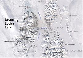
Dronning Louise Land-NE Greenland.jpg
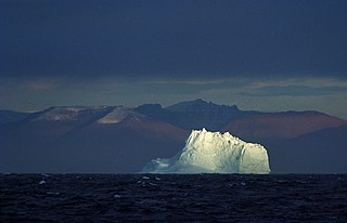
Adolf S. Jensen Land in the southeast
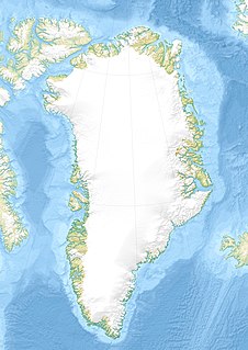
Greenland edcp location map.svg
Red pog.svg
Adolf S. Jensen Land
Location
Geography
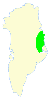
LocationEast Greenland
Coordinates 76°5′N20°50′W / 76.083°N 20.833°W / 76.083; -20.833 Coordinates: 76°5′N20°50′W / 76.083°N 20.833°W / 76.083; -20.833
Adjacent bodies of water
Length55 km (34.2 mi)
Width30 km (19 mi)
Highest elevation1,058 m (3,471 ft)
Administration
Greenland (Denmark)
Zone NE Greenland National Park
Demographics
PopulationUninhabited

Adolf S. Jensen Land (Danish : Ad. S. Jensen Land) is a peninsula in the southern limit of King Frederick VIII Land, northeastern Greenland. [1] Administratively it belongs to the NE Greenland National Park area.

Danish language North Germanic language spoken in Denmark

Danish is a North Germanic language spoken by around six million people, principally in Denmark and in the region of Southern Schleswig in northern Germany, where it has minority language status. Also, minor Danish-speaking communities are found in Norway, Sweden, Spain, the United States, Canada, Brazil, and Argentina. Due to immigration and language shift in urban areas, around 15–20% of the population of Greenland speak Danish as their first language.
Peninsula A piece of land that is bordered by water on three sides but connected to mainland.

A peninsula is a landform surrounded by water on the majority of its border while being connected to a mainland from which it extends. The surrounding water is usually understood to be continuous, though not necessarily named as a single body of water. Peninsulas are not always named as such; one can also be a headland, cape, island promontory, bill, point, fork, or spit. A point is generally considered a tapering piece of land projecting into a body of water that is less prominent than a cape. A river which courses through a very tight meander is also sometimes said to form a "peninsula" within the loop of water. In English, the plural versions of peninsula are peninsulas and, less commonly, peninsulae.

King Frederick VIII Land Region in Greenland

King Frederick VIII Land is a major geographic division of northeastern Greenland. It extends above the Arctic Circle from 76°N to 81°N in a N/S direction along the coast of the Greenland Sea.

Contents


History

The landmass north of Bessel Fjord was deemed to be an island by the Second German North Polar Expedition led by Carl Koldewey that partially explored the area in 1869–70. Koldewey used the name 'Peschel Island' in the English edition of his 1869–70 narrative. [2]

German North Polar Expedition series of arctic German expeditions

The German North Polar Expeditions were a short series of mid-19th century German expeditions to the Arctic. The aim was to explore the North Pole region and to brand the newly united, Prussian-led German Empire as a great power. In 1866, German geographer August Petermann wrote a pamphlet strongly advocating German participation in the international quest for the North Pole, which stimulated a German expedition.

Carl Koldewey German explorer

Carl Christian Koldewey was a German Arctic explorer. He led both German North Polar Expeditions.

The area was later visited by the ill-fated 1906–08 Denmark Expedition (Danmark Ekspeditionen) which named a few landmarks, such as the narrow Syttendemajfjorden in the north. Finally the peninsula was surveyed and mapped in 1932 by Lauge Koch during aerial surveys made during the 1931–34 Three-year Expedition to East Greenland (Treårsekspeditionen). It was named after Danish zoologist Adolf Severin Jensen (1866 - 1953), professor at the University of Copenhagen, who had carried out extensive research on the fisheries of West Greenland, and who was a member of the committee of the 1931–34 Three-year Expedition. [2]

Lauge Koch Danish geologist

Lauge Koch was a Danish geologist and Arctic explorer.

Three-year Expedition to East Greenland

The Three-year Expedition was an exploratory expedition to East Greenland that lasted from 1931 to 1934 financed by the Carlsberg Foundation and the Danish state. The expedition included aerial surveys.

University of Copenhagen public research university in Copenhagen, Denmark

The University of Copenhagen (UCPH) is the oldest university and research institution in Denmark. Founded in 1479 as a studium generale, it is the second oldest institution for higher education in Scandinavia after Uppsala University (1477). The university has 23,473 undergraduate students, 17,398 postgraduate students, 2,968 doctoral students and over 9,000 employees. The university has four campuses located in and around Copenhagen, with the headquarters located in central Copenhagen. Most courses are taught in Danish; however, many courses are also offered in English and a few in German. The university has several thousands of foreign students, about half of whom come from Nordic countries.

Besselfjord Station was built in Adolf S. Jensen Land's southeastern shore. [3] Also the Alf Bruun Hytta and the Carl Ritterhytta, Strømsbukta and Johns Hytta hunting huts were built in the eastern part of the peninsula, the latter three by John Giæver while he lived as a trapper in north-eastern Greenland from 1929 to 1934. The Nanok East Greenland Fishing Company built the hunting huts Laksehytten in 1939 and Fiskerhytten in 1951, both located at the head of Syttendemajfjorden, and Påskehytten, a hut in the east coast in 1938. [2]

John Schjelderup Giæver was a Norwegian author and polar researcher.

Nanok East Greenland Fishing Company

Nanok East Greenland Fishing Company, generally known as 'Nanok' —meaning "polar bear" in Greenlandic, was a Danish company in Greenland.

Geography

Adolf S. Jensen Land is bounded in the west by the Soranerbraen Glacier —beyond which lies Rechnitzer Land, in the north by the Fangersund of the Inderbredningen and the Trangsund of the Dove Bay, in the east by the Storebaelt that opens into the Greenland Sea, and in the south by the Bessel Fjord. Queen Margrethe II Land lies to the south of the Bessel Fjord. [2] Cape Karl Ritter is the peninsula's easternmost point and the Hawkins Vandfald waterfall is located in the southeastern part. There is an ice cap in the SW. [1]

Dove Bay bay in Greenland

Dove Bay is a bay in King Frederick VIII Land, northeastern Greenland. It is part of the Northeast Greenland National Park area.

Greenland Sea A body of water that borders Greenland to the west, the Svalbard archipelago to the east, south of the Fram Strait

The Greenland Sea is a body of water that borders Greenland to the west, the Svalbard archipelago to the east, Fram Strait and the Arctic Ocean to the north, and the Norwegian Sea and Iceland to the south. The Greenland Sea is often defined as part of the Arctic Ocean, sometimes as part of the Atlantic Ocean. However, definitions of the Arctic Ocean and its seas tend to be imprecise or arbitrary. In general usage the term "Arctic Ocean" would exclude the Greenland Sea. In oceanographic studies the Greenland Sea is considered part of the Nordic Seas, along with the Norwegian Sea. The Nordic Seas are the main connection between the Arctic and Atlantic oceans and, as such, could be of great significance in a possible shutdown of thermohaline circulation. In oceanography the Arctic Ocean and Nordic Seas are often referred to collectively as the "Arctic Mediterranean Sea", a marginal sea of the Atlantic.

Bessel Fjord fjord in Greenland

Bessel Fjord is a fjord in northeastern Greenland. Administratively it belongs to the NE Greenland National Park area.

Adolf S. Jensen Land is hilly, except for a small area in the southeast, and its coastline is very indented. The peninsula in the north is almost separated from the southern part by a fjord and Elizabeth Sharon Lake. [4] The highest elevations are in the southern part and are unnamed. Vivian Fjeld is a 1,003 m (3,291 ft) [4] high mountain in the northern subpeninsula, Kapspidsen is a 502 m (1,647 ft) [4] high mountain near the NE end. [2]

Map of Northeastern Greenland. Operational Navigation Chart B-9, 1st edition.jpg
Map of Northeastern Greenland.
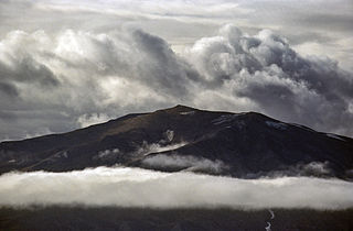
Northern shore of Adolf S. Jensen Land. Vivian Fjeld is the peak visible on the upper left. Tvillingerne island is in the middle and Nanok on the right. 1024 Nordpolausflug- Nordostgronland-05052012221.jpg
Northern shore of Adolf S. Jensen Land. Vivian Fjeld is the peak visible on the upper left. Tvillingerne island is in the middle and Nanok on the right.

Related Research Articles

Gauss Peninsula

Gauss Peninsula is a peninsula in eastern Greenland. Administratively this peninsula is part of the Northeast Greenland National Park zone.

Kaiser Franz Joseph Fjord fjord in Greenland

Kaiser Franz Joseph Fjord is a major fjord system in the NE Greenland National Park area, East Greenland.

Wollaston Foreland peninsula in Greenland

Wollaston Foreland is a peninsula in the NE Greenland National Park area, East Greenland.

Andrée Land (Greenland) peninsula in Greenland

Andrée Land is a peninsula in King Christian X Land, East Greenland that is bounded by Kejser Franz Joseph Fjord, Isfjord and Geologfjord.

Germania Land peninsula in Greenland

Germania Land or Germanialand is a peninsula in northeastern Greenland. Despite the high latitude it is largely unglaciated.

West Jensen Island

West Jensen Island is an uninhabited island of the Lincoln Sea in Peary Land, far northern Greenland.

Skjoldungen large uninhabited island in the King Frederick VI Coast, southeastern Greenland

Skjoldungen is a large uninhabited island in the King Frederick VI Coast, southeastern Greenland. Administratively it is part of the Sermersooq municipality. The weather of the island is characterized by tundra climate.

Kangerlussuaq Fjord, East Greenland Fjord Greenland, Sermersooq

Kangerlussuaq Fjord is a fjord in eastern Greenland. It is part of the Sermersooq municipality.

Waltershausen Glacier glacier in Greenland

Waltershausen Glacier is one of the major glaciers in Greenland. It has its terminus on the east coast of the Greenland ice sheet. This glacier was named after German geologist Wolfgang Sartorius von Waltershausen by the Second German North Polar Expedition led by Carl Koldewey that first surveyed and partially explored the Kaiser Franz Joseph Fjord in 1869–70.

Holm Land

Holm Land, sometimes referred to as "Hahn Land", is a peninsula in King Frederick VIII Land, northeastern Greenland. Administratively it belongs to the NE Greenland National Park area.

Payer Peak mountain in Greenland

Payer Peak, is a mountain in King Christian X Land, Northeast Greenland. Administratively it is part of the Northeast Greenland National Park zone.

Queen Margrethe II Land peninsula in Greenland

Queen Margrethe II Land is a peninsula in the northern limit of King Christian X Land, northeastern Greenland. Administratively it belongs to the NE Greenland National Park area.

Ardencaple Fjord fjord in Greenland

Ardencaple Fjord is a fjord in King Christian X Land, northeastern Greenland. Administratively it is part of the Northeast Greenland National Park.

Daugaard-Jensen Land

Daugaard-Jensen Land,, is a peninsula in northwestern Greenland. It is a part of the Avannaata municipality.

Bessel Fjord, NW Greenland fjord in Greenland

Bessel Fjord, also known as Bessels Bay, is a fjord in northwestern Greenland. Administratively it belongs to the Avannaata municipality.

References

  1. 1 2 "Adolf S. Jensen Land". Mapcarta. Retrieved 29 June 2016.
  2. 1 2 3 4 5 "Catalogue of place names in northern East Greenland". Geological Survey of Denmark. Retrieved 18 June 2016.[ permanent dead link ]
  3. "Besselfjord Station". Mapcarta. Retrieved 29 June 2016.
  4. 1 2 3 GoogleEarth