Related Research Articles

Aerial photography is the taking of photographs from an aircraft or other airborne platforms. When taking motion pictures, it is also known as aerial videography.

The Fairey Aviation Company Limited was a British aircraft manufacturer of the first half of the 20th century based in Hayes in Middlesex and Heaton Chapel and RAF Ringway in Cheshire that designed important military aircraft, including the Fairey III family, the Swordfish, Firefly, and Gannet. It had a strong presence in the supply of naval aircraft, and also built bombers for the RAF.
Aerial archaeology is the study of archaeological sites from the air. It is a method of archaeological investigation that uses aerial photography, remote sensing, and other techniques to identify, record, and interpret archaeological features and sites. Aerial archaeology has been used to discover and map a wide range of archaeological sites, from prehistoric settlements and ancient roads to medieval castles and World War II battlefields.

The Royal Commission on the Ancient and Historical Monuments of Wales, established in 1908, is a Welsh Government sponsored body concerned with some aspects of the archaeological, architectural and historic environment of Wales. It is based in Aberystwyth.

Lambert Glacier is a major glacier in East Antarctica. At about 80 km (50 mi) wide, over 400 km (250 mi) long, and about 2,500 m (8,200 ft) deep, it is the world's largest glacier. It drains 8% of the Antarctic ice sheet to the east and south of the Prince Charles Mountains and flows northward to the Amery Ice Shelf. It flows in part of Lambert Graben and exits the continent at Prydz Bay.
Sherman Mills Fairchild was an American businessman and investor who founded over 70 companies, including Fairchild Aviation, Fairchild Industries, and Fairchild Camera and Instrument. Fairchild made significant contributions to the aviation industry and was inducted into the National Aviation Hall of Fame in 1979. His Semiconductor Division of Fairchild Camera played a defining role in Silicon Valley. He held over 30 patents for products ranging from the silicon semiconductor to the 8-mm home sound motion-picture camera. Fairchild was responsible for inventing the first synchronized camera shutter and flash as well as developing technologies for aerial cameras that were later used on the Apollo Missions.
Blom is a European service provider within acquisition, processing and modelling of geographical information. Blom maintains European databases with collections of map, images and models. With particular focus on online services, Blom provides data and services to customers in government, enterprise and consumer markets and enables partners to create applications using Blom’s databases, location-based services and navigation systems. Blom has more than 600 employees and subsidiaries in 10 countries. The company headquarters is in Oslo, Norway. The parent company NRC Group is listed on the Oslo Stock Exchange.

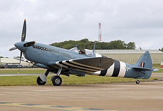
The de Havilland DH.50 was a 1920s British large single-engined biplane transport built by de Havilland at Stag Lane Aerodrome, Edgware, and licence-built in Australia, Belgium, and Czechoslovakia.

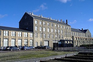
The Historic England Archive is the public archive of Historic England, located in The Engine House on Fire Fly Avenue in Swindon, formerly part of the Swindon Works of the Great Western Railway.
Historic England is an executive non-departmental public body of the British Government sponsored by the Department for Culture, Media and Sport. It is tasked with protecting the historic environment of England by preserving and listing historic buildings, scheduling ancient monuments, registering historic parks and gardens, advising central and local government, and promoting the public's enjoyment of, and advancing their knowledge of, ancient monuments and historic buildings.
The Ordnance Survey International or Ordnance Survey Overseas Directorate its predecessors built an archive of air photography, map and survey records for the United Kingdom from 1946 to 1999. The Ordnance Survey International Collection held mapping records that were acquired outside the UK.

Hunting Aerosurveys Ltd was a British aerial photography company founded by Percy Hunting in 1944. Its operations became more diversified under the name Hunting Surveys.
Aero Pictorial Ltd was a British aerial photography company in operation between 1934–39 and then 1946-60. It was founded by Aerofilms photographer Cyril Murrell (1899–1958) and runs more or less as a one-man band. In his later years, Murrell flew from Elstree Aerodrome in Hertfordshire.

The Aircraft Operating Company was a British aerial photography company, that took over Aerofilms in 1925. In 1940, its staff and equipment were requisitioned by the Air Ministry, and in 1944 the company itself was taken over by Hunting Aerosurveys.

Major James Warren Bagley was an American aerial photographer, topographic engineer and inventor.
Aerial reconnaissance using heavier-than-air machines was an entirely new science that had to be improvised step-by-step. Early operations were low-level flights with the pilot often dismounting from the plane to report verbally to the nearest officers. Photographic support was urgently developed, initially requiring a full-time photographer on board to handle the heavy, awkward equipment. The interpreting of aerial images was an important new speciality, essential for accurate mapping. By 1915, air-to-ground radio was in use for reconnaissance pilots.
Group Captain Frederick Charles Victor Laws, was an officer in the Royal Air Force, an aerial surveyor, and the founder and most prominent pioneer of British aerial reconnaissance.

A transformational growth in aerial reconnaissance occurred in the years 1939–45, especially in Britain and then in the United States. It was an expansion determined mostly by trial and error, represented mostly by new tactics, new procedures, and new technology, though rarely by specialized aircraft types. The mission type branched out into many sub-types, including new electronic forms of reconnaissance. In sharp contrast with the case during the pre-war years, by 1945 air reconnaissance was widely recognized as a vital, indispensable component of air power.
Trimetrogon is an aerial photographic survey method that involves the use of three cameras in one assembly. One camera is pointed directly downwards, and the other two are pointed to either side of the flight path at a 30° depression angle. The images overlap, allowing the use of stereographic interpretation of the topography. The name comes from the Metrogon cameras used in the original montages.
Major George W. G. Allen, was a British engineer who pioneered aerial photography for the purpose of archaeological research.
References
- ↑ "Pioneers and Photos: 100 Years of Aerofilms 1919-2019". historicengland.org.uk. Historic England. Retrieved 20 January 2023.
- ↑ "Friese-Greene, Claude (1898-1943)".
- ↑ "Municipal Air Surveys. Contracts From Doncaster And Birkenhead". The Times. issue:44229,column:E. Gale:The Times digital archive 1785–1985. 25 March 1926. p. 11. Retrieved 30 August 2012.
{{cite news}}: CS1 maint: location (link)(subscription required) - ↑ Flight Magazine (9 April 1925). "Society of Model Aeronautical Engineers". FlightGlobal Archive. p. 218. Archived from the original (PDF) on 5 March 2016. Retrieved 20 January 2023.
- ↑ "The Aerofilms Book of Aerial Photographs, by Aerofilms Ltd". London: Aerofilms Limited. 1965. OCLC 7504323 . Retrieved 20 January 2023.
{{cite journal}}: Cite journal requires|journal=(help) - ↑ "Simmons Aerofilms". National Collection of Aerial Photography. Historic Environment Scotland. Retrieved 20 January 2023.
- ↑ "RCAHMW | Search Our Records | Aerofilms". rcahmw.gov.uk. Retrieved 2021-11-28.
- ↑ "Who made the Conway Library?". Digital Media. 2020-06-30. Retrieved 2021-11-28.
- ↑ Aerofilms (2009). Aerofilms Guide: Football Grounds (17th ed.). Ian Allan Ltd. ISBN 9780711033986.
- ↑ "EastEnders (2000)". BBC. September 2005. Retrieved 30 August 2012.
- 1 2 Webb, C (4 November 1995). "The pictures that prove home is where the art is;Property". The Times. Proquest. p. 1. ProQuest 318505639.
The company took the photographs that were joined together to make the title sequence for the television soap EastEnders
(subscription required) - ↑ Riding, Richard; Mawson, Chris (2008). British Seaside Piers. Ian Allan Ltd. ISBN 9780711032514 . Retrieved August 30, 2012.
- ↑ "Aerofilms". English Heritage. Archived from the original on 5 June 2010. Retrieved 21 November 2018.
- ↑ "Aerofilms".