The Corris Railway is a narrow gauge preserved railway based in Corris on the border between Merionethshire and Montgomeryshire in Mid-Wales.

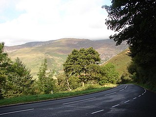
The A487, officially the Fishguard to Bangor Trunk Road, is a trunk road in Wales that follows the coast from Haverfordwest, Pembrokeshire, in the south, to Bangor, Gwynedd, in the north.

Esgairgeiliog is a village in Powys, Wales, UK. It is situated at the junction of the Afon Glesyrch's and Afon Dulas' valleys.

The River Dyfi, also known as the River Dovey, is an approximately 30-mile (48-kilometre) long river in Wales.
Llwyngwern was a station on the Corris Railway in Wales, built to serve the hamlet of Pantperthog and the residents of Plas Llwyngwern, a house where a daughter of the 5th Marquess of Londonderry lived with her husband. Although the Plas was in Montgomeryshire, the station was across the Afon Dulas in Merionethshire. The station was built at Llwyngwern, rather than at Pantperthog, because there is a very tight bend and a steep gradient on the railway at Pantperthog.

Ffridd Gate was a station on the Corris Railway in Merioneth, Wales, UK. It was built at the level crossing over the B4404 road to Llanwrin, near the hamlet of Fridd. A small hamlet also grew up around the station and a nearby (pre-existent) toll-house. The hamlet and former station are near to the confluence of the Afon Dulas and the River Dyfi, around 2+1⁄4 miles (3.6 km) west of the village of Llanwrin and 1 mile (1.6 km) north of the town of Machynlleth.

Sarn Helen refers to several stretches of Roman road in Wales. The 160-mile (260 km) route, which follows a meandering course through central Wales, connects Aberconwy in the north with Carmarthen in the west. Despite its length, academic debate continues as to the precise course of the Roman road. Many sections are now used by the modern road network while other parts are still traceable. However, there are sizeable stretches that have been lost and are unidentifiable.

Corris Uchaf is a village lying in the south of the Snowdonia National Park in Gwynedd, Wales. The slate quarries that surround Corris Uchaf are its most prominent feature.
Maespoeth Junction is a railway location to the south of Corris in Gwynedd. It lies in the historic county of Merionethshire/Sir Feirionnydd, in the valley of the Afon Dulas. It is known principally as a railway junction on the historic Corris Railway, and is also the site of a small number of residential dwellings.

Garneddwen is a hamlet in the south of the county of Gwynedd, Wales. It lies in the historic county of Merionethshire/Sir Feirionnydd, in the valley of the Afon Dulas.

The River Llyfnant is a short river in Ceredigion, on the west coast of Wales. The river rises in the mountains south of Machynlleth, reaches the hill walk of Uwch Garreg and then plunges over a series of waterfalls known as Pistyll y Llyn, into a ravine, descending towards the River Dovey near Dovey Junction railway station.

The Dyfi hills are a range situated in the southernmost area of Snowdonia, bounded by the River Dyfi on the east and south sides, by the Afon Dulas on the west and the Afon Cerist to the north. They lie to the west of the Aran Fawddwy range, north-east of the Tarren y Gesail range and are a subgroup of the Cadair Idris group.

The Ratgoed Tramway was a 2 ft 3 in gauge horse-worked tramway that connected the remote Ratgoed Quarry with the Corris Railway at Aberllefenni. It was 1.75 miles (2.82 km) long.

The Afon Dulas is a river in Powys, Wales. It is a headwater tributary of the River Severn, which it joins at Llanidloes opposite the confluence with the Afon Clywedog. Its principal tributary is the Afon Brochan. The total length of the Dulas and Brochan is 19.6 km. Other tributaries include Nant Cydros, the Rhydyclwydau Brook and Nant Gynwydd.

Mynydd Dolgoed or Craig Portas is a mountain in southern Snowdonia, Wales. It is a long ridge running from a low summit between the valleys of the Afon Angell and the Nant Ceiswyn, north east to the cliff of Craig Portas above Dinas Mawddwy. The next mountain in the ridge to south-east is Mynydd Hendre-ddu, while to the south lie Mynydd Llwydiarth and Mynydd Cymerau.

The Nant Ceiswyn is a small river in Mid Wales. It flows from the northern flank of Mynydd Dolgoed down to Pont Cymerau, north-east of Aberllefenni. Here it joins the Nant Llwydiarth to form the Afon Dulas that flows south to the Afon Dyfi. There was an ancient bridge at Pont Cymerau.

The Nant Llwydiarth is a small river in Mid Wales. It flows from the southern flank of Mynydd Hendre-ddu down to Pont Cymerau, north-east of Aberllefenni. Here it joins the Nant Ceiswyn to form the Afon Dulas that flows south to the Afon Dyfi. There was an ancient bridge at Pont Cymerau.

Mynydd Hendre-ddu or Mynydd Hendreddu is a mountain in southern Snowdonia, Wales. It is one of a line of mountains running from Mynydd Dolgoed in the north, through Mynydd Llwydiarth to Mynydd Hendre-ddu and on to Mynydd y Foel, Y Grug, Mynydd Tri-Arglwyd and Mynydd Gwyn to the south of the village of Aberangell. It forms the watershed between Nant Llwydiarth, which flows to the south-west and into the Afon Dulas, and streams flowing into Afon Angell to the north, which flow east into the River Dyfi.

Cwm Hengae is a valley that runs roughly north-west from the village of Aberllefenni in Wales. The Afon Llefenni river runs along the valley and several slate quarries occupy the valley sides. The Roman road Sarn Helen ran along the valley, connecting Aberllefenni with Dolgellau.


