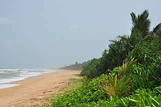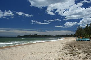
Unawatuna is a coastal town in Galle district of Sri Lanka. Unawatuna is a major tourist attraction in Sri Lanka and known for its beach and corals. It is a suburb of Galle, about 5 kilometres (3.1 mi) southeast to the city center and approximately 108 kilometres (67 mi) south of Colombo. Unawatuna is situated at an elevation of 5 metres (16 ft) above the sea level. Despite significant development in the last decade it is still home to the endangered and endemic purple-faced langur, an unusually shy monkey species that can only be found in Sri Lanka's forests.

Hikkaduwa, in south-west of Sri Lanka, is a large costal tourist area covering 11 villages run by the Hikkaduwa Urban Council. Well known for its scenic beaches, coral reef sanctuary, surfing and nightlife., it extends over 6 km on the ocean, and 3 km inland.

Arugam Bay, known locally as "Arugam Kudah", is situated on the Indian Ocean in the dry zone of Sri Lanka's southeast coast, and a historic settlement of the ancient Batticaloa Territory. Arugam Kudah's literal Tamil translation is "Bay of Cynodon dactylon".

Galle is a district in Southern Province, Sri Lanka. It is one of 25 districts of Sri Lanka, the second level administrative division of the country. The district is administered by a District Secretariat headed by a District Secretary appointed by the central government of Sri Lanka.

Matara is a major city in Sri Lanka, on the southern coast of Southern Province. It is the second largest city in Southern Province. It is 160 km (99 mi) from Colombo. It is a major commercial hub, the administrative capital and largest city of Matara District.

Bentota is a coastal town in Sri Lanka, located in the Galle District of the Southern Province. It is approximately 65 kilometres (40 mi) south of Colombo and 56 kilometres (35 mi) north of Galle. Bentota is situated on the southern bank of the Bentota River mouth, at an elevation of 3 metres (9.8 ft) above the sea level.

Aluthgama is a coastal town in Kalutara District in the Western Province of Sri Lanka. It is approximately 63.5 kilometres (39.5 mi) south of Colombo and 68 kilometres (42 mi) north of Galle. Aluthgama is situated on the northern bank of the Bentota Ganga (River) mouth.

Weligama is a town on the south coast of Sri Lanka, located in Matara District, Southern Province, Sri Lanka, governed by an Urban Council. The name Weligama, literally means "sandy village" which refers to the area's sandy sweep bay. It is approximately 144 kilometres (89 mi) south of Colombo and is situated at an elevation of 9 metres (30 ft) above the sea level.

The Kothduwa temple, or Koth Duwa Raja Maha Viharaya, is a Buddhist temple located on Kothduwa Island on the Madu Ganga in southern Sri Lanka. The island is located in Galle District of the Southern Province approximately 35 km (22 mi) north of Galle and 88 km (55 mi) south of Colombo.
Imaduwa is a suburb of Galle. It is located approximately 21 km (13 mi) away from the Galle within Galle District of the Southern Province. It is situated on the boundary of Galle district and Matara District. It is a major centre which connects Matara District with Galle district. It is a major suburb on the A17 highway, after Galle. It is a major centre on the road for the vehicles and long distance buses run on the route. And also it is a four-way junction on the road. It connects Makumbura-Yakkalamulla-Imaduwa road and Dikkumbura (Ahangama)-Imaduwa road with the A17 highway which runs between Galle and Madampe.
Ruhunu Kumari is a daytime passenger train that runs between Colombo and Matara in Sri Lanka.
Kosgoda is a small town in the Galle District, Southern Province, Sri Lanka. It is situated on the southwestern coast of Sri Lanka, approximately 50 km (31 mi) north of Galle and 76 km (47 mi) south of Colombo.

Koggala is a small coastal town, situated at the edge of a lagoon on the south coast of Sri Lanka, located in Galle District, Southern Province, Sri Lanka, governed by an Urban Council. Koggala is bounded on one side by a reef, and on the other by a large lake, Koggala Lake, into which the numerous tributaries of the Koggala Oya drain. It is approximately 139 kilometres (86 mi) south of Colombo and is situated at an elevation of 3 metres (9.8 ft) above sea level.
Ahungalla is a small coastal town, located in Galle District, Southern Province, Sri Lanka, governed by an Urban Council. It is approximately 76.6 kilometres (47.6 mi) south of Colombo and is situated at an elevation of 12 metres (39 ft) above the sea level.
Boossa is a small town on the south coast of Sri Lanka, located in the Galle District of the Southern Province. It is approximately 123 kilometres (76 mi) south of Colombo and 12 kilometres (7.5 mi) north of Galle, immediately north of the mouth of the Gin Ganga. It is situated at an elevation of 5 metres (16 ft) above the sea level.

Kandyan era frescoes are mural paintings created during the Kingdom of Kandy (1469–1815) in Sri Lanka, a time when kings gave a special place to arts and literature.

Koggala Lagoon is a coastal body of water located in Galle District, Southern Sri Lanka. It is situated near the town of Koggala and adjacent to the southern coast, about 110 km (68 mi) south of Colombo. The lagoon is embellished with eight ecologically rich small islands.

Kshetrarama Maha Vihara is a historic Buddhist temple situated in Moratuwa, Sri Lanka. It is located in the Lakshapathiya area, approximately 1.2 km (0.75 mi) from Katubedda junction on Colombo-Galle main road (A2). The temple has been formally recognized by the Government as an archaeological site in Sri Lanka.

Surfing in Sri Lanka is one of the popular sports in Sri Lanka among foreign tourists despite not being popular among the Sri Lankan locals. Surfing in Sri Lanka dates back to early 1960s. The country has many beaches for surfing, especially in the southern and eastern regions. Places such as Arugam Bay, Hikkaduwa, Weligama, Mirissa and Unawatuna are popular surf spots in Sri Lanka and among tourists. The Tourism in Sri Lanka is also very closely related to the sport of surfing and the Sri Lanka Tourism Promotion Bureau considers the sport of surfing as one of the measures of attracting tourists.

Dodanduwa is a coastal village situated in Galle District, Southern Province of Sri Lanka, integrated into Hikkaduwa Urban Council.


