
India is the second most populated country in the world with nearly a fifth of the world's population. According to the 2019 revision of the World Population Prospects the population stood at 1,352,642,280.
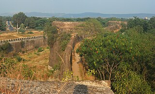
Ahmednagar district is the largest district of Maharashtra state in western India. The historical Ahmednagar city is the headquarters of the district. Ahmednagar was the seat of the Ahmednagar Sultanate of late medieval period. This district is known for the towns of Shirdi associated with Sai Baba, Meherabad associated with Meher Baba, Shani Shinganapur with Shanidev, and Devgad with Lord Dattatreya. Ahmednagar district is part of Nashik Division.The neighbouring districts to Ahmednagar district are Solapur, Osmanabad (SE), Beed (SE), Aurangabad (NE), Nashik (NW), Thane (NW), and Pune (SW) Ahmednagar and Sangamner are largest cities in the district by market, population, education and development of medical and other services.

Chemrey is a village in the Leh district of Ladakh, India. It is located in the Kharu tehsil. The Chemrey Monastery is located in this village.

Arambakkam is a village in the Tiruvallur district of Tamil Nadu, India. It is located in the Gummidipoondi taluk.

Arakapady is a village in the Ernakulam district of Kerala, India. It is located in the Kunnathunad taluk.
Kaippattur is a village in the Ernakulam district of Kerala, India. It is located in the Kanayannur taluk.

Katkol is a village in the southern state of Karnataka, India. It is located in the Ramdurg taluk of Belgaum district in Karnataka.
Amminabhavi is a village in the southern state of Karnataka, India. It is located in the Dharwad taluk of Dharwad district in Karnataka.

The 15th Indian Census was conducted in two phases, house listing and population enumeration. House listing phase began on 1 April 2010 and involved collection of information about all buildings. Information for National Population Register (NPR) was also collected in the first phase, which will be used to issue a 12-digit unique identification number to all registered Indian residents by Unique Identification Authority of India (UIDAI). The second population enumeration phase was conducted between 9 and 28 February 2011. Census has been conducted in India since 1872 and 2011 marks the first time biometric information was collected. According to the provisional reports released on 31 March 2011, the Indian population increased to 1.21 billion with a decadal growth of 17.70%. Adult literacy rate increased to 74.04% with a decadal growth of 9.21%. The motto of the census was 'Our Census, Our future'.
Krishna-kittur is a village in the southern state of Karnataka, India. It is located in the Athani taluka of Belgaum district in Karnataka.

Shangus is a village Panchayat and a tehsil in Anantnag district of the Indian union territory of Jammu and Kashmir. Shangus is about 6 kilometres from Achabal.

Mugaliyachhap, also called Mungaliya Chhap, is a village in the Bhopal district of Madhya Pradesh, India. It is located in the Huzur tehsil and the Phanda block.

Ghadane is a village in the Palghar district of Maharashtra, India. It is located in the Dahanu taluka.
Bapugaon is a village in the Palghar district of Maharashtra, India. It is located in the Dahanu taluka.
Dahyale is a village in the Palghar district of Maharashtra, India. It is located in the Dahanu taluka.
Khambale is a village in the Palghar district of Maharashtra, India. It is located in the Dahanu taluka.
Walajabad taluk is a taluk in the Kanchipuram district of Tamil Nadu, India. At the 2011 Census of India, the taluk covered an area of 339.03 square kilometres (130.90 sq mi) with a population of 125,868. The headquarters of the taluk is the town of Walajabad.

