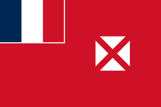
Wallis and Futuna, officially the Territory of the Wallis and Futuna Islands, is a French island collectivity in the South Pacific, situated between Tuvalu to the northwest, Fiji to the southwest, Tonga to the southeast, Samoa to the east, and Tokelau to the northeast.

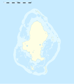
Wallis is a Polynesian atoll/island in the Pacific Ocean belonging to the French overseas collectivity of Wallis and Futuna. It lies north of Tonga, northeast of Fiji, east-northeast of the Hoorn Islands, east of Fiji's Rotuma, southeast of Tuvalu, southwest of Tokelau and west of Samoa. Its area is almost 100 km2 (39 sq mi) with 8,333 people. Its capital is Mata Utu. Roman Catholicism is the predominant religion. Its highest point is Mount Lulu Fakahega. Wallis is of volcanic origin with fertile soil and some remaining lakes. Rainfall is plentiful.

Sigavé is one of the three official chiefdoms of the French territory of Wallis and Futuna in Oceania in the South Pacific Ocean.

Alo is one of three official chiefdoms of the French territory of Wallis and Futuna, in Oceania, in the South Pacific Ocean.
Mala'e is a village in the chiefdom of Alo, on the French Pacific island of Futuna, which is part of the Wallis and Futuna group. It is located in the centre of the island's south coast. Its population, according to the 2018 census, is 168 people.
Leava is the largest village in the chiefdom of Sigave, on the French Pacific island of Futuna, part of the Wallis and Futuna island group. It is also the administrative centre of Sigave.

ʻUvea is one of the three official chiefdoms of the French territory of Wallis and Futuna in Oceania in the South Pacific Ocean.
Ha'afuasia is a village in Wallis and Futuna. It is located in Hahake District on the east coast of Wallis Island. Its population according to the 2018 census was 299 people. To the northwest is Lake Kikila.
Alele is a village in Wallis and Futuna. It is located in Hihifo District on the northeast coast of Wallis Island. Its population according to the 2018 census was 524 people.
Vailala is a village in Wallis and Futuna. It is located in Hihifo District on the northeast coast of Wallis Island. Its population according to the 2018 census was 341 people.
Kolopopo is a village in Wallis and Futuna, which is a French island collectivity in the South Pacific containing 36 villages. It is located in Mua District on the southwest coast of Wallis Island. Its population according to the 2018 census was 99 people. The population has declined in this area due to lack of job opportunities and political tension on the main island. The currency used is Comptoirs Français du Pacifique (CFP) Franc.
Gahi is a village in Wallis and Futuna. It is located in Mua District on the southeast coast of Wallis Island on Gahi Bay. Its population according to the 2018 census was 249 people.
Te'esi is a village in Wallis and Futuna. It is located in Mua District on the southern coast of Wallis Island. Its population according to the 2018 census was 216 people. It is the southernmost settlement on the island located on the southern tip, overlooking Mua Bay.
Poi is a village in Wallis and Futuna. It is located in Alo District on the northeastern coast of Futuna Island. Its population according to the 2018 census was 160 people.
Tamana is a village in Wallis and Futuna. It is located in Alo District on the southern coast of Futuna Island. Its population according to the 2018 census was 152 people.
Taoa is a village in Wallis and Futuna. It is located in Alo District on the southern coast of Futuna Island. Its population according to the 2018 census was 480 people.
Toloke is a village in Wallis and Futuna. It is located in Sigave District on the northwestern tip of Futuna Island. Its population according to the 2018 census was 172 people.
Fiua is a village in Wallis and Futuna. It is located in Sigave District on the northwestern coast of Futuna Island. Its population according to the 2018 census was 257 people.
Alofitai, often simply named Alofi, is a village in Wallis and Futuna. It is located on the northwestern coast of Alofi Island. It belongs to the chiefdom of Alo.
Nuku is a village in Wallis and Futuna. It is located in Sigave District on the northwestern coast of Futuna Island. Its population according to the 2018 census was 204 people.


