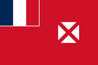
Wallis and Futuna, officially the Territory of the Wallis and Futuna Islands, is a French island collectivity in the South Pacific, situated between Tuvalu to the northwest, Fiji to the southwest, Tonga to the southeast, Samoa to the east, and Tokelau to the northeast.
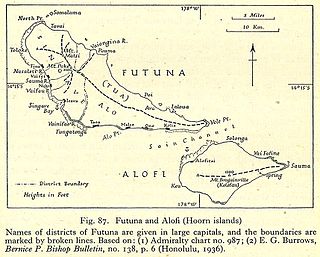
Futuna is the largest island in Hoorn Islands or Îles Horne, located in the Pacific Ocean, part of the French overseas collectivity of Wallis and Futuna. The island occupies an area of 80 km2 (30 sq mi) and as of 2018 it has a population of 10,912.

Politics of Wallis and Futuna takes place in a framework of a parliamentary representative democratic French overseas collectivity, whereby the President of the Territorial Assembly is the head of government, and of a multi-party system. Executive power is exercised by the government.

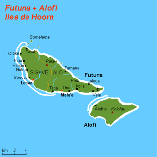
Sigavé is one of the three official chiefdoms of the French territory of Wallis and Futuna in Oceania in the South Pacific Ocean.

Hakake is one of the 5 districts of Wallis and Futuna, located in Wallis Island, in the Pacific Ocean. It is part of the Chiefdom of Uvea.

Alo is one of three official chiefdoms of the French territory of Wallis and Futuna, in Oceania, in the South Pacific Ocean.
The Hoorn Islands are one of the two island groups of which the French overseas collectivity of Wallis and Futuna is geographically composed. The aggregate area is 115 km2, and the population 4,873.
Mala'e is a village in the chiefdom of Alo, on the French Pacific island of Futuna, which is part of the Wallis and Futuna group. It is located in the centre of the island's south coast. Its population, according to the 2018 census, is 168 people.
Petelo Vikena was Tuigaifo, or Monarch, of the Kingdom of Alo, which is also known as the Kingdom of Futuna from his coronation on November 6, 2008 to his abdication on January 22, 2010. Alo is one of the three traditional kingdoms, or chiefdoms, which comprise Wallis and Futuna.

ʻUvea is one of the three official chiefdoms of the French territory of Wallis and Futuna in Oceania in the South Pacific Ocean.
Ono is the main village and capital of the Alo District on the southern coast of Futuna Island. Its population according to the 2018 census was 524 people. This makes it the largest settlement in the chiefdom of Alo.
Toloke is a village in Wallis and Futuna. It is located in Sigave District on the northwestern tip of Futuna Island. Its population according to the 2018 census was 172 people.
Tavai is a village in Wallis and Futuna. It is located in Sigave District on the northwestern coast of Futuna Island. Its population according to the 2018 census was 160 people.
Fiua is a village in Wallis and Futuna. It is located in Sigave District on the northwestern coast of Futuna Island. Its population according to the 2018 census was 257 people.
Vaisei is a village in Wallis and Futuna. It is located in Sigave District on the northwestern coast of Futuna Island. Its population according to the 2018 census was 160 people.
Alofitai, often simply named Alofi, is a village in Wallis and Futuna. It is located on the northwestern coast of Alofi Island. It belongs to the chiefdom of Alo.
Nuku is a village in Wallis and Futuna. It is located in Sigave District on the northwestern coast of Futuna Island. Its population according to the 2018 census was 204 people.

Mua is one of the 5 districts of Wallis and Futuna, located in Wallis Island, in the Pacific Ocean. It is part of the Chiefdom of Uvea.

