
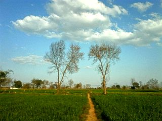
Mandi Bahauddin, also spelled Mandi Baha ud Din, is a district in the Punjab province of Pakistan. It is bordered on the northwest by the Jhelum River, on the southeast by the Chenab River, and on the southwest by the Sargodha District. The district has an area of 2,673 square kilometres (1,032 sq mi). Mandi district currently has 1.5 million population.
Sohawa is one of the major towns in Mandi Bahauddin District in Punjab, Pakistan. It is situated on the Phalia Road, almost 3 km out of the city of Mandi Bahauddin. It basically consists of three villages: Sohawa Bolani, Sohawa Jamlani and Sohawa Dilloana and is divided into two Union Councils, Sohawa Bolani(17) and Sohawa Dilloana(18).

Ghaniaan is a village and Union council of Phalia Tehsil, Mandi Bahauddin District, Punjab, Pakistan. It is located at N 32°40'29 & E 73°64'96 with an altitude of 201 metres above sea lavel and lies about 8 km North West of Phalia on the Phalia-Alipur Chatha road near Chenab River Qadirabad Headworks. The nearest police station is Phalia Police Station, which is about 7.5 km to the North west. Population of village is round about 10000. Like other villages of Phalia, most of the population are farmers.
Chillianwala is a village and union council of Mandi Bahauddin District in the Punjab province of Pakistan. It is located at 32°39'0N 73°36'0E at an altitude of 218 metres and lies to the north-east of the district capital Mandi Bahauddin.
Wara Alam Shah is a village and union council of Mandi Bahauddin District in the Punjab province of Pakistan. It is located at 32°30'30N 73°16'50E.
Chak Jano Kalan is a village and Union council of Phalia Tehsil, Mandi Bahauddin District, Punjab, Pakistan. Chak Jano Kalan is located at 32°27'0N 73°43'0E with an altitude of 216 metres and lies about 34km South East of Mandi Bahauddin on the Gujrat-Sargodha Road. The nearest police station is Pharianwali Police Station, which is 3 km to the east. Chak Jano is divided into three branches, Chak Jano Kalan, Chak Jano Khurd and Nai Abadi. The combined population of Chak Jano is 15,000. About 40% of the population are farmers, 40% is labour, 15% is overseas, and other 5% is commercial and industrial.
Wasu is a village and Union Council of Mandi Bahauddin District in the Punjab province of Pakistan. It is located at 32°34'0N 73°28'60E and has an altitude of 221 metres (728 feet).

Rasul is a village and Union Council of Mandi Bahauddin District in the Punjab province of Pakistan. It has an altitude of 233m. Rasul is a river crossing on the Jhelum River. The town has a university named University of Engineering and Technology, Rasul and a power station.
Chakbasawa or Chak Wasawa is a village and union council of Mandi Bahauddin District in the Punjab province of Pakistan. It is located at 32°34'30N 73°33'30E and has an altitude of 219 metres.
Pindi Bahauddin is a village and union council of Mandi Bahauddin District in the Punjab province of Pakistan. It is located at 32°36'0N 73°28'60E and has an altitude of 217 metres.
Sahna is a village and union council of Mandi Bahauddin District in the Punjab province of Pakistan. It is located at 32°32'60N 73°20'60E and has an altitude of 211 metres.
Mangat is a village and Union Council of Mandi Bahauddin District in the Punjab province of Pakistan. It is located at 32°31'0N 73°30'0E and has an altitude of 223 metres (734 feet).
Kadhar is a village and union council of Mandi Bahauddin District in the Punjab Province of Pakistan. It is located at an altitude of 203 metres. It lies about 2 km from Phalia in southern side. It is a developing village. Government High School for Boys, a Rural Health center and a Union council office are some sites of village.
Nain Ranjha is a village and union council of Mandi Bahauddin District in the Punjab province of Pakistan. It is located at an altitude of 201 metres (662 feet).
Jayya, Jia or Jeya is a Khokaran village of the Mandi Bahauddin District in the Punjab province of Pakistan. It has the postal code 50471. Its 15 km away from Mandi Bahauddin and some 3 km southeast of Chhimmon.
Kotli Khurd is a village in the Mandi Bahauddin District of the Punjab province of Pakistan. It is situated 28 km south east of the district capital - Mandi Bahauddin and 12 km east of the town of Phalia. The population of Kotli Khurd is about 1000. The literacy rate is above 35%. The village is well cultivated area the main crops are wheat rice and sugar cane, most people are farmers and government servants. The village has been developing since the 1947 division. Khurd and Kalan Persian language word which means small and Big respectively when two villages have same name then it is distinguished as Kalan means Big and Khurd means Small with Village Name.
Dhoul Ranjha is a village and Union council of Phalia Tehsil in Mandi Bahauddin District of Punjab, Pakistan.
Raike is a village and Union council of Phalia Tehsil, Mandi Bahauddin District, Punjab, Pakistan.
Shaheedanwali is a village and Union Council of Mandi Bahauddin District in the Punjab province of Pakistan. It is situated 04 km east of the district capital - Mandi Bahauddin, 4 km west of the town of Chillianwala.and 4 km south of the town of Mong. The population of Shaheedanwali is about 28,000.
Jaisak is a village of Mandi Bahauddin District in the Punjab province of Pakistan, It is located at 32°31'06.1"N 73°36'22.6"E. Jaisak is situated 16 km east of the city of Mandi Bahauddin, 11 km north of the city of Phalia and 17.5 km south of the town of Chillianwala. A major canal flows near the town, which is known as Rasul-Qadir Abad Link Canal. The population of the village is about 5,000 and the number of registered voters in the village is about 1,200.
