Ajjowal is a small village of Malikwal Tehsil, Mandi Bahauddin District in the Punjab province of Pakistan.
Ghaniaan is a village and Union council of Phalia Tehsil, Mandi Bahauddin District, Punjab, Pakistan. It is located at N 32°40'29 & E 73°64'96 with an altitude of 201 metres above sea level and lies about 8 km North West of Phalia on the Phalia-Alipur Chatha road near Chenab River Qadirabad Headworks. The nearest police station is Phalia Police Station, which is about 7.5 km to the Northwest. The population of the village is round about 12000.کل زرعی رقبہ 132 مربع
Wara Alam Shah واڑہ عالم شاہ is a village and union council of Mandi Bahauddin District in the Punjab province of Pakistan. Amjad Alam Khan, the founder of Wara Alam Shah, who settled the village. The history of this village is known from an elder that this village came into existence about four hundred years ago. It is located at 32°30'30N 73°16'50E.
Mandi Bahauddin is a tehsil located in Mandi Bahauddin District, Punjab, Pakistan. The city of Mandi Bahauddin is the headquarters of the tehsil. Tehsil has total population of 668,007 according to census of 2017.
Ahla is a village and Union council of Mandi Bahauddin District in the Punjab province of Pakistan. Ahla is situated on the southern bank of Lower Jhelum canal, about 9 km from Mandi Bahauddin city. It is located at an altitude of 202 metres (666 ft) from the sea level. Ahla is headquarters of Union council Ahla. It has a railway station by its name, located almost 3 km from the village.
Murala is a village of and union council of Mandi Bahauddin District in the Punjab province of Pakistan. Murala is 25 km from Mandi Bahauddin in an easterly direction, 12 km from Phalia in a northerly direction and 10 km from the town of Chailianwala in a southerly direction. where most of the families that casts are Warraich ,the village is also known as the murala warraicha, they work agriculture very famous also for cane sugar and fish farm.
Chak Basawa is a village and union council of Mandi Bahauddin District in the Punjab province of Pakistan. It is located at 32°34'30N 73°33'30E and has an altitude of 219 metres.
Pindi Bahauddin also known as Pindi Purani is a village and union council of Mandi Bahauddin District in the Punjab province of Pakistan. It is located at 32°36'0N 73°28'60E and has an altitude of 217 metres.
Sahna is a village and union council of Mandi Bahauddin District in the Punjab province of Pakistan. It is located at 32°32'60N 73°20'60E and has an altitude of 211 metres.
Chhimmon is a village and union council of Mandi Bahauddin District in the Punjab province of Pakistan. It is located at an altitude of 210 metres.
Mangat is a village and Union Council of Mandi Bahauddin District in the Punjab province of Pakistan.

Kadhar is a village and union council of Mandi Bahauddin District in the Punjab Province of Pakistan. It is located at an altitude of 203 metres. It lies about 2 km from Phalia in southern side. It is a developing village. Government High School for Boys, a Rural Health center and a Union council office are some sites of village.
Mianwal Ranjha is a village and union council of Mandi Bahauddin District in the Punjab province of Pakistan. It is located at 31°52'60N 73°5'60E and has an altitude of 183 metres. Mianwal Ranjha is the largest village of Mandi Bahauddin. Read More
Nain Ranjha is a village and union council of Mandi Bahauddin District in the Punjab province of Pakistan. It is located at an altitude of 201 metres (662 feet).
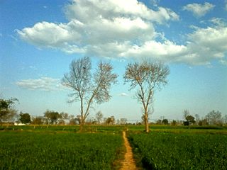
Bhindar Kalan is a village in Mandi Bahauddin District, in the Punjab province of Pakistan. The village is situated 30 kilometres (19 mi) southeast of the district capital of Mandi Bahauddin, and 14 kilometres (8.7 mi) east of the town of Phalia. The population is about 2000. The literacy rate is above 80%. The village is in a well-cultivated area. The main crops are wheat, rice, and sugar cane. Most people of the village are either farmers or government servants. The village has been continuously developing since the partition in 1947.
Dhaipai is a village of Mandi Bahauddin District in the Punjab province of Pakistan. It is located at 32°42'0N 73°33'0E at an altitude of 213 metres.
Kotehra is a village of Mandi Bahauddin District in the Punjab province of Pakistan. It is located at 32°42'0N 73°31'0E at an altitude of 205 metres.
Dhoul Ranjha is a village and Union council of Phalia Tehsil in Mandi Bahauddin District of Punjab, Pakistan.
Raike is a village and Union council of Phalia Tehsil, Mandi Bahauddin District, Punjab, Pakistan.
Jaisak is a village of Mandi Bahauddin District in the Punjab province of Pakistan, It is located at 32°31'06.1"N 73°36'22.6"E. Jaisak is situated 16 km east of the city of Mandi Bahauddin, 11 km north of the city of Phalia and 17.5 km south of the town of Chillianwala. A major canal flows near the town, which is known as Rasul-Qadir Abad Link Canal. The population of the village is about 5,000 and the number of registered voters in the village is about 1,200.