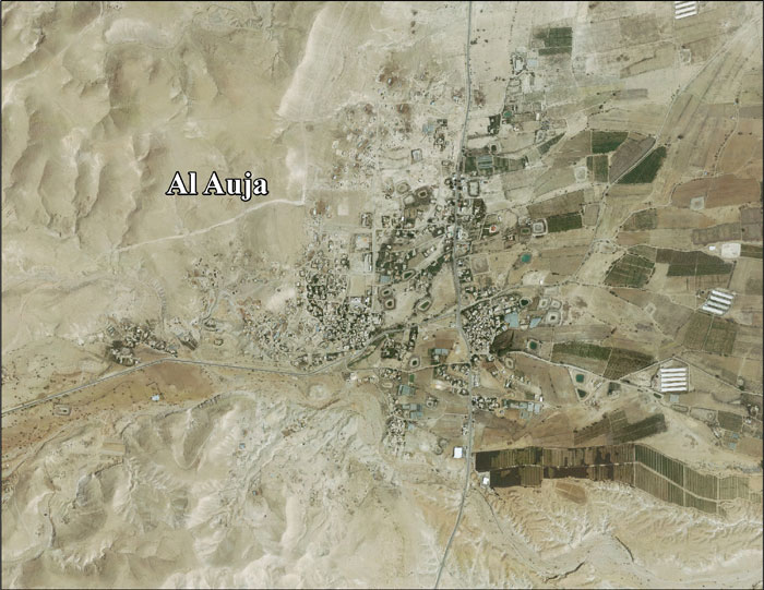
Al-Auja, Jericho

Last updated

Contents

al-Auja
Arabic transcription(s)
   Arabic العوجا
   Latin al-'Auja (official)
al-Awja (unofficial)
Auja 044a.jpg
Southern entrance to al-Auja, 2011
Palestine location map wide.png
Red pog.svg
al-Auja
Location of al-Auja within Palestine
Coordinates: 31°56′51″N35°27′42″E / 31.94750°N 35.46167°E / 31.94750; 35.46167
Palestine grid 195/150
StateFlag of Palestine.svg  State of Palestine
Governorate Jericho
Government
  Type Municipality (from 1994)
Area
  Total
107,905  dunams (107.9 km2 or 41.7 sq mi)
Population
 (2017) [1]
  Total
5,224
  Density48/km2 (130/sq mi)

Al-Auja (Arabic : العوجا) is a Palestinian town in the Jericho Governorate of the State of Palestine, in the eastern West Bank, located ten kilometers north of Jericho. The town has a total area of 107,905 dunams, however its built-up area comprises only 832 dunams. It is situated 230 meters below sea level.

Agricultural land makes up over 10% of the town's area, [2] mostly planted with bananas, oranges, and vegetables for which al-Auja is well known. Irrigation water is mainly supplied from the al-Auja spring. [3]

History

The town is built along, and shares the name of, the Wadi al-Auja stream, "al-auja" meaning "the meandering one". This should not be confused with the other river called in Arabic by the same name, Nahr al-Auja, and known by its biblical and Hebrew name as the Yarkon River. During World War I this coincidence led to the term of "the line of the two Aujas" referring to a strategic line connecting the two river valleys. [4]

British Mandate era

In the 1922 census of Palestine conducted by the British Mandate authorities, Al-Auja, together with ad-Duyuk and Nweimeh had a population of 332; 322 Muslims and 10 Christians, [5] where the Christians were 7 Orthodox, and 3 Syrian Catholic. [6] According to the 1931 census, Al-Auja had a population of 253 Muslims, in 100 houses. [7]

In the 1945 statistics, the village's population was 290, while Arab el Nuseirat had 520, Arab el Kaabina had 260, Arab el Ureinat had 210 and Arab el Saayida had 110 members; a total of 1,390; all Muslims, [8] and together they had jurisdiction over 106,946 dunams of land. [9] Of this, 418 dunams were used for citrus and bananas, 2,822 dunams were for plantations and irrigable land, 6,502 for cereals, [10] while a total of 97,204 dunams were classified as non-cultivable areas. [11]

Jordanian era

In the wake of the 1948 Arab–Israeli War, and after the 1949 Armistice Agreements, al-Auja came under Jordanian rule. It was annexed by Jordan in 1950.

Post 1967

Since the 1967 Six-Day War, al-Auja has been under Israeli occupation. 30,147 dunams of al-Auja's land was classified as "closed-off area" barred from Palestinian use. [2]

According to ARIJ, Israel have confiscated land from Al-Auja in order to construct four Israeli settlements:

According to the Palestinian Central Bureau of Statistics, al-Auja had a population of over 4,000 inhabitants in mid-year 2006. [13] In 1997, refugees constituted 24.7% of the population. [14] The 15.5% of Al-Auja area which is located in "Area A", was transferred to the Palestinian National Authority in a 1994 deal which also included Jericho and Gaza. The remaining 84.5% of al-Auja is Area C, which remains under total Israeli control. [2]

The town and the adjacent village of Ras al-Auja are subject to frequent attacks by settlers and military forces. This includes denying access to water sources, pumping which causes local springs to dry up, [15] destruction of houses, confiscation of agricultural equipment, [16] damaging livestock, [17] uprooting of olive and date trees, [18] interference with grazing and violent attacks on Palestinian civilians. [19] In 2024, an illegal outpost was established near Al-Auja from which the settlers and hilltop youth launch attacks on the residents, including dumping waste into the local spring. [20]

Arson attack in Al-Auja, April 2024 Settlers arson attack Al-Auja.jpg
Arson attack in Al-Auja, April 2024

Archaeology

Archelais

Archelais, a Herodian town founded by and named after Herod Archelaus, is now an archaeological site on the northern outskirts of Auja (Khirbet el-Beiyudat), and is gradually being covered by modern Palestinian construction and devastated by treasure hunters. [21] [22]

Related Research Articles

<span class="mw-page-title-main">Silwad</span> Palestinian town near Ramallah, West Bank, State of Israel

Silwad is a Palestinian town located north-east of Ramallah, about 5 km away from the Nablus-Jerusalem highway of the West Bank, in the State of Palestine. Silwad's altitude is about 851 meters above sea level. According to the Palestinian Central Bureau of Statistics (PCBS), the town had a population of 6,342 inhabitants in 2017.

<span class="mw-page-title-main">Surif</span> Municipality type A in Hebron, State of Palestine

Surif is a Palestinian City in the Hebron Governorate located 25 km northwest of the city of Hebron. According to the Palestinian Central Bureau of Statistics census, Surif had a population of 17,287 in 2017. The population is entirely Muslim.

<span class="mw-page-title-main">Kafr Thulth</span> Municipality type C in Qalqilya, State of Palestine

Kafr Thulth is a Palestinian town located on high, flat land south of Azzoun, 28 kilometers (17 mi) south of Tulkarm in the Qalqilya Governorate. The average elevation is 270 meters (890 ft) above sea level. According to the Palestinian Central Bureau of Statistics, the town's population was 5,606 in the 2017 census.

<span class="mw-page-title-main">Deir Jarir</span> West Bank town in Ramallah and al-Bireh Governorate

Deir Jarir is a Palestinian town in the Ramallah and al-Bireh Governorate of the State of Palestine, in the central West Bank, located twelve kilometers northeast of Ramallah. It is situated on a hilltop overlooking the Jordan Valley at an elevation of 900 metres. According to the Palestinian Central Bureau of Statistics (PCBS), Deir Jarir had a population of 4,469 inhabitants in 2017.

<span class="mw-page-title-main">Dura al-Qar'</span> Municipality type D in Ramallah and al-Bireh, State of Palestine

Dura al-Qar' or Dura al-Qari'a is a Palestinian town in the central West Bank, part of the Ramallah and al-Bireh Governorate. According to the Palestinian Central Bureau of Statistics, Dura al-Qar' had a population of 3,032 inhabitants in 2017.

<span class="mw-page-title-main">Az-Zawiya, Salfit</span> Municipality type C in Salfit, State of Palestine

Az-Zawiya is a Palestinian town in the Salfit Governorate of the State of Palestine, in the northern West Bank, located west of Salfit and south of Qalqilya. According to the Palestinian Central Bureau of Statistics, az-Zawiya had a population of 6,033 in 2017. The town's population is made up of primarily three families: Shuqeir (45%), Muqadi (30%) and Raddad (20%), while the remaining 5% consists of Palestinian refugee families such as Shamlawi, Rabi and Yusif.

<span class="mw-page-title-main">Deir al-Hatab</span> Municipality type D in Nablus, State of Palestine

Deir al-Hatab is a Palestinian village in the Nablus Governorate in the northern West Bank, located east of Nablus, near the neighbouring villages of Salem and Azmout. The village land extends over 12,000 dunams, of which 330 are built-up.

<span class="mw-page-title-main">'Anata</span> Municipality type C in Jerusalem, State of Palestine

'Anata is a Palestinian town in the Jerusalem Governorate of the State of Palestine, in the central West Bank, located four kilometers northeast of Jerusalem's Old City. According to the Palestinian Central Bureau of Statistics, 'Anata had a population of 16,919 in 2017. Its total land area is 30,603 dunams, of which over half now lies within the Israeli Jerusalem municipality and 1,654 is Palestinian built-up area. Since 1967, 'Anata has been occupied by Israel. Together with Shu'afat refugee camp, the village is almost surrounded by the Israeli West Bank barrier, cutting it off from Jerusalem and surrounding villages except for a checkpoint in the west and a road in the north-east that gives access to the rest of the West Bank.

<span class="mw-page-title-main">An-Nuway'imah</span> Village in Jericho Governorate, West Bank

al-Nuway'imah is a Palestinian village in the Jericho Governorate in the eastern West Bank, located five kilometers north of Jericho. It is situated in a low elevation below sea level in the central Jordan Valley. The village contains one primary and secondary school.

<span class="mw-page-title-main">Asira al-Qibliya</span> Municipality type C in Nablus, Palestine

’Asira al-Qibliya is a Palestinian village in the Nablus Governorate in the eastern West Bank, located southwest of Nablus. According to the Palestinian Central Bureau of Statistics (PCBS), the village had a population of 2,935 inhabitants in 2017.

<span class="mw-page-title-main">Kharbatha al-Misbah</span> Arab village in the Ramallah and al-Bireh Governate

Kharbatha al-Misbah is a Palestinian town in the central West Bank, located 12.5 kilometers (7.8 mi) west of Ramallah in the Ramallah and al-Bireh Governorate. According to the Palestinian Central Bureau of Statistics, the town had a population of 6,366 in 2017. It has a total land area of 4,431 dunams, of which 644 are built-up areas and the remainder agricultural lands and forests.

<span class="mw-page-title-main">Beit Sira</span> Municipality type D in Ramallah and al-Bireh, State of Palestine

Beit Sira is a Palestinian village in the central West Bank, located 22 kilometers west of Ramallah and is a part of the Ramallah and al-Bireh Governorate. The village is situated along the Green Line. During the 1948 Arab-Israeli War, around 4,000 dunams of its land became a part of the "No-Man's Land" strip between the north-central West Bank and Israel. Currently Beit Sira's jurisdiction is 3,120 dunams, of which 441 dunams are built-up areas and the remainder is open spaces for future construction or agricultural land.

<span class="mw-page-title-main">Burin, Nablus</span> Municipality type C in Nablus, State of Palestine

Burin is a Palestinian village in the Nablus Governorate of the State of Palestine, in the northern West Bank, located 7 kilometres (4.3 mi) southwest of Nablus. The town had a population of 2,844 in 2017.

<span class="mw-page-title-main">Yatma</span> Municipality type D in Nablus, State of Palestine

Yatma is a Palestinian town in the Nablus Governorate in northern West Bank, located 15 kilometers south of Nablus. According to the Palestinian Central Bureau of Statistics (PCBS), the town had a population of 3,363 inhabitants in 2017.

<span class="mw-page-title-main">Urif</span> Municipality type D in Nablus, State of Palestine

Urif is a Palestinian village in the Nablus Governorate of the State of Palestine, in the northern West Bank, located 13 kilometers south of Nablus. According to the Palestinian Central Bureau of Statistics (PCBS), the town had a population of 3,624 inhabitants in 2017.

<span class="mw-page-title-main">Al-Janiya</span> Municipality type D in Ramallah and al-Bireh, State of Palestine

Al-Janiya is a Palestinian village in the Ramallah and al-Bireh Governorate located 8 kilometers northwest of Ramallah in the northern West Bank. According to the Palestinian Central Bureau of Statistics (PCBS), the village had a population of 1,296 inhabitants by 2017.

Ein ad-Duyuk al-Foqa, also called Duyuk, is a Palestinian village in the Jericho Governorate in the eastern West Bank situated in the Jordan Valley, located 3 kilometers (1.9 mi) northwest of Jericho. According to the Palestinian Central Bureau of Statistics, Ein ad-Duyuk al-Foqa had a population of 885 inhabitants in 2017. In 1997, refugees constituted 27.9% of the population. The primary health care for the village is through contributions from the Ministry of Health and Medical Relief Committee.

<span class="mw-page-title-main">Al-Mazra'a al-Qibliya</span> Municipality type C in Ramallah and al-Bireh, State of Palestine

Al-Mazra'a al-Qibliya is a Palestinian village in the Ramallah and al-Bireh Governorate. The village had a population of 5,180 in 2017.

<span class="mw-page-title-main">Abu Shukheidim</span> Municipality type C in Ramallah and al-Bireh, State of Palestine

Abu Shukheidim was a Palestinian village in the Ramallah and al-Bireh Governorate.

<span class="mw-page-title-main">Madama, Nablus</span> Palestinian village in the West Bank

Madama is a Palestinian village in the Nablus Governorate.

References

  1. Preliminary Results of the Population, Housing and Establishments Census, 2017 (PDF). Palestinian Central Bureau of Statistics (PCBS) (Report). State of Palestine. February 2018. pp. 64–82. Retrieved 2023-10-24.
  2. 1 2 3 Al 'Auja village Archived 2007-08-14 at the Wayback Machine Applied Research Institute - Jerusalem. 21 January 2006.
  3. Welcome to al-'Auja Palestine Remembered.
  4. H. S. Gullett (1923). The Australian Imperial Force in Sinai and Palestine, 1914-1918 (PDF). Sydney: Angus & Robertson Ltd. p. 487. Archived from the original (PDF) on 3 November 2013. Retrieved 16 September 2015. Allenby did not hesitate. His original objective had been the "line of the two Aujas" from the Nahr Auja, which falls into the Mediterranean above Jaffa, to the Wady Auja, a little stream which, bursting from springs in the desert foot-hills above the Jordan valley, flows eastwards to the Jordan River about ten miles north of the Dead Sea.
  5. Barron, 1923, Table VII, Sub-district of Jericho, p. 19
  6. Barron, 1923, Table XIV, p. 45
  7. Mills, 1932, p. 45
  8. Government of Palestine, Department of Statistics, 1945, p. 24
  9. Government of Palestine, Department of Statistics. Village Statistics, April, 1945. Quoted in Hadawi, 1970, p. 56 Archived 2008-08-05 at the Library of Congress Web Archives
  10. Government of Palestine, Department of Statistics. Village Statistics, April, 1945. Quoted in Hadawi, 1970, p. 101 Archived 2018-06-22 at the Wayback Machine
  11. Government of Palestine, Department of Statistics. Village Statistics, April, 1945. Quoted in Hadawi, 1970, p. 151 Archived 2018-06-22 at the Wayback Machine
  12. 1 2 3 4 Al 'Auja Town Profile p. 19
  13. Projected Mid -Year Population for Jericho District by Locality 2004- 2006 Archived 2012-02-07 at the Wayback Machine Palestinian Central Bureau of Statistics
  14. Palestinian Population by Locality and Refugee Status Archived 2008-11-18 at the Wayback Machine (1997) Palestinian Central Bureau of Statistics.
  15. "Israeli settlers continue to level Palestinian land near Jericho". Wafa. 30 November 2022.
  16. "Al-'Auja, Jordan Valley: Israel demolishes house under construction and confiscates community residents' bulldozer". BTSELEM. 24 March 2022.
  17. "Ras 'Ein al-'Auja, Jordan Valley: Israeli settlers, with military and police escort, steal sheep and fire in the air. Police officers arrest the sheep's owner following settlers' false claims". BTSELEM. 3 February 2024.
  18. "Israel uproots and confiscates dozens of olive and palm seedlings, al-'Auja area, Jericho District". BTSELEM.
  19. "Israeli Settlers Attack Palestinian Village of Al-Auja in Jericho". DAYS OF PALESTINE. September 8, 2023.
  20. "Extremist settlers begin building new outpost near Jericho". Middle East Monitor. April 15, 2024.
  21. Jacobson, David M. (2014). "Editorial: Vandalism and Worse at Herodian Sites". Palestine Exploration Quarterly . 146 (3). London: 173-176. doi: 10.1179/0031032814Z.000000000103 . ISSN   1743-1301.
  22. Ben Zvi, Sara Jo (8 January 2018). "Wanton Destruction on a Calamitous Scale". Segula Magazine. Jerusalem. Retrieved 20 May 2021.

Bibliography