Al-Jiftlik | |
---|---|
Arabic transcription(s) | |
• Arabic | الجفتلك |
• Latin | Al-Jeftlik (official) El-Jeftlak (unofficial) |
Coordinates: 32°08′39″N35°29′36″E / 32.14417°N 35.49333°E | |
Palestine grid | 196/172 |
State | State of Palestine |
Governorate | Jericho |
Government | |
• Type | Village council |
• Head of Municipality | Muhammad Omar Jahalin [1] |
Area | |
• Total | 185,032 dunams (185.0 km2 or 71.4 sq mi) |
Population (2017) [2] | |
• Total | 3,100 |
• Density | 17/km2 (43/sq mi) |
Al-Jiftlik (Arabic : الجفتلك) is a Palestinian village in the Jericho Governorate of the State of Palestine, in the West Bank, located 33 kilometers north of Jericho. Al Jiftlik is bordered by the Jordan River to the east. Nearby Palestinian localities include az-Zubaidat to the northeast, Furush Beit Dajan to the northwest, Beit Furik to the west, Aqraba, Majdal Bani Fadil and Duma to the southwest and al-Fasayil to the south. [3] According to the Palestinian Central Bureau of Statistics (PCBS), al-Jiftlik had a population of 3,100 in the 2017 census. [2]
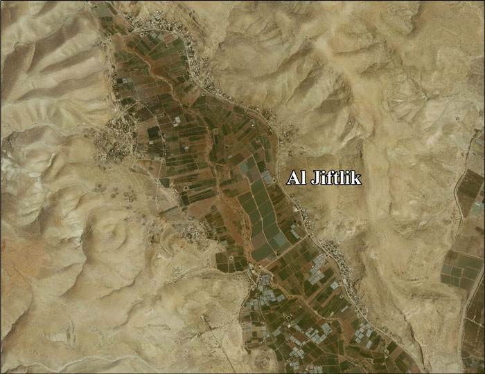
The village's total area amounts to 185,032 dunams, of which 972 dunams are Palestinian built up areas, 77 are for commercial and industrial transport units, 64,032 are arable lands and 108,606 dunams are open spaces. Israeli settlements, including Massua, Hamra and Argaman and military bases account for 11,293 dunams. [3] The remaining land consists of forests and inland water. [3]
The majority of the land in al-Jiftlik belonged to the al-Masa'id tribe, a powerful Bedouin family whose land spanned from Damia in Transjordan, on the east bank of the Jordan River, to the borders of Jericho in the West Bank. Most of its residents are descendants of the al-Masa'id tribe and immigrants from Tammun to the north. [3]
The village's name is derived from the Turkish word chiflik , the term for "land tenure" in the late Ottoman Empire which was applied in this as in many other Ottoman locations. [4] It received its name due to the agricultural nature of the village. [3] During the mandate period, there was a Tegart fort known as the Jiftlik Police Post just west of the present village. [4]
In the wake of the 1948 Arab–Israeli War, and after the 1949 Armistice Agreements, Al-Jiftlik came under Jordanian rule.
Since the Six-Day War in 1967, Al-Jiftlik has been under Israeli occupation. In the aftermath of the war over 800 homes in al-Jiftlik were razed by the Israeli army and its 6,000 inhabitants were ordered to leave. Most of al-Jiftlik's inhabitants, however, returned to the village. [5]
After the 1995 Accords between the Israel and the Palestine Liberation Organization (PLO), the village was designated as part of Area C. This makes it subject to full Israeli military and civil administration. [3] This has allowed the Israelis to commit what Robert Fisk in 2010 called "ethnic cleansing via bureaucracy". According to the head of the village council in Jiftlik, Palestinian requests for building were denied or delayed for years, and anything built without permission was "ruthlessly" torn down by the Israelis. [6]
In 2005 a village council was established to administer local affairs. Its nine members are appointed by the Palestinian National Authority. The council maintains a permanent headquarters and owns a waste collection vehicle. Among its responsibilities are building water and electricity networks in al-Jiftlik and providing an ambulance for the village. [3]
According to ARIJ, Israel has confiscated land from Al-Jiftlik in order to construct several Israeli settlements:
In the 2007 census al-Jiftlik had a population of 3,546 with exactly 50% being males and the other 50% females. The total number of households was 578 who lived in 692 housing units. The principal clans in al-Jiftlik are the 'Arab al-Masa'id, 'Arab al-Jahalin, 'Arab al-Ayed, al-Ajajrah, Abu Sureis, Abu Dalakh, Abu Dheila, al-Annuz, al-Rutimat and al-Nafei'at. According to the Applied Research Institute-Jerusalem (ARIJ), about 100 families have left al-Jiftlik since the start of the Second Intifada in 2000. [3]
Like several other villages in the Jordan Valley area, al-Jiftlik is subject to Israeli restrictions on construction and movement, and most often requests for building permits are denied. The village lacks electricity and water infrastructure. [8] It has primary school managed by the UNRWA with 950 students.
Id'eis is a Palestinian community several kilometres south of Al-Jiftlik, close to the Masua Israeli settlement. In May 2014, there were 23 families in two neighboring compounds made up of 13 families consisting of 75 people in 15 residential structures living in the north-west compound and 10 families consisting of 53 people living in 14 tents in the southern compound. Each compound also has many livestock structures for their flocks of several thousand sheep and goats. The community makes its living from shepherding and settled in the present location in 1982 having left the Hebron area and migrated across the Jordan Valley as they searched for pastureland. On 21 May 2014, the southern compound was demolished by five Israeli Civil Administration bulldozers supported by IDF soldiers and Border Police on the basis that the families did not have building permits. [9]
Qalqilya or Qalqiliya is a Palestinian city in the West Bank which serves as the administrative center of the Qalqilya Governorate. In the 2017 census, the city had a population of 51,683. Qalqilya is surrounded by the Israeli West Bank wall, with a narrow gap in the east controlled by the Israeli military and a tunnel to the Palestinian town of Hableh. Qalqilya is under the administration of the Palestinian National Authority, while remaining under Israeli military occupation.
Abu Dis or Abu Deis is a Palestinian village in the West Bank, in the Jerusalem Governorate of the State of Palestine, bordering Jerusalem. Since the 1995 Oslo II Accord, Abu Dis land has been mostly part of "Area B", under Israeli military control and Palestinian civic control. According to the Palestinian Central Bureau of Statistics (PCBS) census, Abu Dis had a population of 12,251 in 2017.
Beit Hanina is an Arab Palestinian neighborhood in East Jerusalem. It is on the road to Ramallah, eight kilometers north of central Jerusalem, at an elevation of 780 meters above sea level. Beit Hanina is bordered by Pisgat Ze'ev and Hizma to the east, Ramot, Ramat Shlomo and Shuafat to the south, Beit Iksa and Nabi Samwil to the west, and Bir Nabala, al-Jib, Kafr Aqab and ar-Ram to the north.
'Atara is a Palestinian village in the Ramallah and al-Bireh Governorate, located 15 kilometers north of Ramallah in the central West Bank. It is situated along a mountain ridge line with four peaks and is built upon the second highest point in the West Bank at 810 meters above sea level. 'Atara's total land area consists of 9,545 dunams, most of which is cultivable.
Al-Auja is a Palestinian town in the Jericho Governorate of the State of Palestine, in the eastern West Bank, located ten kilometers north of Jericho. The town has a total area of 107,905 dunams, however its built-up area comprises only 832 dunams. It is situated 230 meters below sea level.
'Anata is a Palestinian town in the Jerusalem Governorate of the State of Palestine, in the central West Bank, located four kilometers northeast of Jerusalem's Old City. According to the Palestinian Central Bureau of Statistics, 'Anata had a population of 16,919 in 2017. Its total land area is 30,603 dunams, of which over half now lies within the Israeli Jerusalem municipality and 1,654 is Palestinian built-up area. Since 1967, 'Anata has been occupied by Israel. Together with Shu'afat refugee camp, the village is almost surrounded by the Israeli West Bank barrier, cutting it off from Jerusalem and surrounding villages except for a checkpoint in the west and a road in the north-east that gives access to the rest of the West Bank.
Fasayil or Fasa'il, ancient Phasaelis, is a Palestinian village in the northeastern West Bank, a part of the Jericho Governorate, located 14 kilometres (8.7 mi) northwest of Jericho and about 40 kilometres (25 mi) southeast of Nablus. The closest Palestinian locality is Duma to the west. The village is located 2 km south of the Israeli settlement of Petza'el. According to the 2017 census by the Palestinian Central Bureau of Statistics (PCBS), the village had a population of 1,637.
al-Nuway'imah is a Palestinian village in the Jericho Governorate in the eastern West Bank, located five kilometers north of Jericho. It is situated in a low elevation below sea level in the central Jordan Valley. The village contains one primary and secondary school.
Beit Sira is a Palestinian village in the central West Bank, located 22 kilometers west of Ramallah and is a part of the Ramallah and al-Bireh Governorate. The village is situated along the Green Line. During the 1948 Arab-Israeli War, around 4,000 dunams of its land became a part of the "No-Man's Land" strip between the north-central West Bank and Israel. Currently Beit Sira's jurisdiction is 3,120 dunams, of which 441 dunams are built-up areas and the remainder is open spaces for future construction or agricultural land.
Beit Wazan is a Palestinian village in the Nablus Governorate of the State of Palestine, in the northern West Bank, located 4.5 kilometers west of Nablus. According to the Palestinian Central Bureau of Statistics (PCBS), the village had a population of 1,312 inhabitants in 2017.
Osarin is a Palestinian town in the Nablus Governorate in northern West Bank, located 16 kilometers southeast of Nablus. According to the Palestinian Central Bureau of Statistics (PCBS), the town had a population of 2,053 inhabitants in 2017.
Khirbet Abu Falah is a Palestinian village in the Ramallah and al-Bireh Governorate, located 26 kilometers (16 mi) north of Ramallah in the central West Bank. According to the Palestinian Central Bureau of Statistics (PCBS), the village had a population of 4,394 in the 2017 census.
Khirbet al-Deir, or Khirbet ed-Deir, is a Palestinian village located 10 kilometres (6.2 mi) southwest of Bethlehem, and 15 kilometres (9.3 mi) northwest of Hebron. The town is in the Hebron Governorate of central West Bank. According to the 2017 Palestinian Central Bureau of Statistics (PCBS) Census, the village had a population of 358 people.
Al-Ubeidiya is a Palestinian town located 6 kilometers (3.7 mi) east of Bethlehem, in the Bethlehem Governorate of the State of Palestine, in the central West Bank. According to the Palestinian Central Bureau of Statistics (PCBS), al-Ubeidiya had a population of over 14,460 in 2017.
az-Zubaidat is a Palestinian village in the Jericho Governorate in the eastern West Bank situated in the Jordan Valley, located 27 kilometers north of Jericho. According to the Palestinian Central Bureau of Statistics, az-Zubaidat had a population of over 1,679 inhabitants in 2017.
ʿArab al-Jahalin also known as al-Jabal is a Palestinian Bedouin neighborhood in the Jerusalem Governorate, located five kilometers southeast of Jerusalem in the West Bank. According to the Palestinian Central Bureau of Statistics (PCBS), ʿArab al-Jahalin had a population of approximately 1,856 inhabitants in mid-year 2017. The village is situated on a hillside outside al-Eizariya and 300 meters away from the Jerusalem Municipal dump. It is located in Area C of the West Bank, with few parts is in Area B. While the Israeli government has full control over the village, the populace hold Palestinian IDs.
Argaman is an Israeli settlement organized as a moshav in the West Bank. Located in the Jordan Valley, eight kilometres north of the Damia Bridge with an area of 4,500 dunams, it falls under the jurisdiction of Bik'at HaYarden Regional Council. In 2022, its population was 131.
Deir Razih is a Palestinian village in the southern West Bank located 11 kilometers (6.8 mi) southwest of Hebron, in the Hebron Governorate. It relies mainly on nearby Dura for basic services. Its total land area is made of 540 dunams, including its built-up area. The village had a population of 294 residents in 2017.
Jannatah is a Palestinian town in the central West Bank 5 kilometers (3.1 mi) south of Bethlehem in the Bethlehem Governorate. Nearby villages include Hindaza in the north and Tuqu' to the south. It is situated 570 meters (1,870 ft) above sea level. The total land area is 11,901 dunams of which 319 constitute built-up area and 277 have been confiscated by the Israeli government for settlements and a military base. Much of the remainder is used for arable land.
Marj Al-Ghazal is a Palestinian village in the Jericho Governorate in the West Bank, located 34.8 kilometers (21.6 mi) north of Jericho. According to the Palestinian Central Bureau of Statistics (PCBS), Marj Al-Ghazal had a population of 243 in the 2017 census.