"}" id="mwBg">
Masua | |
---|---|
![]() | |
Coordinates: 32°06′48″N35°29′33″E / 32.11333°N 35.49250°E | |
District | Judea and Samaria Area |
Council | Bik'at HaYarden |
Region | West Bank |
Affiliation | HaOved HaTzioni |
Founded | 1969 |
Founded by | Nahal |
Population (2022) [1] | 297 |
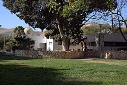
Masua (Hebrew : מַשּׂוּאָה, lit. Torch, Arabic : مسواه), also transliterated as Massu'a, is an Israeli settlement organized as a moshav shitufi in the West Bank. [2] Located in the Jordan Valley, with an area of 6,000 dunams, it falls under the jurisdiction of Bik'at HaYarden Regional Council. [2] In 2022 it had a population of 297.
The international community considers Israeli settlements in the West Bank illegal under international law, but the Israeli and US governments dispute this. [3]
The village was established in 1969 as a Nahal settlement, and was converted to a civilian moshav by a HaOved HaTzioni gar'in five years later. [2]
According to ARIJ, Israel has confiscated 2,209 dunams of land from the Palestinian village of Al-Jiftlik in order to construct Masua. [4]
Four kilometers west-southwest of Masua is the Sartava Nature Reserve, named in tribute to a mountain from which, in Mishnaic times, Jews would relay signals via torch to indicate that a new month had been proclaimed.
Formerly bonfires were lighted (to announce the appearance of the new moon); but when the Cutheans practiced their deceit, it was ordained that messengers should be sent out. How were these bonfires lighted? They brought long staves of cedar wood, canes, and branches of the olive tree, and bundles of tow which were tied on top of them with twine; with these they went to the top of a mountain, and lighted them, and kept waving them to and fro, upward and downward, till they could perceive the same repeated by another person on the next mountain, and thus, on the third mountain, etc. Whence did these bonfires commence? From the Mount of Olives to Sartabha, from Sartabha to Grophinah, from Grophinah to Hoveran, from Hoveran to Beth Baltin; they did not cease waving the burning torches at Beth Baltin, to and fro, upward and downward, until the whole country of the captivity appeared like a blazing fire.
The summit of Sartava has remains of a fort built by King Alexander of Judea. The area of Sartava, which is split down its length due to the Great Rift Valley, is unique in that it embodies a transition between the Mediterranean habitats of Samaria on the one hand and the more desert-like habitats of the Arava on the other. [6]
Modi'in Illit is a Haredi Jewish-Israeli settlement organized as a city council in the West Bank, situated midway between Jerusalem and Tel Aviv.
Kokhav HaShahar is an Israeli settlement in the northern West Bank, organized as a community settlement in the Binyamin region. Located on a mountain ridge overlooking the Jordan Valley and accessible via the Allon Road, it falls under the municipal jurisdiction of Mateh Binyamin Regional Council. In 2022, it had a population of 2,501.
Modi'in-Maccabim-Re'ut is a city located in central Israel, about 35 kilometres (22 mi) southeast of Tel Aviv and 30 kilometres (19 mi) west of Jerusalem, and is connected to those two cities via Highway 443. In 2022 the population was 99,171. The population density in that year was 1,794 people per square kilometer.
Yeshivat Har Etzion, commonly known in English as "Gush" and in Hebrew as "Yeshivat HaGush", is a hesder yeshiva located in Alon Shvut, in Gush Etzion. It is considered one of the leading institutions of advanced Torah study in the world and with a student body of roughly 480, it is one of the largest hesder yeshivot in the West Bank.
Kfar Hittim is a moshav shitufi in northern Israel. Located on a hill 3 km west of Tiberias, it falls under the jurisdiction of Lower Galilee Regional Council. It was Israel's first moshav shitufi, and can also be considered the first Tower and Stockade settlement. In 2022 it had a population of 600.
Mekhora is an Israeli settlement in the West Bank organized as a moshav. It was built on lands confiscated by the Israel Defense Forces from the Palestinian villages of Al-Jiftlik, Beit Dajan and Beit Furik.
Masad is a community settlement in northern Israel. Located to the west of the Sea of Galilee, it falls under the jurisdiction of Lower Galilee Regional Council. In 2022 it had a population of 389.
Mitzpe Yeriho, also spelled Mitzpeh Yericho, is a religious Israeli settlement in the West Bank, located next to the Palestinian city of Jericho, from where it gets its name. Located 20 km east of Jerusalem and 10 km east of Ma'ale Adumim along Highway 1 in the Judean desert, it is organised as a community settlement and falls under the jurisdiction of Mateh Binyamin Regional Council. In 2022 it had a population of 2,657.
Yitav is an Israeli settlement and moshav shitufi in the southern Jordan Valley of the West Bank. Located just north of Jericho and west of the Palestinian village of al-Auja, it falls under the jurisdiction of Bik'at HaYarden Regional Council. In 2022 it had a population of 261.
Har Adar is an Israeli settlement organized as a local council in the Seam Zone and the Maccabim sub-region of the West Bank. Founded in 1986, it had a population of 4,065 in 2022. It is located near Abu Ghosh and the Green Line on Road 425, approximately 15 kilometers west of Jerusalem. Har Adar is ranked high on the Israeli socio-economic scale, at 9/10. Har Adar was initially built adjacent to the Green Line but is now largely located within the West Bank.
Bnei Yehuda is an Israeli settlement organized as a moshav located in the southern Golan Heights, under the administration of Israel. The moshav was built in 1972 and falls under the municipal jurisdiction of the Golan Regional Council. The international community considers Israeli settlements in the Golan Heights illegal under international law, but the Israeli and the U.S government disputes this. In 2022 its population was 1,152.
Deir Istiya is a Palestinian town of 3,696 in the Salfit Governorate of the State of Palestine, in the northern West Bank, 15 kilometers (9.3 mi) southwest of Nablus. The built-up area of Deir Istiya is 74 dunams, and its old city has about thirty families.
Argaman is an Israeli settlement organized as a moshav in the West Bank. Located in the Jordan Valley, eight kilometres north of the Damia Bridge with an area of 4,500 dunams, it falls under the jurisdiction of Bik'at HaYarden Regional Council. In 2022, its population was 131.
Gitit is an Israeli settlement in the West Bank, organized as a moshav. Located in the Jordan Valley with an area of 1,500 dunams, it falls under the jurisdiction of Bik'at HaYarden Regional Council. In 2022 it had a population of 502.
Yafit is an Israeli settlement organized as a moshav shitufi in the West Bank. Located in the Jordan Valley, it falls under the jurisdiction of Bik'at HaYarden Regional Council. In 2022 it had a population of 225.
Petza'el is a moshav and Israeli settlement in the West Bank. Located in the center of the Jordan Valley, 34.5 kilometers from the Green line, it falls under the jurisdiction of Bik'at HaYarden Regional Council. In 2022 it had a population of 371. It is named for Phasael, older brother of Herod the Great, for whom he had named a city nearby in ancient times.
Kfar Uria is a moshav in central Israel. Located near Beit Shemesh in the Shephelah. It falls under the jurisdiction of Mateh Yehuda Regional Council. In 2022 it had a population of 910.
Khirbet Beit Zakariyyah is a small Palestinian village southwest of Bethlehem in the West Bank, perched on a hill that rises about 995 metres (3,264 ft) above sea level. Administratively, it is associated with the village of Artas under the Bethlehem Governorate. It is also located in between the Israeli settlements of Alon Shevut and Rosh Tzurim, both of which were built on land confiscated from the village. The village had a population of 142 in 2017.
Yitzchok (Yitzchak) Lichtenstein is an Israeli-American Orthodox rabbi who is a co-rosh yeshiva of Yeshiva Torah Vodaas located in Brooklyn, New York and the Mara d'asra of Kehillas Bais Avrohom in Monsey. He is a major editor for the writings of Chaim Soloveitchik, Moshe Soloveichik and Joseph B. Soloveitchik. He is the second son of Rav Aharon Lichtenstein and Dr. Tovah Soloveitchik.
שם השמורה – לפי מיקומהּ על הר סרטבה (קרן צרטבה). על פסגת ההר היו משיאים משואות להודיע על חידוש החודש וקידושו." "בראש הר סרטבה, שרידי מצודת אלכסנדריום, אשר נבנתה על-ידי אלכסנדר ינאי ונקראה על שמוֹ." "הקער הזה מבותר לאורכּו – חלק מע' וחלק מז' – על-ידי מערכת השבר הסורי-אפריקני." "שטח השמורה כולל, נוסף לגוש הר סרטבה, גם שטח המייצג מעבר מבתי-גידול ים-תיכוניים בקמר השומרון, לבתי-גידול בבקעת הירדן; מעין פרשת-דרכים, בציר האורך של בקעת הירדן. מכאן מסתעפת מגמת התפשטות של יסודות מדבריים, ערבתיים וטרופים לכיווּן מע', לעבר גב ההר, עד עמק נחל תרצה והמדרונות הפונים אליו.