
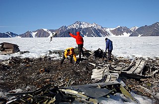
Ejnar Mikkelsen was a Danish polar explorer and writer. He is most known for his expeditions to Greenland.

The Watkins Range is Greenland's highest mountain range. It is located in King Christian IX Land, Sermersooq municipality.

Hovgaard Island is a large uninhabited island of the Greenland Sea, Greenland. The island was named after Andreas Hovgaard, a polar explorer and officer of the Danish Navy who led an expedition to the Kara Sea on steamship Dijmphna in 1882–83.

Kangerlussuaq Fjord is a fjord in eastern Greenland. It is part of the Sermersooq municipality.

Waltershausen Glacier is one of the major glaciers in Greenland. It has its terminus on the east coast of the Greenland ice sheet.

Storstrømmen, is one of the major glaciers in northeastern Greenland. The North-East Greenland Ice Stream (NEGIS) discharges into 3 main marine-terminating outlets: 79N Glacier, Zachariae Isstrøm and Storstrømmen – as arranged North to South.

King Frederik VIII Land is a major geographic division of northeastern Greenland. It extends above the Arctic Circle from 76°N to 81°N in a North-South direction along the coast of the Greenland Sea.
Queen Louise Land is a vast mountainous region located west of Dove Bay, King Frederik VIII Land, northeastern Greenland. Administratively it is part of the Northeast Greenland National Park zone.

Odinland, also Odinsland in the Defense Mapping Agency Greenland Navigation charts, is a peninsula in the King Frederick VI Coast, southeastern Greenland. It is a part of the Sermersooq municipality.

Ejnar Mikkelsen Range is a mountain range in King Christian IX Land, eastern Greenland. Administratively it is part of the Sermersooq Municipality.
The Graah Mountains are a mountain range in southeastern Greenland. Administratively this range is part of the Kujalleq municipality.

The Peary Channel was a hypothetical sound or marine channel running from east to west separating Peary Land in northernmost Greenland from the mainland further south.

Nunatak Glacier, also known as Nunatak Glacier, is a glacier in King Christian X Land, Northeast Greenland. Administratively it lies in the Northeast Greenland National Park zone.
The Wiedemann Range is a mountain range in King Christian IX Land, eastern Greenland. Administratively this range is part of the Sermersooq Municipality.
Pic de Gerlache is a mountain in King Frederick VIII Land, NE Greenland. Administratively it is part of the Northeast Greenland National Park.

Ymer Nunatak is a nunatak in the Queen Louise Land area of northeastern Greenland. Administratively it is part of the Northeast Greenland National Park zone.

L. Bistrup Bræ is a glacier in Northeastern Greenland. Administratively it belongs to the Northeast Greenland National Park.
Borgjøkel is a glacier in Queen Louise Land, northeastern Greenland. Administratively it belongs to the Northeast Greenland National Park.


