
State Route 96 (SR 96) is a 30.680-mile (49.375 km) east–west state highway in Lamar and Fayette counties in western Alabama, United States, that runs nearly entirely along the southern edge of the valley formed by Luxapallila Creek and connects Mississippi Highway 50 (MS 50) with Alabama State Route 18 (SR 18).

State Route 528 (SR 528) is north–south state highway in the northeastern portion of the U.S. state of Ohio. The southern terminus is at an intersection with U.S. Route 422 (US 422) and SR 88 in the village of Parkman, about 6½ miles south of Middlefield, and its northern terminus is at U.S. Route 20 about 2 miles (3.2 km) north of Madison. The entire highway is a two-lane highway, that passes through woodland and farmland. SR 528 was commissioned in the mid-1930s on the same route. The highway was extended in 1940, to US 20, replacing another state route. In the mid-1960s the route was extended south to US 422.

State Route 203 is a 3.080-mile-long (4.957 km) route that serves as a bypass around the northern and western portions of the town of Elba in Coffee County.
State Route 248 is a 6.066-mile-long (9.762 km) route that serves as a connection between U.S. Route 84 in Enterprise with Fort Novosel.

State Route 26 (SR 26) is a 14.560-mile-long (23.432 km) state highway in Russell County in the southeastern part of the U.S. state of Alabama. The western terminus of the highway is at its intersection with SR 51, and the eastern terminus of the highway is at its intersection with U.S. Route 431 (US 431) at the unincorporated community of Seale, approximately 20 miles (32 km) southwest of Phenix City.

State Route 110 (SR 110) is a 32.257-mile-long (51.913 km) state highway in the central part of the U.S. state of Alabama. The western terminus of the highway is at an intersection with SR 126 within sight of the Interstate 85 (I-85) and U.S. Route 80 (US 80) interchange in the eastern part of Montgomery. The eastern terminus of the highway is at an intersection with US 82 west of Union Springs, Alabama.

State Route 39 (SR 39) is a 23.057-mile-long (37.107 km) state highway in the western part of the U.S. state of Alabama. The southern terminus of the highway is at its intersection with U.S. Route 11 (US 11) near Livingston. The northern terminus of the highway is at its intersection with SR 14 at Clinton, an unincorporated community in western Greene County.

State Route 88 (SR 88) is a 3.310-mile-long (5.327 km) state highway completely within the city limits of Enterprise, in Coffee County. The western terminus of the highway is at an intersection with U.S. Route 84 north of town. The eastern terminus of the highway is at an intersection with SR 167/SR 192 in the southeastern part of town. SR 88 heads through downtown Enterprise before following Plaza Drive.

State Route 181 is a 18.235-mile-long (29.346 km) route in Baldwin County in the southwestern part of the state. The southern terminus of the route is at its junction with US 98 near Magnolia Springs. The northern terminus of the route is at its junction with US 31, near Spanish Fort.

State Route 55 (SR 55) is a 58.758-mile-long (94.562 km) state highway in the southern part of the U.S. state of Alabama. The southern terminus of the highway is at the Florida state line, where the highway continues as Florida State Road 85. The northern terminus of the highway is at an intersection with SR 106 at Georgiana in southern Butler County.

State Route 120 (SR 120) is a 4.160-mile-long (6.695 km) state highway in Tallapoosa County in the east-central part of the U.S. state of Alabama. The western terminus of the highway is at an intersection with SR 49 in the unincorporated community of Reeltown. The eastern terminus of the highway is at an intersection with SR 14 west of Notasulga.

State Route 122 (SR 122) is a 3.777-mile-long (6.078 km) state highway in Coffee County in the southern part of the U.S. state of Alabama. The western terminus of the highway is at an intersection with U.S. Route 84 (US 84) at New Brockton. The eastern terminus of the highway is at an intersection with SR 51 north of Enterprise.

State Route 83 (SR 83) is a 24-mile-long (39 km) state highway in Conecuh and Monroe counties in the southern part of the U.S. state of Alabama. The southern terminus of the highway is at an intersection with US 31/US 84 in Evergreen. The northern terminus of the highway is at an intersection with SR 47 at the unincorporated community of Midway in Monroe County.

State Route 92 (SR 92) is an 11.019-mile-long (17.733 km) state highway in the southeastern part of the U.S. state of Alabama. The western terminus of the highway is at an intersection with SR 167 southeast of Enterprise. The eastern terminus of the highway is at an intersection with U.S. Route 84 (US 84) in rural Houston County north of the unincorporated community of Wicksburg.

State Route 168 is a 17.392-mile-long (27.990 km) route in the northeastern part of the state. The western terminus of the route is at its junction with SR 75 at Douglas. The eastern terminus of the route is at its junction with SR 68 approximately eight miles northeast of Boaz in southwestern DeKalb County.
State Route 136 (SR 136) is a 6.151-mile (9.899 km) state highway in Monroe County in the southwestern part of the U.S. state of Alabama. The western terminus of the highway is at an intersection with SR 21 south of Monroeville. The eastern terminus of the route is at an intersection with U.S. Route 84 and SR 41 near the Monroe–Conecuh county line, at a point east of Excel.
State Route 114 (SR 114) is a 14.251-mile-long (22.935 km) state highway in the southwestern part of the U.S. state of Alabama. The western terminus of the highway is at an intersection with SR 10 near Lavaca, an unincorporated community approximately 11 miles (18 km) east of Butler. The eastern terminus of the highway is at an intersection with SR 69 at Myrtlewood.
State Route 189 is a 32.857-mile (52.878 km) state highway in Coffee and Crenshaw counties, in Alabama, United States, that serves as a connection between Kinston, Elba and Brantley. SR 189 intersects SR 52 at its southern terminus and US 331 at its northern terminus.

State Route 141 (SR 141) is a 14.430-mile (23.223 km) state highway in the southeastern part of the U.S. state of Alabama. The highway travels from SR 189 southeast of Elba north to U.S. Route 331 (US 331) and SR 9 south of Brantley.
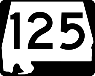
State Route 125 (SR 125) is a 24.72-mile-long (39.78 km) state highway in Coffee and Pike counties in the southeastern part of the U.S. state of Alabama. The southern terminus of the highway is at U.S. Route 84 (US 84) and SR 87 in Elba. The northern terminus of the route is at an intersection with US 231 south of Brundidge.


