Alampa Creek

Last updated
Alampa Creek
Tributary to Pinishook Creek
USA Mississippi relief location map.svg
Red pog.svg
Location of Alampas Creek mouth
Usa edcp relief location map.png
Red pog.svg
Alampa Creek (the United States)
Location
Country United States
State Mississippi
County Winston
Physical characteristics
SourceLittle Creek divide
  locationabout 6 miles northwest of Plattsburg, Mississippi
  coordinates 32°57′47″N89°14′34″W / 32.96306°N 89.24278°W / 32.96306; -89.24278 [1]
  elevation542 ft (165 m) [2]
Mouth Pinishook Creek
  location
about 2 miles north of Plattsburg, Mississippi
  coordinates
32°57′49″N89°11′36″W / 32.96361°N 89.19333°W / 32.96361; -89.19333 Coordinates: 32°57′49″N89°11′36″W / 32.96361°N 89.19333°W / 32.96361; -89.19333 [1]
  elevation
446 ft (136 m) [3]
Length4.06 mi (6.53 km) [4]
Basin size4.76 square miles (12.3 km2) [5]
Discharge 
  location Pinishook Creek
  average7.35 cu ft/s (0.208 m3/s) at mouth with Pinishook Creek [5]
Basin features
Progression Pinishook CreekPearl RiverLake Borgne → → Gulf of Mexico
River system Pearl River
Tributaries 
  leftunnamed tributaries
  rightunnamed tributaries
BridgesWalter Sisson Road, Plattsburg-Mt. Calvery Road

Alampa Creek is a stream in the U.S. state of Mississippi. [6] It is a tributary to Pinishook Creek.

Contents

Alampa most likely is a name derived from the Choctaw language meaning "hiding places". [7]

Course

Alampa Creek rises about 6 miles northwest of Plattsburg, Mississippi, and then flows generally east to join Pinishook Creek about 2 miles north of Plattsburg. [3]

Watershed

Alampas Creek drains 4.76 square miles (12.3 km2) of area, receives about 57.6 in/year of precipitation, has a wetness index of 458.37, and is about 50% forested. [5]

Related Research Articles

Albertson Brook Stream in New Jersey, USA

Albertson Brook, also called Albertsons Brook, is the name of Nescochague Creek upstream of the confluence with Great Swamp Brook in the southern New Jersey Pine Barrens in the United States.

Abrams Creek (Virginia) Stream in Virginia, USA

Abrams Creek is an 11.2-mile-long (18.0 km) tributary stream of Opequon Creek in Frederick County and the independent city of Winchester in Virginia. Abrams Creek rises north of Round Hill and flows in a southeasterly direction through Winchester. From Winchester, Abrams Creek flows east into Opequon Creek. The stream was originally known as Abraham's Creek.
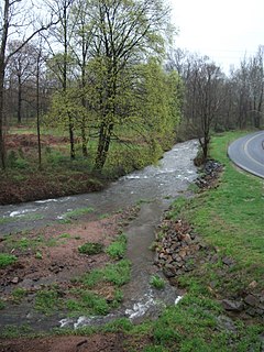
Allegheny Creek Stream in Pennsylvania, USA

Allegheny Creek is an 11.3-mile-long (18.2 km) tributary of the Schuylkill River in Berks County, Pennsylvania in the United States.

Abrams Creek (Tennessee) Stream in Tennessee, USA

Abrams Creek is a creek in Blount County, Tennessee. Its headwaters are in Cades Cove, and it is a tributary of the Little Tennessee River. It is named after the Chilhowee Cherokee chief Old Abraham ("Abram"). Visitors swim and fish in the creek. The creek was deliberately poisoned in 1957 to kill fish in potential competition with rainbow trout; many fish species were extirpated from the river and have never recovered.

Ackerson Creek Stream in California, USA

Ackerson Creek is a stream in Tuolumne County, California, in the United States. It is a tributary of the South Fork Tuolumne River.

Alder Creek (Mariposa County, California) Stream in California, USA


Alder Creek is a stream in Mariposa County, California, in the United States. It is a tributary of the South Fork Merced River.

Alger Creek Stream in Mississippi, USA

Alger Creek is a stream in Mono County, California, in the United States.

Abalobadiah Creek Stream in California, USA

Abalobadiah Creek is a stream with its mouth on the coast about a mile above the mouth of Ten Mile River on the Pacific Ocean coast of Mendocino County, California. Its source is at 39°35′21″N123°44′26″W at an elevation of 800 feet (240 m) in the coastal mountains.
Abbott Branch (Courtois Creek tributary) Stream in Missouri, USA

Abbott Branch is a stream in northern Iron County, Missouri. It is a tributary of Courtois Creek.

Adair Creek Stream in Missouri, USA

Adair Creek is a stream in western Reynolds County in the Ozarks of southeast Missouri. It is a tributary of Logan Creek.

Agency Creek (Idaho) Stream in Idaho, USA

Agency Creek is a stream in the U.S. state of Idaho. It is a tributary of the Lemhi River.
Alco Creek Stream in Oregon, USA

Alco Creek is a stream in the U.S. state of Oregon. It is a tributary to Elk Creek.

Aeneas Creek Stream in Montana, USA

Aeneas Creek is a stream in the U.S. state of Montana. It is a tributary to Graves Creek.

Addition Creek Stream in Montana, USA


Addition Creek is a stream in the U.S. state of Montana. It is a tributary to South Fork Flathead River.

Shorts Ditch Stream in Delaware, USA

Shorts Ditch is a 2.14 mi (3.44 km) long 1st order tributary to Deep Creek in Sussex County, Delaware. This is the only stream of this name in the United States.

Wolf Run (Buffalo Creek tributary) Stream in Pennsylvania, USA

Wolf Run is a 3.61 mi (5.81 km) long 2nd order tributary to Buffalo Creek in Washington County, Pennsylvania.

Cross Creek (Ohio River tributary) Tributary of the Ohio River

Cross Creek is a 21.71 mi (34.94 km) long 4th order tributary to the Ohio River in Brooke County, West Virginia.

Haynan Creek Stream in Pennsylvania, USA

Haynan Creek is a 1.48 mi (2.38 km) long 1st order tributary to Cross Creek in Washington County, Pennsylvania. This is the only stream of this name in the United States.

Harmon Creek (Ohio River tributary) Tributary of the Ohio River

Harmon Creek is a 15.75 mi (25.35 km) long 3rd order tributary to the Ohio River in Brooke County, West Virginia.

Kings Creek (Ohio River tributary) Tributary of the Ohio River

Kings Creek is a 15.23 mi (24.51 km) long 4th order tributary to the Ohio River in Hancock County, West Virginia.

References

  1. 1 2 "GNIS Detail - Alampa Creek". geonames.usgs.gov. US Geological Survey. Retrieved 21 June 2021.
  2. "Get Maps". USGS Topoview. US Geological Survey. Retrieved 21 June 2021.
  3. 1 2 "Get Maps". USGS Topoview. US Geological Survey. Retrieved 21 June 2021.
  4. "ArcGIS Web Application". epa.maps.arcgis.com. US EPA. Retrieved 21 June 2021.
  5. 1 2 3 "Alampa Creek Watershed Report". US EPA Geoviewer. US EPA. Retrieved 21 June 2021.
  6. U.S. Geological Survey Geographic Names Information System: Alampa Creek
  7. Baca, Keith A. (2007). Native American Place Names in Mississippi. University Press of Mississippi. p. 3. ISBN   978-1-60473-483-6.