
The Partido de Bahía Blanca is a partido of the Buenos Aires Province is located at the south-west of the province in central Argentina at coordinates 38°42′S62°16′W
Los Ramones is the name of a municipality and its corresponding seat of government and main population center in Mexican state of Nuevo Leon.

Santa Rita de Cássia is a Brazilian municipality in the state of Bahia. In 2020 the town's population was estimated as 28,481 inhabitants.
Sauce Viejo is a city in the province of Santa Fe, Argentina. It is located about 22 km from the province's capital city, Santa Fe, and has a population of 8,123 inhabitants which represents a growth of 87.96% compared to the 3,631 inhabitants of the previous census.

Pardilla is a municipality and town located in the province of Burgos, Castile and León, Spain. According to the 2004 census (INE), the municipality has a population of 126 inhabitants.
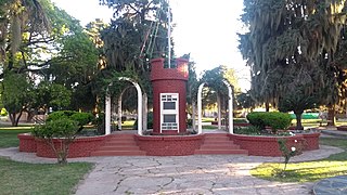
Recreo is a city in Catamarca Province, Argentina. It is the head town of the La Paz Department. Recreo is also referred to the name of the Carts Recreo.
San José is a small town in the Santa Cruz Department in the South American Andean Republic of Bolivia.

Abramo is a village and rural locality (municipality) in La Pampa Province in Argentina.
Agustoni is a village and rural locality (municipality) in La Pampa Province in Argentina.
Algarrobo del Águila is a village and rural locality (municipality) in La Pampa Province in Argentina. It is the capital of the Chical Có Department, 171 km from Santa Rosa, the provincial capital of the La Pampa province, and 693 km from Buenos Aires. It is located on Provincial Route 10 and National Route 151.

Abdón Castro Tolay is a rural municipality and village in the Cochinoca department in Jujuy Province in Argentina. It was founded in October 1919. Its main activity is the raising of llamas and sheep.

Rinconada is a rural municipality and village in Jujuy Province in Argentina. It is located in the west of the province of Jujuy and is the head of the Rinconada Department.
Fuerte Quemado is a village and municipality in Catamarca Province in northwestern Argentina. It is about 15 km away from south of Quilmes and situated on the left bank of the Santa Maria River in Argentina.
Villa de Pomán is a town and municipality in Catamarca Province in northwestern Argentina.

Barrio San Pedro Pescador is a village and municipality in Chaco Province in northern Argentina, located on the thin coastal levee of the Paraná River. The town is located in the Primero de Mayo Department and reports administratively to the Colonia Benitez municipality. It occupies the left side of the Chaco end of the General Manuel Belgrano Bridge, which links the province of Chaco with the city of Corrientes. The low-lying and floodable characteristics of the right bank of the Parana River are not conducive for human settlement, San Pedro Pescador being Chaco's only urban settlement located on the main channel of this river. Paradoxically the Parana River is the main source of livelihood (fishing) and its main threat, because of the periodic floods that force temporary abandonment by its inhabitants.
Alto de la Sierra is a village and rural municipality in Salta Province within the Rivadavia department in northwestern Argentina. Much of the population is aboriginal, engaged mainly in small-scale farming.

Barda del Medio is a village and municipality in Río Negro Province in Argentina. It is located northwest of the province of Río Negro, in the General Roca department, to the north of Patagonia. The population of Barda del Medio is 6.5 km from the municipality of Contralmirante Cordero, along National Route 151, and is under its jurisdiction.
Máximo Fernández is a hamlet in Bragado county, Buenos Aires, Argentina.

Iruya is a department is located in the north of Salta Province in northwest Argentina in the high altitude basin of the Bermejo River. It is one of 23 administrative units in the province.
López is an Argentine locality and town in the San Jerónimo Department within the Santa Fe Province.


