Albalá is a municipality located in the province of Cáceres, Extremadura, Spain, officially Albalá del Caudillo from 1960 until 2001. According to the 2006 census (INE), the municipality has a population of 850 inhabitants.
La Aldea del Obispo is a municipality located in the province of Cáceres, Extremadura, Spain. According to the 2006 census (INE), the municipality has a population of 368 inhabitants.
Belvís de Monroy is a municipality located in the province of Cáceres, Extremadura, Spain. According to the 2006 census (INE), the municipality had a population of 701.

Berrocalejo is a municipality located in the province of Cáceres, Extremadura, Spain. According to the 2005 census (INE), the municipality has a population of 115 inhabitants.

Bohonal de Ibor is a municipality located in the province of Cáceres, Extremadura, Spain. According to the 2006 census (INE), the municipality has a population of 542 inhabitants.
Cabañas del Castillo is a municipality located in the province of Cáceres, Extremadura, Spain. According to the 2006 census (INE), the municipality has a population of 477 inhabitants.
Campo Lugar is a municipality located in the province of Cáceres Extremadura, Spain. According to the INE has a population of approximately 1108 inhabitants.
Cañamero is a municipality located in the province of Cáceres, Extremadura, Spain. According to the 2005 census (INE), the municipality has a population of 1630 inhabitants.
Casas de Miravete is a municipality located in the province of Cáceres, Extremadura, Spain. According to the 2006 census (INE), the municipality has a population of 172 inhabitants.

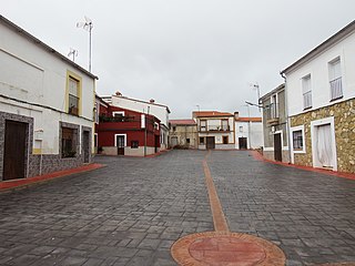
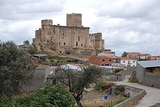
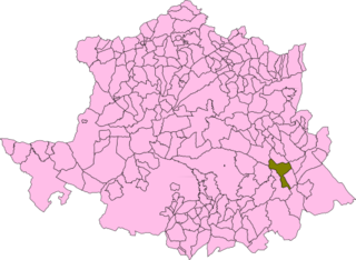
Conquista de la Sierra is a municipality located in the province of Cáceres, Extremadura, Spain. According to the 2006 census (INE), the municipality has a population of 220 inhabitants.

Deleitosa is a municipality located in the province of Cáceres, Extremadura, Spain. As of 2023, the municipality had a population of 685 inhabitants, according to the National Institute of Statistics. In 1950 during the Francoist era, W. Eugene Smith visited Deleitosa to show the poverty of Spain in photographs.

Fresnedoso de Ibor is a municipality located in the province of Cáceres, Extremadura, Spain. According to the 2006 census (INE), the municipality has a population of 338 inhabitants.

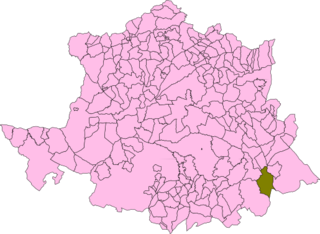
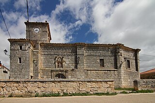
Torreorgaz is a municipality in the province of Cáceres, Extremadura, Spain. According to the 2017 census (INE), the municipality has a population of 1669 inhabitants.

Villamesías is a municipality located in the province of Cáceres, Extremadura, Spain. According to the 2006 census (INE), the municipality has a population of 344 inhabitants.
Zarza de Montánchez is a municipality located in the Sierra de Montánchez area, province of Cáceres, Extremadura, Spain. According to the 2006 census (INE), the municipality has a population of 631 inhabitants.

Abertura is a municipality in the province of Cáceres and autonomous community of Extremadura, Spain. The municipality covers an area of 62.71 square kilometres (24.21 sq mi) and as of 2011 it had a population of 447 people.

Aldeacentenera is a village in the province of Cáceres and autonomous community of Extremadura, Spain. The municipality covers an area of 110.56 square kilometres (42.69 sq mi) and as of 2011 had a population of 733 people.
El Gordo is a municipality in the province of Cáceres and autonomous community of Extremadura, Spain. The municipality covers an area of 78.72 square kilometres (30.39 sq mi) and as of 2011 had a population of 385 people.

Majadas de Tiétar is a municipality in the province of Cáceres and autonomous community of Extremadura, Spain. The municipality covers an area of 52 square kilometres (20 sq mi) and as of 2011 had a population of 1352 people.

Tornavacas is a municipality located in the province of Cáceres, in the autonomous community of Extremadura, Spain. The municipality covers an area of 595 square kilometres (230 sq mi) and as of 2011 had a population of 1170 people.