
San Clemente is a municipality in Cuenca, Castile-La Mancha, Spain. The municipality covers an area of 277.51 square kilometres (107.15 sq mi) and as of 2011 had a population of 7367 people.

Abertura is a municipality in the province of Cáceres and autonomous community of Extremadura, Spain. The municipality covers an area of 62.71 square kilometres (24.21 sq mi) and as of 2011 it had a population of 447 people.

Ahigal is a municipality in the province of Cáceres and autonomous community of Extremadura, Spain. The municipality covers an area of 52.07 square kilometres (20.10 sq mi) and as of 2011 had a population of 1435 people.

Aldeacentenera is a village in the province of Cáceres and autonomous community of Extremadura, Spain. The municipality covers an area of 110.56 square kilometres (42.69 sq mi) and as of 2011 had a population of 733 people.
Cabezabellosa is a village in the province of Cáceres and autonomous community of Extremadura, Spain. The municipality covers an area of 34 square kilometres (13 sq mi) and as of 2011 had a population of 408 people.

Cañaveral is a municipality in the province of Cáceres, an autonomous community of Extremadura, Spain. The municipality covers an area of 86.48 square kilometres (33.39 sq mi) and as of 2011 had a population of 1248 people.

Casas de Don Antonio is a municipality in the province of Cáceres and autonomous community of Extremadura, Spain. The municipality covers an area of 31 square kilometres (12 sq mi) and as of 2011 had a population of 213 people.

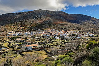
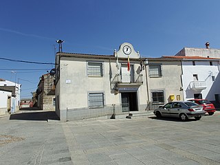
Collado de la Vera is a municipality in the province of Cáceres and autonomous community of Extremadura, Spain. The municipality covers an area of 44.94 square kilometres (17.35 sq mi) and as of 2011 had a population of 188 people.
Cuacos de Yuste is a municipality in the province of Cáceres and autonomous community of Extremadura, Spain. The municipality covers an area of 52.6 square kilometres (20.3 sq mi) and as of 2011 had a population of 902 people. It is best known for the Monastery of Yuste, whence Charles V, Holy Roman Emperor, retired and died.
Descargamaría is a municipality in the province of Cáceres and autonomous community of Extremadura, Spain. The municipality covers an area of 49.92 square kilometres (19.27 sq mi) and as of 2011 had a population of 190 people.
El Gordo is a municipality in the province of Cáceres and autonomous community of Extremadura, Spain. The municipality covers an area of 78.72 square kilometres (30.39 sq mi) and as of 2011 had a population of 385 people.

Guijo de Coria is a municipality in the province of Cáceres and autonomous community of Extremadura, Spain. The municipality covers an area of 74.75 square kilometres (28.86 sq mi) and as of 2011 had a population of 263 people.

Jerte is a municipality in the province of Cáceres and autonomous community of Extremadura, Spain. The municipality covers an area of 59 square kilometres (23 sq mi), and as of 2011 had a population of 1316 people.

Majadas de Tiétar is a municipality in the province of Cáceres and autonomous community of Extremadura, Spain. The municipality covers an area of 52 square kilometres (20 sq mi) and as of 2011 had a population of 1352 people.
Navalvillar de Ibor is a municipality located in the province of Cáceres, in the autonomous community of Extremadura, Spain. The municipality covers an area of 54.5 square kilometres (21.0 sq mi) and as of 2011 had a population of 484 people.
Rebollar is a municipality in the province of Cáceres and autonomous community of Extremadura, Spain. The municipality covers an area of 12 square kilometres (4.6 sq mi) and as of 2011 had a population of 230 people.
Santa Ana is a municipality in the province of Cáceres and autonomous community of Extremadura, Spain. The municipality covers an area of 34.99 square kilometres (13.51 sq mi) and as of 2011 had a population of 294 people.

Toril is a municipality in the province of Cáceres and autonomous community of Extremadura, Spain. The municipality covers an area of 149.76 square kilometres (57.82 sq mi) and as of 2014 had a population of 176 people.

Tornavacas is a municipality located in the province of Cáceres, in the autonomous community of Extremadura, Spain. The municipality covers an area of 595 square kilometres (230 sq mi) and as of 2011 had a population of 1170 people.

Villar de Plasencia is a municipality located in the province of Cáceres, in the autonomous community of Extremadura, Spain. The municipality covers an area of 24.99 square kilometres (9.65 sq mi) and as of 2011 had a population of 243 people.

