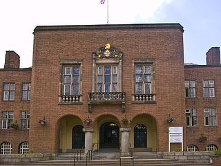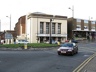
Dudley is a large market town and administrative centre in the county of West Midlands, England, 6 miles (9.7 km) south-east of Wolverhampton and 10.5 miles (16.9 km) north-west of Birmingham. Historically an exclave of Worcestershire, the town is the administrative centre of the Metropolitan Borough of Dudley and in 2011 had a population of 79,379. The Metropolitan Borough, which includes the towns of Stourbridge and Halesowen, had a population of 312,900. In 2014 the borough council named Dudley as the capital of the Black Country.

The Metropolitan Borough of Dudley is a metropolitan borough of West Midlands, England. It was created in 1974 following the Local Government Act 1972, through a merger of the existing Dudley County Borough with the municipal boroughs of Stourbridge and Halesowen. The borough borders Sandwell to the east, the city of Birmingham to the south east, Bromsgrove to the south in Worcestershire, South Staffordshire District to the west, and the city of Wolverhampton to the north.

Sedgley is a town in the north of the Metropolitan Borough of Dudley, in the West Midlands, England.

Oxleas Wood is one of the few remaining areas of ancient deciduous forest in Eltham in the Royal Borough of Greenwich, in southeast London. Some parts date back over 8,000 years to the end of the last ice age, the Younger Dryas. It is part of a larger continuous area of woodland and parkland on the south side of Shooter's Hill: other parts are Jack Wood, Castle Wood, Oxleas Meadows, Falconwood Field, Eltham Common and Eltham Park North. Eltham Park North includes the ancient Shepherdleas Wood.

Coldfall Wood is an ancient woodland in Muswell Hill, North London. It covers an area of approximately 14 hectares and is surrounded by St Pancras and Islington Cemetery, the East Finchley public allotments, and the residential streets Creighton Avenue and Barrenger Road. It is the site of the discoveries which first led to the recognition that glaciation had once reached southern England. It was declared a local nature reserve in 2013, and is also a Site of Borough Importance for Nature Conservation, Grade 1.

Kingfisher Country Park is a country park in Britain. It is situated in East Birmingham, West Midlands. Initially designated as Project Kingfisher by Birmingham City Council, the park was formally declared a country park in July 2004. The country park is located along an 11 km stretch of the River Cole from Small Heath (Birmingham) to Chelmsley Wood (Solihull) at the M6 motorway. It is a Local Nature Reserve.

Scholes Coppice in an area of ancient woodland located to the north-west of Kimberworth in the Metropolitan Borough of Rotherham in South Yorkshire, England. It was once part of the Kimberworth Deer Park, and contains a number of archaeological sites, the most significant of which is thought to be an Iron Age hill fort. Known as Caesar's Camp or Castle Holmes, this Scheduled Ancient Monument was partially excavated in the 1990s. It consists of an outer bank 2–5 metres high and 15 metres wide that may have been topped by a wooden palisade, which is paralleled by a 15-metre-wide ditch. There is no obvious entrance to the site.

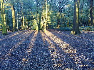
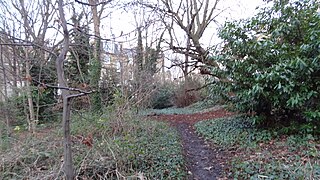
Cotwall End Valley is a local nature reserve in West Midlands, England. It is about a mile south of Sedgley, in the Metropolitan Borough of Dudley.

Marline Valley Woods is a 55.1-hectare (136-acre) biological Site of Special Scientific Interest on the western outskirts of Hastings in East Sussex. An area of 40.3 hectares is a Local Nature Reserve owned by Hastings Borough Council and managed by the Sussex Wildlife Trust.

Gornal is a suburban area and electoral ward of the Dudley Metropolitan Borough, in the West Midlands county in England. It encompasses three historic villages: Upper Gornal, Lower Gornal, and Gornal Wood. Gornal was formerly part of Staffordshire, prior to the creation of the West Midlands in 1974. It now falls under the town of Dudley and uses the DY postcode. Gornal is roughly 11 miles outside of Birmingham.

Ruislip Woods is a Site of Special Scientific Interest and national nature reserve covering 726 acres (294 ha) in Ruislip in the London Borough of Hillingdon. The woods became the second national nature reserve in an urban area of England in May 1997, receiving the Green Flag Award in 2006. Ruislip Local Nature Reserve at TQ 090 899 is part of the national nature reserve.

Barnsbury Wood is a Local Nature Reserve and Site of Borough Importance for Nature Conservation, Grade I, in Barnsbury in the London Borough of Islington. With an area of only 0.35 hectares, it is the smallest Local Nature Reserve in London It is owned and managed by Islington Council.

Whitegrove Copse is a 3.6-hectare (8.9-acre) Local Nature Reserve on the northern outskirts of Bracknell in Berkshire. It is owned and managed by Bracknell Forest Borough Council.

Alder Moors is a 8.5-hectare (21-acre) Local Nature Reserve in Woodley, a suburb of Reading in Berkshire. It is owned and managed by Wokingham District Council.

Pearman's Copse is a 6.9-hectare (17-acre) Local Nature Reserve in Lower Earley, a suburb of Reading in Berkshire. It is owned and managed by Wokingham District Council.

Blunts Wood and Paiges Meadow is a 28.9-hectare (71-acre) Local Nature Reserve in Haywards Heath in West Sussex. It is owned and managed by Mid Sussex District Council.

Valley Park Woodlands is a 24.8-hectare (61-acre) Local Nature Reserve in Chandler's Ford in Hampshire. It is owned and managed by Test Valley Borough Council.

Forge Mill Lake is a local nature reserve in Sandwell Valley, near West Bromwich in West Midlands, England. It is within Sandwell Valley Country Park.


