Alerta Airport

Last updated
Alerta Airport
Summary
Airport type Public
Operator CORPAC S.A.
Serves Alerta, Peru
Elevation  AMSL 797 ft / 243 m
Coordinates 11°39′00″S69°13′45″W / 11.65000°S 69.22917°W / -11.65000; -69.22917
Map
Peru location map.svg
Airplane silhouette.svg
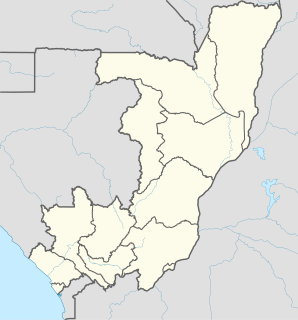
ALD
Location of the airport in Peru
Runways
Direction Length Surface
m ft
09/27 1,210 3,970 Grass
GCM [1] Landings.com [2]

Alerta Airport( IATA : ALD, ICAO : SPAR) is an airstrip serving Alerta, a village near the Bolivian border in the Ucayali Region of Peru. The village is on the Río Muymanu (sv), a stream in the Amazon basin.

An IATA airport code, also known as an IATA location identifier, IATA station code or simply a location identifier, is a three-letter code designating many airports around the world, defined by the International Air Transport Association (IATA). The characters prominently displayed on baggage tags attached at airport check-in desks are an example of a way these codes are used.

ICAO airport code four-letter code designating many airports around the world

The ICAOairport code or location indicator is a four-letter code designating aerodromes around the world. These codes, as defined by the International Civil Aviation Organization and published in ICAO Document 7910: Location Indicators, are used by air traffic control and airline operations such as flight planning.

Alerta Town in Madre de Dios Region, Peru

Alerta is a city in the Madre de Dios Region of Peru. It is located very close to the border with the Madre de Dios Region. It is located 696 km (435 mi) from the regions capital, Pucallpa.

Contents

The airstrip is 1 kilometre (0.6 mi) north of the village. The runway may have 660 metres (2,170 ft) usable length due to encroaching vegetation. [3]

The Iberia non-directional beacon (Ident: IBE) is 19.3 nautical miles (35.7 km) northwest of the airstrip. [4]

Non-directional beacon radio transmitter which emits radio waves in all directions

A non-directional (radio) beacon (NDB) is a radio transmitter at a known location, used as an aviation or marine navigational aid. As the name implies, the signal transmitted does not include inherent directional information, in contrast to other navigational aids such as low frequency radio range, VHF omnidirectional range (VOR) and TACAN. NDB signals follow the curvature of the Earth, so they can be received at much greater distances at lower altitudes, a major advantage over VOR. However, NDB signals are also affected more by atmospheric conditions, mountainous terrain, coastal refraction and electrical storms, particularly at long range.

See also

The transport in Peru.

Related Research Articles

Bakouma Airport

Bakouma Airport is an airstrip serving Bakouma, a village in the Mbomou prefecture of the Central African Republic. The airstrip is 2 kilometres (1 mi) east of the village along the RR18 road.

Birao Airport airport

Birao Airport is a rural airstrip serving Birao, a village in the Vakaga prefecture of the Central African Republic. The runway is 10 kilometres (6.2 mi) southwest of the village.

Bouca Airport

Bouca Airport is an airstrip serving Bouca, a village in the Ouham prefecture of the Central African Republic.

Ouanda Djallé Airport

Ouanda Djallé Airport is an airstrip serving Ouanda Djallé, a village in the Vakaga prefecture of the Central African Republic. The airstrip lies alongside the RN5 road that runs northwest out of the village.

Tepoe Airstrip airport

Tepoe Airstrip is an airstrip serving Pelelu Tepu, Suriname. The runway extends southwest from the village.

Afobaka Airstrip airport

Afobaka Airstrip is an airstrip near Afobaka, a village in the Brokopondo District of Suriname. The airstrip is primarily used for emergency evacuation and gold shipment. It is 5 kilometres (3.1 mi) from the campsite of the Gross Rosebel gold mine, which has its own airstrip.

Cayana Airstrip

Cayana Airstrip is an airstrip serving the villages around Kajana in the Sipaliwini District of Suriname. The runway is just west of Kajana, across the Suriname River.

Drietabbetje Airstrip

Drietabbetje Airstrip serves the Tapanahony River village of Drietabbetje, Suriname. The river breaks into braided channels at Drietabbetje, and the airstrip is on one of the larger islands.

Lawa Anapaike Airstrip

Lawa Anapaike Airstrip is an airstrip serving the Indian village of Kawemhakan on the Lawa River in Suriname. The airstrip of this relatively modern Indian village is named after its former chief Anapaike.

Sipaliwini Airstrip

Sipaliwini Airstrip, near the village of Sipaliwini, in the most southern part of Suriname in the Sipaliwini District. It was constructed as part of Operation Grasshopper and the runway of the airstrip was publicly opened in 1962.

Iberia Airport airport in Peru

Iberia Airport is an airport serving Iberia in the Madre de Dios Region of Peru. The town is in the Amazon basin, 18 kilometres (11 mi) from the Peruvian border with Bolivia.

Kindamba Airport airport in the Republic of Congo

Kindamba Airport is an airstrip serving the village of Kindamba, Republic of the Congo. The runway is 2 kilometres (1.2 mi) southwest of the village.

Loliondo Airstrip

Loliondo Airstrip is an airstrip serving the village of Loliondo, in the Arusha Region of Tanzania.

Malefiloane Airstrip

Malefiloane Airstrip is a high elevation airstrip serving the village of Malefiloane in Mokhotlong District, Lesotho. The runway is on a ridge above the Mokhotlong River valley.

Ceiba Doblada Airport

Ceiba Doblada Airport is an airstrip serving the village of Ceiba Doblada in Usulután Department, El Salvador. The unmarked grass runway is 8 kilometres (5.0 mi) east of the village.

La Chepona Airport

La Chepona Airport is an airstrip serving the village of La Chepona in Usulután Department, El Salvador. The airstrip and village are on an estuarian island just east of the Jiquilisco Bay.

Manú Airport airport in Peru

Manú Airport is an airstrip serving the village of Boca Manú and the Manú National Park in the Madre de Dios Region of Peru. The grass runway is on the opposite side of the Madre de Dios River, 3.5 kilometres (2.2 mi) southwest of the village, which is near the confluence of the Madre de Dios and Manú Rivers.

Requena Airport

Requena is an airstrip serving the Tapiche River town of Requena in the Loreto Region of Peru. The runway also serves as a street, and is lined with houses on its west side.

Bellavista Airport aérodrome in Peru

Bellavista Airport is an airstrip serving the town of Jeberos in the Loreto Region of Peru.

Satipo Airport airport in Peru

Satipo Airport is an airstrip adjacent to the town of Satipo in the Junín Region of Peru. The runway parallels highway 24A as it enters the southwestern edge of town. The location is in the valley of the Satipo River, with nearby mountainous terrain to the north and south.

References

The Aviation Safety Network (ASN) is a website that keeps track of aviation accidents, incidents, and hijackings. Their database contains details of over 10,700 reports. The ASN includes an aviation database with aviation investigations, news, photos, and statistics.