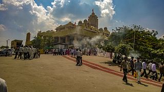
Pathardipronunciation (help·info) is a town and a municipal council in Ahmednagar district in the Indian state of Maharashtra.
Mokhada is a census town in Jawhar subdivision of Palghar district of Maharashtra state in Konkan division.
villages in mokhada :
1 Adoshi
2 Amale
3 Ase
4 Beriste
5 Botoshi
6 Brahmagaon
7 Charangaon
8 Chas
9 Dandwal
10 Dhamani
11 Dhamanshet
12 Dhondmaryachimet
13 Dhudgaon
14 Dolhare
15 Ghanval
16 Ghosali
17 Gomghar
18 Gonde Bk.
19 Gonde Kh.
20 Hirve
21 Jogalwadi
22 Kaduchiwadi
23 Kalamgaon
24 Karegaon
25 Karol
26 Kashti
27 Kevanale
28 Khoch
29 Khodala
30 Kiniste
31 Kochale
32 Koshimshet
33 Kurlod
34 Lakshiminagar
35 Mokhada
36 Morhande
37 Nashera
38 Nilmati
39 Osarvira
40 Pachaghar
41 Palsunde
42 Pathardi
43 Pimpalgaon
44 Poshera
45 Rajivnagar
46 Sakhari
47 Saturly
48 Sawarde
49 Sayade
50 Shastrinagar
51 Shirasgaon
52 Shirson
53 Shivali
54 Suryamal
55 Swaminagar
56 Udhale
57 Vashind
58 Wakadpada
59 Washala
Madhi is a village in Pathardi taluka of Ahmednagar district in Maharashtra.

Mohta is a village in Pathardi Taluka of Ahmednagar district.

Pathardi taluka, is a taluka in Ahmednagar subdivision of Ahmednagar district in Maharashtra State of India.
Saidapur is a village and a mandal in Karimnagar district, Andhra Pradesh, India.
Vadgaon or Wadgaon may refer to:
Shevgaon Assembly constituency is one of the 288 Vidhan Sabha constituencies of Maharashtra state, western India. This constituency is located in Ahmednagar district. There are total 379 booth in this constituency.
Rahuri Assembly constituency is one of the 288 Vidhan Sabha constituencies of Maharashtra state, western India. This constituency is located in Ahmednagar district.
Patardi is a village in the Baghmundi CD block in the Jhalda subdivision of the Purulia district in the state of West Bengal, India.

Dharwadi is a village in Pathardi taluka in Ahmednagar District of Maharashtra State, India. It belongs to Khandesh and Northern Maharashtra region. It belongs to Nashik Division. It is located 28 km towards East from District headquarters Ahmednagar. 29 km from Pathardi. 257 km from State capital Mumbai.
Agaskhand is a village in Pathardi taluka, Ahmadnagar district of Maharashtra state in Indian territory.
Aakola is a village in Pathardi taluka, Ahmadnagar district of Maharashtra state in Indian territory.
Ambika nagar is a village in Pathardi taluka, Ahmednagar district of Maharashtra state in Indian territory.


