Alie Street

Last updated

Alie Street
Disused factory, Alie Street E1 - geograph.org.uk - 1761482.jpg
Disused factory, Alie Street, 2010
Open street map central london.svg
Red pog.svg
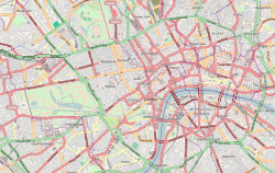
Shown within Central London
Former name(s)Ayliff Street, Great Alie Street and Little Alie Street
Location Tower Hamlets, London
Postal code E1
Nearest Tube station Underground no-text.svg Aldgate; Aldgate East
Coordinates 51°30′48.96″N0°4′17.66″W / 51.5136000°N 0.0715722°W / 51.5136000; -0.0715722
West end Mansell Street
East end Commercial Road
Construction
Construction start17th Century
Completion17th Century

Alie Street is a 400-metre-long street located in Whitechapel, in the London Borough of Tower Hamlets. It links Mansell Street with Commercial Road in the East End of London. For much of its history, the western part was known as Great Alie Street, with the eastern part called Little Alie Street.

History

Detail from John Rocque's Map of London, 1746 Goodman's fields on Roque's map 1746.png
Detail from John Rocque's Map of London, 1746

Originally called Ayliff Street, it was named after a relative of William Leman, whose great-uncle, John Leman had bought Goodman's Fields earlier in the seventeenth century. [1] Alie Street ran along the northern side, with Leman Street to the east, Prescot Street to the south, and Mansell Street to the West. These new streets developed in the late seventeenth century while Goodman's Fields was used as a tenterground. [2]

From the 1800s to the late 20th century, the western section from Mansell Street to Leman Street was known as Great Alie Street, with an extension going east from Leman Street to Commercial Road being known as Little Alie Street. [3]

Related Research Articles

<span class="mw-page-title-main">Cowley, London</span> Suburban village in the United Kingdom

Cowley is a village contiguous with the town of Uxbridge in the London Borough of Hillingdon. A largely suburban village with 16 listed buildings, Cowley is 15.4 miles (24.8 km) west of Charing Cross, bordered to the west by Uxbridge Moor in the Green Belt and the River Colne, forming the border with Buckinghamshire. Cowley was an ancient parish in the historic county of Middlesex.

<span class="mw-page-title-main">Paddington</span> Area of central London, England

Paddington is an area in the City of Westminster, in central London, England. A medieval parish then a metropolitan borough, it was integrated with Westminster and Greater London in 1965. Paddington station, designed by the engineer Isambard Kingdom Brunel opened in 1847. It is also the site of St Mary's Hospital and the former Paddington Green Police Station.

<span class="mw-page-title-main">Peckham</span> District in London, England

Peckham is a district in south-east London, within the London Borough of Southwark. It is 3.5 miles (5.6 km) south-east of Charing Cross. At the 2001 Census the Peckham ward had a population of 14,720.

<span class="mw-page-title-main">St Pancras, London</span> Area of central London, England

St Pancras is a district in central London. It was originally a medieval ancient parish and subsequently became a metropolitan borough. The metropolitan borough then merged with neighbouring boroughs and the area it covered now forms around half of the modern London Borough of Camden. The area of the parish and borough includes the sub-districts of Camden Town, Kentish Town, Gospel Oak, Somers Town, King's Cross, Chalk Farm, Dartmouth Park, the core area of Fitzrovia and a part of Highgate.

<span class="mw-page-title-main">Whitechapel</span> Human settlement in England

Whitechapel is an area in London, England, and is located in the London Borough of Tower Hamlets. It is in East London and part of the East End. It is the location of Tower Hamlets Town Hall and therefore the borough town centre. Whitechapel is located 3.4 miles (5.5 km) east of Charing Cross.

<span class="mw-page-title-main">Battle of Cable Street</span> 1936 anti-fascist confrontation in London

The Battle of Cable Street was a series of clashes that took place at several locations in the East End of London, most notably Cable Street, on Sunday 4 October 1936. It was a clash between the Metropolitan Police, sent to protect a march by members of the British Union of Fascists led by Sir Oswald Mosley, and various anti-fascist demonstrators including local trade unionists, communists, anarchists, British Jews, and socialist groups. The anti-fascist counter-demonstration included both organised and unaffiliated participants.

<span class="mw-page-title-main">London Inner Ring Road</span> Major roads that encircle the centremost part of London

The London Inner Ring Road, or Ring Road as signposted, is a 12-mile (19 km) route with an average diameter of 2.75–5.5 miles (4.43–8.85 km) formed from a number of major roads that encircle Central London. The ring road forms the boundary of the London congestion charge zone, although the ring road itself is not part of the zone.

<span class="mw-page-title-main">Piccadilly</span> Road in the City of Westminster, London, England

Piccadilly is a road in the City of Westminster, London, England, to the south of Mayfair, between Hyde Park Corner in the west and Piccadilly Circus in the east. It is part of the A4 road that connects central London to Hammersmith, Earl's Court, Heathrow Airport and the M4 motorway westward. St James's is to the south of the eastern section, while the western section is built up only on the northern side. Piccadilly is just under 1 mile (1.6 km) in length, and it is one of the widest and straightest streets in central London.

<span class="mw-page-title-main">Mansell Street</span>

Mansell Street is a street in Central London, which is part of the London Inner Ring Road. For most of its length from the north, this street marks the boundary between the City of London and the London Borough of Tower Hamlets. However, the southernmost part is entirely in Tower Hamlets.

Seven Sisters is a district of Tottenham, north London, England, at the eastern end of Seven Sisters Road, which runs from Tottenham High Road to join the A1 in Holloway.

<span class="mw-page-title-main">Prescot</span> Town in England

Prescot is a town and civil parish within the Metropolitan Borough of Knowsley in Merseyside, United Kingdom. It lies about eight miles (13 km) to the east of Liverpool city centre. At the 2001 Census, the civil parish population was 11,184. The population of the larger Prescot East and West wards at the 2011 census totalled 14,139. Prescot marks the beginning of the A58 road which runs through to Wetherby, near Leeds in West Yorkshire. The town is served by Prescot railway station and Eccleston Park railway station in neighbouring Eccleston.

Originally called the Commercial Railway, the London and Blackwall Railway (L&BR) in east London, England, ran from Minories to Blackwall via Stepney, with a branch line to the Isle of Dogs, connecting central London to many of London's docks. It was operational from 1840 until 1926 and 1968, closing after the decline of inner London's docks. Much of its infrastructure was reused as part of the Docklands Light Railway. The L&BR was leased by the Great Eastern Railway in 1866, but remained independent until absorbed into the London and North Eastern Railway at the 1923 Grouping. Another branch was opened in 1871, the Millwall Extension Railway.

<span class="mw-page-title-main">Cable Street</span> Street in the East End of London, England

Cable Street is a road in the East End of London, England, with several historic landmarks nearby. It was made famous by the Battle of Cable Street in 1936.

<span class="mw-page-title-main">John Leman</span>

Sir John Leman (1544–1632) was a tradesman from Beccles, England who became Lord Mayor of London.

<span class="mw-page-title-main">Whitechapel High Street</span> Street in London

Whitechapel High Street is a street in the Borough of Tower Hamlets in the East End of London. It is about 0.2 miles long, making it "one of the shortest high streets in London". It links Aldgate High Street to the south-west with Whitechapel Road to the north-east, and includes junctions with Commercial Street to the north and Commercial Road to the east.

Sir William Leman, 2nd Baronet was an English politician who sat in the House of Commons from 1690 to 1695.

<span class="mw-page-title-main">Leman Street</span> Street in the London Borough of Tower Hamlets

Leman Street, once known as Lemon Street, is a street in Tower Hamlets. It was built in the seventeenth century as part of the development of Goodman's Fields. It is named after John Leman who was responsible for this development, which also included Ayliff Street, Mansell Street, and Prescot Street.

<span class="mw-page-title-main">Stephen Godin</span>

Stephen Peter Godin was an English insurance broker in the City of London and a land-owner in Middlesex. He acquired Cullands Grove in Southgate in what is now north London and may have built the first house on the land. He played an active part in public life and was an officer of a number of charitable organisations.

<span class="mw-page-title-main">Prescot Street</span>

Prescot Street is a street in Aldgate in the London Borough of Tower Hamlets in Central London. It runs between Goodman's Yard and Mansell Street in the west and Leman Street in the east. The area, including Ayliff Street, Leman Street and Mansell Street as well as Prescot Street, was built up in the seventeenth century as part of the development of Goodman's Fields by William Leman. Prescot was the maiden name of Leman's mother Rebecca.

<span class="mw-page-title-main">Chamber Street</span>

Chamber Street, once known as Chambers Street, is in the London Borough of Tower Hamlets in east London. It runs between Mansell Street in the west and Leman Street in the east, parallel with Prescot Street to the North and the London, Tilbury and Southend line to the south.

References

  1. "Alie Street Blog Post – July 2015". www.rcpath.org. Royal College of Pathologists. Retrieved 19 March 2017.
  2. "Archaeology at 31-33 Prescot Street & 99 Mansell Street" (PDF). marldon.net. Marldon. Retrieved 19 March 2017.
  3. "Hollings page one". freepages.genealogy.rootsweb.ancestry.com. Retrieved 19 March 2017.