
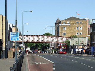
Bethnal Green is an area in London, England and is located in the London Borough of Tower Hamlets. It is in east London and part of the East End. The area emerged from the small settlement which developed around the Green, much of which survives today as Bethnal Green Gardens, beside Cambridge Heath Road. By the 16th century the term applied to a wider rural area, the Hamlet of Bethnal Green, which subsequently became a Parish, then a Metropolitan Borough before merging with neighbouring areas to become the north-western part of the new Tower Hamlets.

Poplar is a district in East London, England and is in the London Borough of Tower Hamlets. It is an inner-city suburb located five miles (8 km) east of Charing Cross and lays on the western bank of the River Lea and is part of the London Docklands.

Shoreditch is an area in London, England and is located in the London Borough of Hackney alongside neighbouring parts of Tower Hamlets, which are also perceived as part of the area due to historic ecclesiastical links. Shoreditch lies just north-east of the border with the City of London and is considered to be a part of London's East End.

Whitechapel is an area in London, England, and is located in the London Borough of Tower Hamlets. It is in east London and part of the East End. It is the location of Tower Hamlets Town Hall and therefore the borough town centre. Whitechapel is located 3.4 miles (5.5 km) east of Charing Cross.

The London Borough of Tower Hamlets is a borough of London, England. Situated on the north bank of the River Thames and immediately east of the City of London, the borough spans much of the traditional East End of London and includes much of the regenerated London Docklands area. The 2019 mid-year population for the borough is estimated at 324,745.

The London Inner Ring Road, or Ring Road as signposted, is a 12-mile (19 km) route with an average diameter of 2.75–5.5 miles (4.43–8.85 km) formed from a number of major roads that encircle Central London. The ring road forms the boundary of the London congestion charge zone, although the ring road itself is not part of the zone.

Bromley, commonly known as Bromley-by-Bow, is a district in the London Borough of Tower Hamlets in East London, located on the western banks of the River Lea, in the Lower Lea Valley in East London. It is an inner-city suburb located 4.7 miles east of Charing Cross.

Spitalfields is an area in London, England and is located in the London Borough of Tower Hamlets. It is in East London and situated in the East End. Spitalfields is formed around Commercial Street and Brick Lane. It has several markets, including Spitalfields Market, the historic Old Spitalfields Market, Brick Lane Market and Petticoat Lane Market. The area has a long attracted migrants from overseas, including many Jews, whose presence gained the area the 19th century nickname of Little Jerusalem.

Balfron Tower is a 26-storey residential building in Poplar, located in the London Borough of Tower Hamlets, London. Built in a Brutalist style, it forms part of the Brownfield Estate, an area of social housing between Chrisp Street Market and the A12 northern approach to the Blackwall Tunnel. It was designed by Ernő Goldfinger in 1963 for the London County Council, built 1965–67 by the GLC, and has been a listed building since 1996. Balfron Tower is stylistically similar to Goldfinger's later Trellick Tower in North Kensington, within West London

Minories is the name of a small former administrative unit, and also of a street in the Aldgate area of the City of London. Both the street and the former administrative area take their name from the Abbey of the Minoresses of St. Clare without Aldgate.

Millwall is a district on the western and southern side of the Isle of Dogs, in east London, England, in the London Borough of Tower Hamlets. It lies to the immediate south of Canary Wharf and Limehouse, north of Greenwich and Deptford, east of Rotherhithe, west of Cubitt Town, and has a long shoreline along London's Tideway, part of the River Thames. It was part of the County of Middlesex and from 1889 the County of London following the passing of the Local Government Act 1888, it later became part of Greater London in 1965.

The Royal London Hospital is a large teaching hospital in Whitechapel in the London Borough of Tower Hamlets. It is part of Barts Health NHS Trust. It provides district general hospital services for the City of London and Tower Hamlets and specialist tertiary care services for patients from across London and elsewhere. The current hospital building has 1248 beds and 34 wards. It opened in February 2012.
Commercial Road is a street in the London Borough of Tower Hamlets in the East End of London. It is 1.9 miles (3.1 km) long, running from Gardiner's Corner, through Stepney to the junction with Burdett Road in Limehouse at which point the route splits into the East India Dock Road and the West India Dock Road. It is an artery connecting the historic City of London with the more recently developed financial district at Canary Wharf, and part of the A13.

Sir John Leman (1544–1632) was a tradesman from Beccles, England who became Lord Mayor of London.

St George's German Lutheran Church is a church in Alie Street, Whitechapel just to the east of the City of London. From its foundation in 1762 until 1995 it was used by German Lutherans. Today the small vestry serves as an office for the Historic Chapels Trust and the church is available for hire for secular events.
Sir William Leman, 2nd Baronet was an English politician who sat in the House of Commons from 1690 to 1695.
Alie Street is a 400-metre-long street located in Whitechapel, in the London Borough of Tower Hamlets. It links Mansell Street with Commercial Road in the East End of London. For much of its history, the western part was known as Great Alie Street, with the eastern part called Little Alie Street.

Leman Street, once known as Lemon Street, is a street in Tower Hamlets. It was built in the seventeenth century as part of the development of Goodman's Fields. It is named after John Leman who was responsible for this development, which also included Ayliff Street, Mansell Street, and Prescot Street.

Prescot Street is a street in Aldgate in the London Borough of Tower Hamlets in Central London. It runs between Goodman's Yard and Mansell Street in the west and Leman Street in the east. The area, including Ayliff Street, Leman Street and Mansell Street as well as Prescot Street, was built up in the seventeenth century as part of the development of Goodman's Fields by William Leman. Prescot was the maiden name of Leman's mother Rebecca.

Chamber Street, once known as Chambers Street, is in the London Borough of Tower Hamlets in east London. It runs between Mansell Street in the west and Leman Street in the east, parallel with Prescot Street to the North and the London, Tilbury and Southend line to the south.

