This article needs additional citations for verification .(May 2021) |
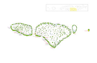
The channel in between Vaavu Atoll and Meemu Atoll from the eastern set of atolls and Ari Atoll and Nilandhe Atoll from the western set of atolls in the Maldives.
This article needs additional citations for verification .(May 2021) |
The channel in between Vaavu Atoll and Meemu Atoll from the eastern set of atolls and Ari Atoll and Nilandhe Atoll from the western set of atolls in the Maldives.

Johnston Atoll is an unincorporated territory of the United States, currently administered by the United States Fish and Wildlife Service (USFWS). Johnston Atoll is a National Wildlife Refuge and part of the Pacific Remote Islands Marine National Monument. It is closed to public entry, and limited access for management needs is only granted by Letter of Authorization from the United States Air Force and a Special Use Permit from the U.S. Fish and Wildlife Service.

The Marshall Islands, officially the Republic of the Marshall Islands, is an independent island country near the Equator in the Pacific Ocean, slightly west of the International Date Line. Geographically, the country is part of the larger island group of Micronesia. The country's population of 58,413 people is spread out over five islands and 29 coral atolls, comprising 1,156 individual islands and islets. The capital and largest city is Majuro. It has the largest portion of its territory composed of water of any sovereign state, at 97.87%. The islands share maritime boundaries with Wake Island to the north, Kiribati to the southeast, Nauru to the south, and Federated States of Micronesia to the west. About 52.3% of Marshall Islanders live on Majuro. In 2016, 73.3% of the population were defined as being "urban". The UN also indicates a population density of 760 inhabitants per square mile (295/km2), and its projected 2020 population is 59,190.

Midway Atoll is a 2.4-square-mile (6.2 km2) atoll in the North Pacific Ocean. Midway Atoll is an insular area of the United States and is an unorganized and unincorporated territory. The largest island is Sand Island, which has housing and an airstrip. Immediately to the east of Sand Island across the narrow Brooks Channel is Eastern Island, which is uninhabited and has no facilities. Forming a rough, incomplete circle around the two main islands and creating Midway Lagoon is Spit Island, a narrow reef.

Palmyra Atoll, also referred to as Palmyra Island, is one of the Northern Line Islands. It is located almost due south of the Hawaiian Islands, roughly one-third of the way between Hawaii and American Samoa. North America is about 3,300 miles northeast and New Zealand the same distance southwest, placing the atoll at the approximate center of the Pacific Ocean. The land area is 4.6 sq mi (12 km2), with about 9 miles (14 km) of sea-facing coastline and reef. There is one boat anchorage known as West Lagoon, accessible from the sea by a narrow artificial channel.

United States Minor Outlying Islands is a statistical designation defined by the International Organization for Standardization's ISO 3166-1 code. The entry code is ISO 3166-2:UM. The minor outlying islands and groups of islands consist of eight United States insular areas in the Pacific Ocean and one in the Caribbean Sea.

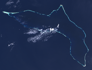
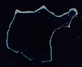
An atoll, sometimes known as a coral atoll, is a ring-shaped coral reef, including a coral rim that encircles a lagoon partially or completely. There may be coral islands or cays on the rim. Atolls are located in warm tropical or subtropical oceans and seas where corals can grow. Most of the approximately 440 atolls in the world are in the Pacific Ocean.
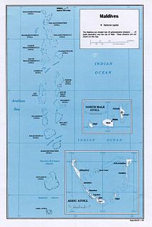
Maldives is an island country in the Indian Ocean, South Asia, south-southwest of India. It has a total land size of 298 km2 (115 sq mi) which makes it the smallest country in Asia. It consists of approximately 1,190 coral islands grouped in a double chain of 26 atolls, spread over roughly 90,000 square kilometers, making this one of the most geographically dispersed countries in the world. It has the 31st largest exclusive economic zone of 923,322 km2 (356,497 sq mi). Composed of live coral reefs and sand bars, the atolls are situated atop a submarine ridge, 960 km (600 mi) long that rises abruptly from the depths of the Indian Ocean and runs from north to south. Only near the southern end of this natural coral barricade do two open passages permit safe ship navigation from one side of the Indian Ocean to the other through the territorial waters of Maldives. For administrative purposes the Maldives government organized these atolls into twenty-one administrative divisions.
Kwajalein Atoll is part of the Republic of the Marshall Islands (RMI). The southernmost and largest island in the atoll is named Kwajalein Island, which its majority English-speaking residents often use the shortened name, Kwaj. The total land area of the atoll amounts to just over 6 square miles (16 km2). It lies in the Ralik Chain, 2,100 nautical miles southwest of Honolulu, Hawaii.

Bikini Atoll, sometimes known as Eschscholtz Atoll between the 1800s and 1946, is a coral reef in the Marshall Islands consisting of 23 islands surrounding a 229.4-square-mile (594.1 km2) central lagoon. Post Second World War, the atoll's inhabitants were forcibly relocated in 1946, after which the islands and lagoon were the site of 23 nuclear tests by the United States until 1958.

Enewetak Atoll is a large coral atoll of 40 islands in the Pacific Ocean and with its 664 people forms a legislative district of the Ralik Chain of the Marshall Islands. With a land area total less than 5.85 square kilometres (2.26 sq mi), it is no higher than 5 meters (16.4 ft) and surrounds a deep central lagoon, 80 kilometres (50 mi) in circumference. It is the second-westernmost atoll of the Ralik Chain and is 305 kilometres (190 mi) west from Bikini Atoll.
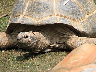
Aldabra is the world's second-largest coral atoll. It is situated in the Aldabra Group of islands in the Indian Ocean that are part of the Outer Islands of the Seychelles, with a distance of 1,120 km (700 mi) southwest of the capital, Victoria, on Mahé Island.

Waterworld is a 1995 American post-apocalyptic action film directed by Kevin Reynolds and co-written by Peter Rader and David Twohy. It was based on Rader's original 1986 screenplay and stars Kevin Costner, who also produced it with Charles Gordon and John Davis. It was distributed by Universal Pictures.

The Northwestern Hawaiian Islands or Leeward Islands are the small islands and atolls in the Hawaiian island chain located northwest of the islands of Kauai and Niihau. Politically, they are all part of Honolulu County in the U.S. state of Hawaii, except Midway Atoll, which is a territory distinct from the State of Hawaii, and grouped as one of the United States Minor Outlying Islands. The United States Census Bureau defines this area, except Midway, as Census Tract 114.98 of Honolulu County. Its total land area is 3.1075 square miles (8.048 km2). All the islands except Nihoa are north of the Tropic of Cancer, making them the only islands in Hawaii that lie outside the tropics.
Rongelap AtollRONG-gə-lap is a coral atoll of 61 islands in the Pacific Ocean, and forms a legislative district of the Ralik Chain of the Marshall Islands. Its total land area is 8 square miles (21 km2). It encloses a lagoon with an area of 1,000 square miles (2,600 km2). It is historically notable for its close proximity to US hydrogen bomb tests in 1954, and was particularly devastated by fallout from the Castle Bravo test. The population was evacuated from Rongelap following the test due to high radiation levels. However, according to the most recent census in 2011 it has begun to recover with about eighty people living on the atoll.
Kaafu Atoll is the code name given to an administrative division in the Republic of Maldives which consists of the geographical atolls of Kaashidhoo Island, Gaafaru, North Malé Atoll and South Malé Atoll. As the two Malé Atolls are the main islands of the administrative district, the entire Kaafu Atoll administrative division is officially named Malé Atoll or Malé Atolhu in the Maldivian language, Dhivehi.
Fainu is one of the inhabited islands of Raa Atoll. Fainu is situated in Raa Atoll which is officially known as North Maalhosmadulu Atoll. The island is located between the Kinolhas and Inguraidhoo. The island is 151.84 km north of the country's capital, Malé. From Fainu in a normal boat it takes about over 8 hours to reach capital city Male'.

Ontong Java Atoll or Luangiua is one of the largest atolls on earth. It is sometimes referred to as Lord Howe Atoll, not to be confused with Lord Howe Island.
Mokilese also known as Mwoakilloan, Mwokilese, or Mwoakilese is a Micronesian language originally spoken on Mwoakilloa, Federated States of Micronesia. Of the 1200 Mokilese speakers, only about 500 live on Mwoakilloa.
There are broad channels between the Atolls of the Maldives known locally as 'kandu'. The deepness and broadness of the channels vary from channel to channel.

Nuclear testing at Bikini Atoll consisted of the detonation of 23 nuclear weapons by the United States between 1946 and 1958 on Bikini Atoll in the Marshall Islands. Tests occurred at 7 test sites on the reef itself, on the sea, in the air, and underwater. The test weapons produced a combined fission yield of 42.2 Mt of TNT in explosive power.
| | This Maldives location article is a stub. You can help Wikipedia by expanding it. |