Alikalia

Last updated
Alikalia
Nickname: 
Kuranko London
Sierra Leone adm location map.svg
Red pog.svg
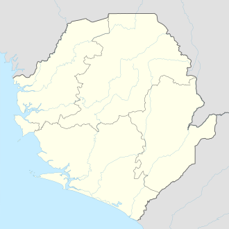
Alikalia
Location in Sierra Leone
Coordinates: 9°10′N11°24′W / 9.167°N 11.400°W / 9.167; -11.400 Coordinates: 9°10′N11°24′W / 9.167°N 11.400°W / 9.167; -11.400
CountryFlag of Sierra Leone.svg  Sierra Leone
Province Northern Province
District Koinadugu District
Chiefdom Neini Chiefdom
Government
   Current Honorable Daniel Koroma
Population
 (2009)
  Total3,254
Time zone UTC+0 (GMT)

Alikalia is a town in Koinadugu District in the Northern Province of Sierra Leone. As of 2009 it had an estimated population of 3,254. [1] Alikalia happens to be the second largest town in Koinadugu District, followed by the head quarter town which is Kabala.

Alikalia is surrounded by hills and streams.

Related Research Articles

<span class="mw-page-title-main">Kabala, Sierra Leone</span> Place in Northern Province, Sierra Leone

Kabala is the capital and largest town of Koinadugu District in the Northern Province of Sierra Leone. Kabala is one of the main towns in Northern Sierra Leone and is set in a rural landscape, surrounded by mountains.

<span class="mw-page-title-main">Bombali District</span> Place in Northern Province, Sierra Leone

Bombali is a district in the Northern Province of Sierra Leone. Its capital and largest city is Makeni, which is also the largest city in the north. The Bombali district is one of the sixteen districts of Sierra Leone. Bombali is one of the largest districts in Sierra Leone by geographical area, after Koinadugu district, and is the second most populous district in the Northern part of Sierra Leone, after Port Loko district. In the 2015 Sierra Leone national census, the population of Bombali district was 606,183. Other major towns in Bombali District include Kamabai, Karina and Binkolo.

<span class="mw-page-title-main">Northern Province, Sierra Leone</span> Province of Sierra Leone

The Northern Province is one of the five provincial divisions of Sierra Leone. It is located in the Northern geographic region of Sierra Leone. It comprises the following four Districts: Bombali, Falaba, Koinadugu and Tonkolili. The Northern Province covers an area of 35,936 km2 (13,875 sq mi) with a population of 2,502,865, based on the 2015 Sierra Leone national census. Its administrative and economic center is Makeni. The North borders the Western Area to the West, the Republic of Guinea to the north-east, the Eastern Province and Southern Province to the south-east.

<span class="mw-page-title-main">Tonkolili District</span> Place in Northern Province, Sierra Leone

Tonkolili District is a district in the Northern Province of Sierra Leone. Its capital and largest city is Magburaka. The other major towns include Masingbi, Yele, Mile 91, Bumbuna, Yonibana, Matotoka. Mathora, Magbass and Masanga. Tonkolili District is home to the largest sugar factory in Sierra Leone, and one of the largest sugar factories in West Africa, that is located in the town of Magbass. Tonkolili District had a population of 530,776. The district occupies a total area of 7,003 km2 (2,704 sq mi) and comprises eleven chiefdoms.

<span class="mw-page-title-main">Limba people (Sierra Leone)</span> Ethnic group, third largest in Sierra Leone

The Limba people are the third largest ethnic group in Sierra Leone. They represent 12.4% of Sierra Leone's total population. They are based in the north of the country across seven provinces, comprising about 12% of the national populations. They’re predominantly found in the Northern Province of Sierra Leone.

<span class="mw-page-title-main">Koinadugu District</span> Place in Northern Province, Sierra Leone

Koinadugu District is a district in the Northern Province of Sierra Leone. It is the largest District in Sierra Leone in geographical area, and one of the least most densely populated. Its capital and largest city is Kabala, which is also one of the main cities in Northern Sierra Leone. The District of Koinadugu has a population of 404,097, based on the 2015 Sierra Leone national census; and has a total area of 12,121 km2 (4,680 sq mi). Koinadugu District is subdivided into eleven chiefdoms.

Mandinka people of Sierra Leone is a major ethnic group in Sierra Leone and a branch of the Mandinka people of West Africa. Most Sierra Leonean Mandingo are the direct descendants of Mandinka settlers from Guinea, who settled in the north and eastern part of Sierra Leone, beginning in the late 1870s to the 1890s under the rule of prominent Mandinka Muslim cleric Samori Ture. Also later a significantly large population of Mandinka from Guinea migrated and settled in Eastern Sierra Leone and Northern Sierra Leone in the early to mid 20th century. The Mandingo people of Sierra Leone have a very close friendly and allied relationship with their neighbors the Mandingo people of Guinea and Liberia, as they share pretty much identical dialect of the Mandingo language, tradition, culture and food.

Diang is a chiefdom in Koinadugu District of Sierra Leone with a population of 19,700. Its principal town is Kondembaia. Lake Sonfon is located in the chiefdom an inland mountain lake of religious and cultural significance.There are two ruling houses namely, Ferekeya and Magbaia for Paramount Chieftency in Diang Chiefdom.

Nieni is a chiefdom in Koinadugu District of Sierra Leone with a population of 39,107. Its principal town is Yiffin.

Sengbe is a chiefdom in Koinadugu District of Sierra Leone with a population of 22,458. Its principal town is Yogomaia.

Sulima is a chiefdom in Koinadugu District of Sierra Leone with a population of 20,062. Its principal town is Falaba.

<span class="mw-page-title-main">Wara-Wara Bafodia Chiefdom</span>

Wara-Wara Bafodia is a chiefdom in Koinadugu District of Sierra Leone with a population of 25,713. Its principal/capital town is Bafodia.

Dembelia Sikunia is a chiefdom in Koinadugu District of Sierra Leone with a population of 14,552. Its principal town is Sikunia.

Kasunko is a chiefdom in Koinadugu District of Sierra Leone with a population of 20,357. Its principal town is Fadugu.

<span class="mw-page-title-main">Religion in Sierra Leone</span>

Sierra Leone is officially a secular state, although Islam and Christianity are the two main and dominant religions in the country. The constitution of Sierra Leone provides for freedom of religion and the Sierra Leone Government generally protects it. The Sierra Leone Government is constitutionally forbidden from establishing a state religion, though Muslim and Christian prayers are usually held in the country at the beginning of major political occasions, including presidential inauguration.

<span class="mw-page-title-main">Ethnic groups in Sierra Leone</span> Ethnic groups living within the country of Sierra Leone

Sierra Leone is home to about sixteen ethnic groups, each with its own language. In Sierra Leone, membership of an ethnic group often overlaps with a shared religious identity.

<span class="mw-page-title-main">Falaba District</span> Place in Northern Province, Sierra Leone

Falaba District is a district in the Northern Province of Sierra Leone. It is one of the sixteen Districts of Sierra Leone. Its capital and largest town is Bendugu. Other towns in Falaba District include Falaba, Sikunia, Krubola, Musaia Ganya and Mansadu Falaba District is divided into thirteen chiefdoms. Falaba District is one of the largest Districts in Sierra Leone in land area, However, it is one of the least most populous districts in the country. Falaba District is known for its mostly conservative Muslim population. Falaba District has a population of 205,353, based on 2018 estimate.

Folasaba Chiefdom is a chiefdom in Koinadugu District of Sierra Leone. Its capital is Musaia.

Wara-Wara Yagala Chiefdom is a chiefdom in Koinadugu District of Sierra Leone. Its capital is Gbawuria.

References

  1. "Sierra Leone: largest cities and towns and statistics of their population". World Gazetteer. Retrieved January 24, 2009.[ dead link ]

Edited by: Momorie M. Kamara Edit Date: 06/03/2023