
King and Queen County is a county in the U.S. state of Virginia, located in the state's Middle Peninsula on the eastern edge of the Richmond, VA metropolitan area. As of the 2010 census, the population was 6,945. Its county seat is King and Queen Court House.

Caroline County is a United States county located on the eastern part of the Commonwealth of Virginia. The northern boundary of the county borders on the Rappahannock River, notably at the historic town of Port Royal. The Caroline county seat is Bowling Green.

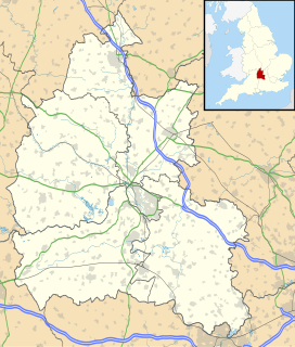
Amelia County is a county located just southwest of Richmond in the Commonwealth of Virginia, United States. The county is located in Central Virginia and is included in the Greater Richmond Region. It's county seat is Amelia Courthouse.

Chantilly is a census-designated place (CDP) in western Fairfax County, Virginia, United States. The population was 23,039 at the 2010 census. Chantilly is named after an early-19th-century mansion and farm, which in turn took the name of an 18th-century plantation that was located in Westmoreland County, Virginia. The name "Chantilly" originated in France with the Château de Chantilly, about 28 miles north of Paris.

Seven Corners is a commercial center and census-designated place (CDP) in Fairfax County, Virginia, United States. The population was 9,255 at the 2010 census. Seven Corners has a "Falls Church" mailing address but is not within Falls Church's city limits. The area got its name from the intersection of State Route 7, U.S. Route 50, State Route 613, State Route 338 and Wilson Boulevard. The junction of these four roads once created seven corners.

Tysons, also known as Tysons Corner, is a census-designated place (CDP) and unincorporated community in Fairfax County, Virginia, United States. Located in Northern Virginia between the community of McLean and the town of Vienna along the Capital Beltway (I-495), it lies within the Washington Metropolitan Area. Tysons is home to two super-regional shopping malls—Tysons Corner Center and Tysons Galleria—and the corporate headquarters of numerous companies such as Intelsat, DXC Technology, Gannett, Hilton Worldwide, Freddie Mac, Capital One, Alarm.com and Booz Allen Hamilton. Tysons is Fairfax County's central business district and a regional commercial center. It has been characterized as a quintessential example of an edge city. The population was 19,627 as of the 2010 census.

The Royal Mile is a succession of streets forming the main thoroughfare of the Old Town of the city of Edinburgh in Scotland. The term was first used descriptively in W M Gilbert's Edinburgh in the Nineteenth Century (1901), "...with its Castle and Palace and the royal mile between", and was further popularised as the title of a guidebook by R T Skinner published in 1920, "The Royal Mile (Edinburgh) Castle to Holyrood(house)".

Wardour Street is a street in Soho, City of Westminster, London. It is a one-way street that runs north from Leicester Square, through Chinatown, across Shaftesbury Avenue to Oxford Street. Throughout the 20th century the street became a centre for the British film industry and the popular music scene.
U.S. Route 360 is a spur of US 60 in the U.S. state of Virginia. The U.S. Highway runs 225.31 miles (362.60 km) from US 58 Business, Virginia State Route 293, and SR 360 in Danville east to SR 644 in Reedville. US 360 connects Danville, South Boston, and Keysville in Southside Virginia with the state capital of Richmond. The U.S. Highway also connects Richmond with Tappahannock on the Middle Peninsula and the eastern Northern Neck, where the highway serves as the primary route through Northumberland County. US 360 is a four-lane divided highway for almost all of its length.

Botley is a village in the civil parish of North Hinksey in the ceremonial county of Oxfordshire, just west of the Oxford city boundary. Historically part of Berkshire, it stands on the Seacourt Stream, a stream running off the River Thames. The intersection of the A34 and A420 is to the village's north.

The Los Gatos Creek Trail is a 9.7-mile (15.6 km) pedestrian and bicycle trail that runs through western Santa Clara County in California, from Lexington Reservoir in Los Gatos, California through Campbell, California to Meridian Avenue in San Jose, California alongside Los Gatos Creek. The trail is heavily used.

Cumnor is a village and civil parish 3+1⁄2 miles (6 km) west of the centre of Oxford, England. The village is about 2 miles (3 km) southwest of Botley and its centre is west of the A420 road to Swindon.

State Route 14 is a primary state highway in the U.S. state of Virginia. The state highway runs 71.10 miles (114.42 km) from U.S. Route 360 in St. Stephens Church east to a cul-de-sac in Bayside. SR 14 is the primary highway of King and Queen and Mathews counties and the main east–west highway of Gloucester County; the highway connects the namesake county seats of all three counties.

State Route 205 is a primary state highway in the U.S. state of Virginia. The state highway runs 18.47 miles (29.72 km) from SR 3 at Purkins Corner east to SR 3 at Oak Grove. SR 205 connects several small communities in eastern King George County and northwestern Westmoreland County. The state highway also passes through the Potomac River resort of Colonial Beach, where the highway has a spur, State Route 205Y.

Kempsville is a borough in the City of Virginia Beach, Virginia, a historic section with origins in US colonial times located in the former Princess Anne County. In modern times, it is a community within the urbanized portion of the independent city of Virginia Beach, the largest city in Virginia.
Dean Court is a suburb 2 miles (3.2 km) west of the centre of Oxford, England. Dean Court was part of Berkshire until the 1974 local government boundary changes transferred it to Oxfordshire.

Fort Ann is a town in Washington County, New York, United States. It is part of the Glens Falls Metropolitan Statistical Area. The town population was 6,417 at the 2000 census. The town contains a village, also called Fort Ann, located in its southeast corner.

Howellville or Howell is an unincorporated community in Harris County, Texas, United States, which has been absorbed by Greater Houston. The site is located at the intersection of Alief Clodine Road and Sugar Land Howell Road on the west side of Houston, approximately halfway between the original settlements of Clodine and Alief. There are no road signs identifying the place. The community began as a stop on a railroad line that no longer exists.


