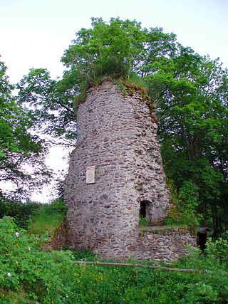
The Königsburg is a ruined medieval castle southeast of Königshütte, a village in the borough of Oberharz am Brocken, in Harz district in the German state of Saxony-Anhalt.
Rieder is a village and a former municipality in the district of Harz, in Saxony-Anhalt, Germany. Since 1 December 2013, it is part of the town Ballenstedt. Between 1 January 2011 and 19 February 2013, it was part of the town Quedlinburg.

Blankenburg (Harz) is a town and health resort in the district of Harz in Saxony-Anhalt, Germany, at the north foot of the Harz Mountains, 12 miles (19 km) southwest of Halberstadt.

Sankt Andreasberg is a former town in the district of Goslar, in Lower Saxony, Germany. Since 1 November 2011, it is part of the town Braunlage. It is situated in the Harz, approximately 7 km west of Braunlage proper, and 20 km east of Osterode am Harz.

Benneckenstein is a town in the district of Harz, in Saxony-Anhalt, Germany. Since 1 January 2010, it has been part of the town of Oberharz am Brocken. Benneckenstein is in the eastern Harz, 14 km southeast of Braunlage, and 24 km south of Wernigerode. Its population is 1,698 (2021).
Zorge is a village and a former municipality in the district of Göttingen, in Lower Saxony, Germany. Since 1 November 2016 it has been part of the municipality of Walkenried. The river Zorge rises in the village.

Altenbrak is a village and a former municipality in the district of Harz, in Saxony-Anhalt, Germany.
Stecklenberg is a village and a former municipality in the district of Harz, in Saxony-Anhalt, Germany. Since 23 November 2009, it is part of the town Thale.

The Harzer Wandernadel is a system of hiking awards in the Harz mountains in central Germany. Hikers can earn awards at different levels of challenge by walking to the various checkpoints in the network and stamping their passbooks to record the visit. With 222 checkpoints in three federal states and across five districts in the Harz and with membership in five figures, the system has gained a following Germany-wide.

The Harz Witches' Trail is a footpath, just under 100 km long, in Germany that runs from Osterode through the Harz mountains and over its highest peak, the Brocken, to Thale. It is a project by the Harz Transport Association and Harz Club and is part of the system of trails known as the Harzer Wandernadel.

The Bode Gorge is a 10 kilometres (6.2 mi) long ravine that forms part of the Bode valley between Treseburg and Thale in the Harz Mountains of central Germany. The German term, Bodetal, is also used in a wider sense to refer to the valleys of the Warme and Kalte Bode rivers that feed the River Bode.

The Hexentanzplatz in the Harz mountains is a plateau that lies high above the Bode Gorge, opposite the Rosstrappe in Saxony-Anhalt, Germany.

The Hoher Kleef is a rock formation in Rübeland in the district of Harz within the Harz mountains of Germany. It is mainly composed of granite.

Drei Annen Hohne is the name of a small settlement within the municipal area of Wernigerode in Saxony-Anhalt, Germany.

Trautenstein is a village in the borough of Oberharz am Brocken in the district of Harz in the German state of Saxony-Anhalt. Formerly an independent municipality, it was merged into the town Hasselfelde in 2002, which was merged into Oberharz am Brocken in 2010. Its population is 390 (2021).

Volkmarskeller is the name of a cave that used to have a church next to it in the vicinity of Blankenburg (Harz) in the German state of Saxony-Anhalt.
The Wilhelmsblick in the Harz Mountains of central Germany is a viewing point near the village of Treseburg in the Bode Gorge in the county of Harz, Saxony-Anhalt. From this single point, four different stretches of the River Bode may be seen as it swings in great loops around the spur on which the viewing point is located.

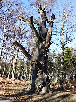
The Hunrodeiche or, more rarely, the Hunrodseiche, in the Harz Mountains of central Germany is an oak tree over 1,000 years old near Hainfeld in the county of Mansfeld-Südharz in the state of Saxony-Anhalt.

The Bergrat Müller Pond, named after a former mining director, Müller, in the Harz mountains of central Germany is a storage pond laid out from 1737 to 1738. It has an area of about 1.3 ha and lies in the forested southern part of the borough of Quedlinburg in the county of Harz in Saxony-Anhalt.
The Jagdkopf a hill, 603.1 m above sea level (NN) high, in the Harz Mountains of Germany. It is located between the villages of Wieda and Zorge in the unincorporated area of Harz in the district of Göttingen in the state of Lower Saxony.


