Almo, Idaho Indian massacre myth

Last updated

The Almo, Idaho, Indian massacre is an attack that is alleged to have occurred in 1861 when a band of Native Americans attacked a wagon train of 300 overland migrants in the Washington Territory, what is now southern Idaho. [1] But unlike other massacres involving Native Americans in the 19th century, there is not enough substantial evidence to conclude that a massacre of this magnitude actually occurred near Almo in 1861. A monument in the small town of Almo was erected in 1938 by the Sons and Daughters of Idaho Pioneers. The monument stands in the memory of the travelers who were supposedly murdered in the massacre. [2]   The endurance of the myth and the monument that is built to remember the "massacre" engenders negative feelings among Native Americans, a group that has historically experienced persecution at the hands of white settlers. [1] The monument itself displays 19th and 20th century attitudes towards Native Americans, and Native Americans believe that this monument needs to be removed, as it falsely represents Native peoples and cultures and contributes to the misinformation prevalent about Native Americans. [3]

Contents

Background

Map of the area which the Shoshone tribe covered in modern day Idaho, Wyoming, Utah, and Nevada Shoshone map.svg
Map of the area which the Shoshone tribe covered in modern day Idaho, Wyoming, Utah, and Nevada

According to the legend of the massacre, a wagon train of about 300 migrants on the trail west to California, near Almo Creek in modern-day Southern Idaho, was attacked by a band of Native Americans of the Shoshone tribe, particularly the Northern Shoshone, which were native to the area. [4] Once the last wagon cleared the creek, the attacking Native Americans surrounded train to cut them from the creek, their nearest source of water. The Shoshones terrorized the pioneers by shooting them with arrows or bullets if they tried to escape. By this point, the migrants had moved their wagons into a circle with the animals inside to defend themselves from the onslaught. [5] While under siege, the migrants desperately attempted to dig wells to find water, but their efforts proved futile. The siege that the Shoshone laid upon the wagon train continued for days, killing off nearly all of the members of the wagon train, with the exception of two men, three women, and a baby, who escaped to Brigham, Utah, now known as Brigham City, Utah. A rescue party was sent from Utah, but upon arrival they found no survivors and the wagons looted. The bodies of those killed were buried in the wells that were dug. [5]

Skepticism

Since the 15th century, the populations of indigenous peoples on the North American continent have declined due to conflicts between Native Americans and European settlers, both intentional and unintentional. Aggressions from white people towards Native Americans and from Native Americans towards whites often resulted in casualties on both sides, but typically exacted heavier tolls among the Natives. [1] If true, the Almo massacre would be an uncommon instance of Natives killing a large number of white settlers; however, there is little evidence to corroborate the occurrence of the massacre. [1]

Historian Brigham Madsen notes that the earliest telling of the story of the massacre was recorded by Charles Walgamott in 1927, more than 60 years after the massacre allegedly occurred. No records of the event were left by the five supposed survivors nor the inhabitants in Brigham, Utah, the community to which they reportedly fled. [2] There is also no evidence concerning the lives of the three hundred pioneers before they began their westward journey, other than that their journey began on the Missouri River, and was headed for California. [5] Additionally, Walgamott's account fails to provide the wagon trains' purpose in trekking west. [5]

Attacks from Native Americans that resulted in the deaths of white people were usually reported in local newspapers near where the massacres occurred, yet there are no known newspaper reports of what supposedly happened at Almo Creek. [2] A massacre of this magnitude would be one of the most infamous of its kind in United States history, but the lack of evidence makes it difficult to accept as a factual and historical event by historians. [3] This complication in turn makes it hard to widely recognize. The alleged incident near Almo is absent from a long list of violent engagements between Native Americans and whites during the second half of the nineteenth century and into the twentieth century, according to National Geographic. [6] Additionally, the absence of mass graves near Almo that would indicate the massacre did occur has caused the site to be left out of a list of graves and monumental sites along the California and Oregon trails. [7]

If the massacre did not happen, one explanation for the origins of the story comes from the poor relations between Native Americans and western settlers in the 19th century. Although there were positive and neutral interactions between Native Americans and western settlers, negative and occasional violent interactions grew more frequent on the California and Oregon trails in the mid-19th century. [8] Journal entries from overland pioneers on the Oregon trail indicate that there was an increase in the fear of attacks from Native Americans. [9] John D. Unruh noted that the number of emigrants killed by Native Americans and Native Americans killed by emigrants steadily increased between 1840 and 1860. [8]

There were other accounts of violence between emigrants and Native Americans that occurred near Almo in September 1860 and September 1862 that were both reported in the Deseret News. [10] The year 1861 was described as a quiet season, but skirmishes between Native Americans and whites were reported to have happened in the area in 1862, according to newspapers in both Nevada Territory and California. [10]

Although there was an increase in attacks and in the number of emigrants killed, reports of the attacks were often embellished or distorted to put Native Americans in a negative light. [8] An example of this was a better-attested skirmish that was started by some members of the Shoshone tribe attacking a wagon train on August 9, 1862, near the Snake River in southeastern Idaho in which eight overland emigrants and about twenty Native Americans were killed. Despite there being more Native Americans killed, the attack was labeled a "massacre" by white people and they demanded the government take action. No thought was given to the injustices that the Shoshone were suffering. The location of this attack is near what is now referred to as Massacre Rocks in Idaho, the name of which shows that it has been exaggerated to a greater degree than what initially occurred. [11] To create and spread the story of the Almo massacre may have been part of an effort to portray Native Americans in a negative way like the August 1862 attack was inflated to "massacre" status. Historian James Loewen noted that portraying Native Americans in such a negative manner falls into a popular, though offensive, stereotype of "savage Indians" that grew in the late 19th and early 20th centuries. [12]

Monument

City of Rocks State Park near Almo, Idaho is a popular destination for hikers and rock climbers. CityofRocks2023.jpg
City of Rocks State Park near Almo, Idaho is a popular destination for hikers and rock climbers.

The monument standing in Almo is dedicated to the memory of the nearly 300 pioneers that did not escape the alleged massacre. The monument was erected on October 17, 1938. [2] The monument is a granite stone carved in the shape of the state of Idaho with an inscription that reads "Almo, Idaho, dedicated to the memory of those who lost their lives in a most horrible Indian massacre, 1861. Three hundred immigrants west bound, only five escaped. Erected by S. & D. of Idaho Pioneers 1938." [13] Some of the longtime residents of Almo, including the Sons and Daughters of the Idaho Pioneers, view the monument as essential to the history of the town. [3]

Controversy

Although the exact reasons for its creation are unknown, some believe the monument was made in an effort to make Almo a recognizable place on the map and increase the likelihood that tourists would stop in town on their way to City of Rocks National Reserve. [13] City of Rocks, sometimes referred to as Silent City of Rocks, is a popular destination for hikers and rock climbers and is situated close to Almo and the nearby town of Oakley. [14]

Citizens of Almo are at a crossroads when it comes to the monument. Defenders of the monument claim it strengthens the economy of the little unincorporated town as a popular tourist sight. [4] Additionally, some residents of Almo maintain that it is a part of their history. One resident claims that its a part of the villages' identity, as many residents of modern-day Almo are fourth or fifth generation residents. [3] A retired school teacher from Almo recalls it being taught as a part of the schools curriculum. [3] Some have a more understanding point of view, describing the monument as someone being "over-eager." [4] The President of the Sons and Daughters of Idaho Pioneers has openly apologized to the Shoshone tribe; however, before her death, the monument was not removed or replaced. [3]

Legacy

Monument to Chief Pocatello of the Shoshone tribe in Pocatello, Idaho Chief pocatello 2011.jpg
Monument to Chief Pocatello of the Shoshone tribe in Pocatello, Idaho

Given the lack of evidence, modern day members of the Shoshone tribe understandably view the monument, which tells the story of the massacre as long as it stands, in a more negative and offensive light. Keith Tinno of the Shoshone-Bannock tribe demanded an apology from the Sons and Daughters of the Idaho Pioneers confronting the reality that the tribe was falsely accused of an event that did not definitively happen. [3] One suggestion is to replace the monument commemorating the massacre, considered an embarrassment by some, with one that is in memory of Chief Pocatello of the Shoshone tribe. This monument or something similar would be more historically accurate and provide the city of Almo a better image than one dedicated to the mythological massacre. [2]

Violence from Native Americans on settlers

Actual massacres occurred where Native Americans were the aggressors. Native American aggression is attributed to the creation of the Almo, Idaho Massacre myth. [3] [12]

See also

Related Research Articles

<span class="mw-page-title-main">Oregon Trail</span> Historic migration route spanning Independence, MO–Oregon City, OR

The Oregon Trail was a 2,170-mile (3,490 km) east–west, large-wheeled wagon route and emigrant trail in the United States that connected the Missouri River to valleys in Oregon Territory. The eastern part of the Oregon Trail spanned part of what is now the state of Kansas and nearly all of what are now the states of Nebraska and Wyoming. The western half of the trail spanned most of the current states of Idaho and Oregon.

A wagon train is a group of wagons traveling together. Before the extensive use of military vehicles, baggage trains followed an army with supplies and ammunition.

<span class="mw-page-title-main">Bear River Massacre</span> 1863 massacre of Shoshone by U.S. military

The Bear River Massacre, or the Engagement on the Bear River, or the Battle of Bear River, or Massacre at Boa Ogoi, took place in present-day Franklin County, Idaho, on January 29, 1863. After years of skirmishes and food raids on farms and ranches, the United States Army attacked a Shoshone encampment gathered at the confluence of the Bear River and Battle Creek in what was then southeastern Washington Territory, near the present-day city of Preston. Colonel Patrick Edward Connor led a detachment of California Volunteers as part of the Bear River Expedition against Shoshone tribal chief Bear Hunter. Hundreds of Shoshone men, women, and children were killed near their lodges; the number of Shoshone victims reported by local settlers was higher than that reported by soldiers.

<span class="mw-page-title-main">Fort Hall</span> Fortification

Fort Hall was a fort in the Western United States that was built in 1834 as a fur trading post by Nathaniel Jarvis Wyeth. It was located on the Snake River in the eastern Oregon Country, now part of present-day Bannock County in southeastern Idaho. Wyeth was an inventor and businessman from Boston, Massachusetts, who also founded a post at Fort William, in present-day Portland, Oregon, as part of a plan for a new trading and fisheries company. In 1837, unable to compete with the powerful British Hudson's Bay Company, based at Fort Vancouver, Wyeth sold both posts to it. Great Britain and the United States both operated in the Oregon Country in these years.

<span class="mw-page-title-main">California Trail</span> Historic migration route in the western United States

The California Trail was an emigrant trail of about 1,600 mi (2,600 km) across the western half of the North American continent from Missouri River towns to what is now the state of California. After it was established, the first half of the California Trail followed the same corridor of networked river valley trails as the Oregon Trail and the Mormon Trail, namely the valleys of the Platte, North Platte, and Sweetwater rivers to Wyoming. The trail has several splits and cutoffs for alternative routes around major landforms and to different destinations, with a combined length of over 5,000 mi (8,000 km).

<span class="mw-page-title-main">City of Rocks National Reserve</span> Protected natural area in Idaho, United States

The City of Rocks National Reserve, also known as the Silent City of Rocks, is a United States National Reserve and state park in south-central Idaho, approximately 2 miles (3.2 km) north of the border with Utah. It is widely known for its enormous granite rock formations and excellent rock climbing.

<span class="mw-page-title-main">Massacre Rocks State Park</span>

Massacre Rocks State Park is a history-focused public recreation area in the Northwest United States featuring the Massacre Rocks, a famous spot along the Oregon Trail and California Trail during the middle 19th century. The state park is located along the Snake River, ten miles (16 km) southwest of American Falls, in Power County, Idaho.

<span class="mw-page-title-main">Pocatello (Shoshone leader)</span> Native American leader (1815–1884)

Chief Pocatello was a leader of the Northern Shoshone, a Native American people of the Great Basin in western North America. He led attacks against early settlers during a time of increasing strife between settlers and Native Americans. After making peace with the U.S. Government, he moved his people to their present reservation in Idaho and led the Shoshone during their struggle to survive following their deportation. The city of Pocatello is named in his honor.

<span class="mw-page-title-main">Fort Hall Indian Reservation</span> Indian reservation in United States, Shoshone-Bannock

The Fort Hall Reservation is a Native American reservation of the federally recognized Shoshone-Bannock Tribes in the U.S. state of Idaho. This is one of five federally recognized tribes in the state. The reservation is located in southeastern Idaho on the Snake River Plain about 20 miles (32 km) north and west of Pocatello. It comprises 814.874 sq mi (2,110.51 km2) of land area in four counties: Bingham, Power, Bannock, and Caribou. To the east is the 60-mile-long (97 km) Portneuf Range; both Mount Putnam and South Putnam Mountain are located on the Fort Hall Reservation.

<span class="mw-page-title-main">Bozeman Trail</span> Protected area

The Bozeman Trail was an overland route in the Western United States, connecting the gold rush territory of southern Montana to the Oregon Trail in eastern Wyoming. Its most important period was from 1863 to 1868. Despite the fact that the major part of the route in Wyoming used by all Bozeman Trail travelers in 1864 was pioneered by Allen Hurlbut, it was named after John Bozeman. Many miles of the Bozeman Trail in present Montana followed the tracks of Bridger Trail, opened by Jim Bridger in 1864.

The Snake War (1864–1868) was an irregular war fought by the United States of America against the "Snake Indians," the settlers' term for Northern Paiute, Bannock and Western Shoshone bands who lived along the Snake River. Fighting took place in the states of Oregon, Nevada, and California, and in Idaho Territory. Total casualties from both sides of the conflict numbered 1,762 dead, wounded, or captured.

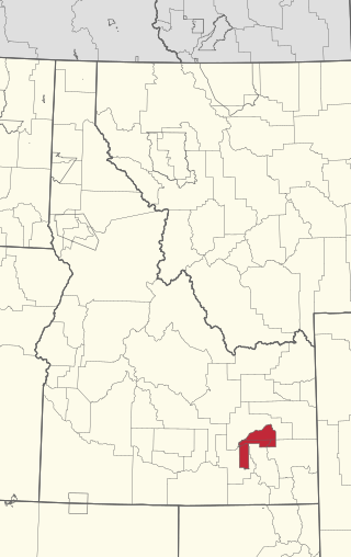
Almo is an unincorporated town in the Upper Raft River Valley in Cassia County, Idaho, United States.

<span class="mw-page-title-main">Emigrant Trail in Wyoming</span> 19th century pioneer route in western United States

The Emigrant Trail in Wyoming, which is the path followed by Western pioneers using the Oregon, California, and Mormon Trails, spans 400 miles (640 km) through the U.S. state of Wyoming. The trail entered from Nebraska on the eastern border of the state near the present day town of Torrington and exited on the western border near the towns of Cokeville and Afton. An estimated 350,000 to 400,000 settlers traveled on the trail through Wyoming between 1841 and 1868. All three trails follow the same path through most of the state. The Mormon Trail splits at Fort Bridger and enters Utah, while the Oregon and California Trails continue to Idaho.

<span class="mw-page-title-main">Great Platte River Road</span>

The Great Platte River Road was a major overland travel corridor approximately following the course of the Platte River in present-day Nebraska and Wyoming that was shared by several popular emigrant trails during the 19th century, including the Trapper's Trail, the Oregon Trail, the Mormon Trail, the California Trail, the Pony Express route, and the military road connecting Fort Leavenworth and Fort Laramie. The road, which extended nearly 370 miles (600 km) from the Second Fort Kearny to Fort Laramie, was utilized primarily from 1841 to 1866. In modern times it is often regarded as a sort of superhighway of its era, and has been referred to as "the grand corridor of America's westward expansion".

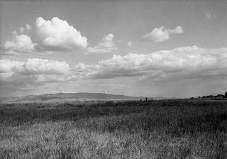
In August, 1851, a band of Shoshoni Indians led by Cho Cho Co reportedly attacked a wagon train led by Thomas Clark on the Oregon Trail near where the Raft River joins the Snake River in present-day Idaho. Afterward, reports held that the natives' primary objective was to steal horses from Thomas Clark's wagon train party, and that the indigenous tribe killed Clark's mother and brother and another man traveling with them during the horse robbery.

<span class="mw-page-title-main">Goodale's Cutoff</span> United States historic place

Goodale's Cutoff formed a spur of the Oregon Trail beginning in Idaho, United States. The cutoff left the trail near Fort Hall, crossed the Snake River Plain to the Lost River, and then turned west to the area of Boise, crossing Camas Prairie. It rejoined the main trail from Ditto Creek to Boise, then ran to the north of the main trail, crossing the Snake River into Oregon at Brownlee's Ferry. In Oregon travelers could now reach the Eagle Valley and Pine Valley areas, and the gold mines in Auburn. The cutoff rejoined the main Oregon Trail at the Powder River, near Baker City.

The Overland Trail was a stagecoach and wagon trail in the American West during the 19th century. While portions of the route had been used by explorers and trappers since the 1820s, the Overland Trail was most heavily used in the 1860s as a route alternative to the Oregon, California, and Mormon trails through central Wyoming. The Overland Trail was famously used by the Overland Stage Company owned by Ben Holladay to run mail and passengers to Salt Lake City, Utah, via stagecoaches in the early 1860s. Starting from Atchison, Kansas, the trail descended into Colorado before looping back up to southern Wyoming and rejoining the Oregon Trail at Fort Bridger. The stage line operated until 1869 when the completion of the First transcontinental railroad eliminated the need for mail service via stagecoach.

In the history of the American frontier, pioneers built overland trails throughout the 19th century, especially between 1840 and 1847 as an alternative to sea and railroad transport. These immigrants began to settle much of North America west of the Great Plains as part of the mass overland migrations of the mid-19th century. Settlers emigrating from the eastern United States did so with various motives, among them religious persecution and economic incentives, to move from their homes to destinations further west via routes such as the Oregon, California, and Mormon Trails. After the end of the Mexican–American War in 1849, vast new American conquests again encouraged mass immigration. Legislation like the Donation Land Claim Act and significant events like the California Gold Rush further encouraged settlers to travel overland to the west.

<span class="mw-page-title-main">Route of the Oregon Trail</span>

The historic 2,170-mile (3,490 km) Oregon Trail connected various towns along the Missouri River to Oregon's Willamette Valley. It was used during the 19th century by Great Plains pioneers who were seeking fertile land in the West and North.

<span class="mw-page-title-main">Bahsahwahbee</span> United States historic place

Bahsahwahbee is a grove of Rocky Mountain juniper trees, locally called swamp cedars, in White Pine County, Nevada, where multiple massacres of Western Shoshone people occurred in the 19th century, two by the U.S. Army and one by vigilantes. The name means "sacred water valley" in the Shoshoni language. The area is managed by the Bureau of Land Management and is located 8 mi (13 km) northwest of Great Basin National Park, 5 mi (8.0 km) northeast of Majors Place.

References

  1. 1 2 3 4 King, Thomas (2013). The Inconvenient Indian (1st ed.). Minneapolis: University of Minnesota Press. pp. 3–7. ISBN   9781452940298.
  2. 1 2 3 4 5 Madsen, Brigham (1993). "The "Almo Massacre" Revisited". Idaho Yesterdays. 37 (3): 1–2.
  3. 1 2 3 4 5 6 7 8 Associated Press (January 18, 1994). "Idaho Legend's Days May Be Numbered". Deseret News. Retrieved November 29, 2023.
  4. 1 2 3 Matthews, Mychel (November 17, 2013). "Tiny Almo, Idaho, celebrates history – real or not". The Lewiston Tribune. Retrieved November 30, 2023.
  5. 1 2 3 4 Walgamott, Charles (1936). Six Decades Back. Caldwell, Idaho: The Claxton Printers. pp. 122–126.
  6. Truer, Anton (2016). The Indian Wars: Battles, bloodshed, and the fight for freedom on the American Frontier. Washington D.C.: National Geographic. ISBN   9781426217432.
  7. Brown, Randy; Duffin, Reg (1998). Graves and Sites on the Oregon and California Trails. Independence, Missouri: Oregon-California Trails Association. ISBN   0963590197.
  8. 1 2 3 Unruh, John (1993). The Plains Across: The overland emigrants and the trans-Mississippi West. Urbana: University of Illinois Press. pp. 185–191. ISBN   0252063600.
  9. Boag, Peter (1993). "The Indians of This Place are Snakes in the Grass". Idaho Yesterdays. 37 (3): 16–26.
  10. 1 2 Idaho State Historical Society Reference Series (February 1971). "Almo Massacre" (PDF). Archived from the original (PDF) on February 3, 2013. Retrieved December 1, 2023.
  11. Smith, Justin (February 7, 2020). "The massacre that never happened". Idaho State Journal. Retrieved November 27, 2023.
  12. 1 2 Loewen, James (2019). Lies Across America: What Our Historic Sites Get Wrong. New York City: The New Press. pp. 101–105. ISBN   9781620974933.
  13. 1 2 Flloyd, Jonathan A (2013). "The Legend of the Almo Massacre: Ostensive Action and the Commodification of Folklore" All Graduate Plan B and other Reports. 29. Retrieved November 30, 2023.
  14. "City of Rocks". National Park Service. Retrieved December 2, 2023.