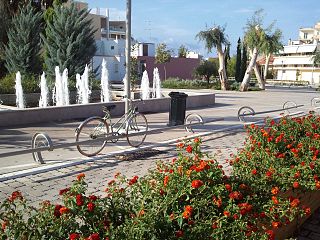
Amaliada is a town and a former municipality in northwestern Elis, West Greece, Greece. Since the 2011 local government reform it is part of the municipality Ilida, of which it is the seat and a municipal unit. The municipal unit has an area of 251.945 km2. In 2011, the municipal unit had 28,520 inhabitants, of whom 16,763 lived in the town of Amaliada. It is near the archaeological site of Elis, the city-state whose territory was the site of the ancient Olympic Games. It is situated in the plains of Elis, 6 km from the Ionian Sea. It is 10 km southeast of Gastouni, 16 km northwest of Pyrgos and 60 km southwest of Patras.
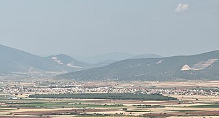
Almyros or Halmyros is a town and a municipality of the regional unit of Magnesia, region of Thessaly, Greece. It lies in the center of prosperous fertile plain known as 'Krokio Pedio', which is crossed by torrents. Almyros is an important agricultural and commercial center of Magnesia, and is also developing as a tourist center for the area. The main agricultural products are tomatoes, cotton, wheat, almonds, peanuts and pistachio nuts.

Agios Nikolaos, Hagios Nikolaos or Aghios Nikolaos is a coastal city on the Greek island of Crete, lying east of the island's capital Heraklion, north of the city of Ierapetra and west of the city of Sitia.

Gazi is a Western suburb of Heraklion and a former municipality in the Heraklion regional unit of Crete in Greece. Since the 2011 local government reform, it has been part of the municipality Malevizi, of which it is a municipal unit. It lies 6 kilometres west of Heraklion, on the north coast of Crete. With 12,606 inhabitants, it was the seat of the municipality of Gazi, which comprised several nearby villages with a total population of 19,221 and an area of 95.81 square kilometres (36.99 sq mi).

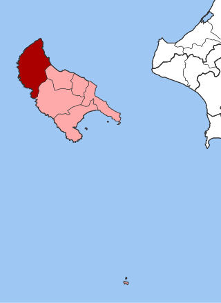
Paliki is a peninsula and a former municipality on the island of Kefalonia, Ionian Islands, Greece. At the 2011 local government reform it became part of the municipality Kefalonia. In 2019 this municipality was divided into three municipalities, and the municipal unit Paliki became the only municipal unit of the new municipality Lixouri. The municipal unit has an area of 119.341 km2. The name comes from the ancient town of Pale/Pali, which was north of Lixouri and is now an archaeological site. The peninsula is the westernmost part of Kefalonia. The seat of the municipality was the town Lixouri (3,752).

Alikanas is a village in the municipal unit of Alykes situated on the northeastern coast about 15 km northwest of Zakynthos (city) on the island of Zakynthos, Greece. It is situated 1 km (0.6 mi) from the neighbouring village of Alykes, on the Ionian coast. Alikanas is a very well known tourist destination. People from all over the world are visiting Alikanas in the summer. It has a beautiful sandy wide beach. On the beach of Alykanas you can find the lily of the sea, protected by Greek and International legislation. The famous caretta caretta might be seen sometimes in these waters, even though they prefer less populated areas.

Arkadioi was a former municipality on the island of Zakynthos, Ionian Islands, Greece. Since the 2011 local government reform it is part of the municipality Zakynthos, of which it is a municipal unit. It is located on the north coast of the island. It has a land area of 26.475 km². Its population was 5,729 at the 2021 census. The seat of the municipality was in Vanato. The municipal unit consists of the communities Vanato, Agios Kirykos, Kalipado, Kypseli, Planos, Sarakinado and Tragaki.

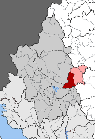
Artemisia is a former municipality on the island of Zakynthos, Ionian Islands, Greece. Since the 2011 local government reform it is part of the municipality Zakynthos, of which it is a municipal unit. It is on the central west coast of the island. It has a land area of 104.890 km² and a 2021 census population of 4,440 inhabitants. Its municipal seat was the town of Machairado.
Elatia is a former municipality on the island of Zakynthos, Ionian Islands, Greece. Since the 2011 local government reform it is part of the municipality Zakynthos, of which it is a municipal unit. It is located in the northwestern part of the island. With a land area of 111.412 km², it is the largest municipal unit on Zakynthos, comprising about 27 percent of its area. Its population was 1,754 at the 2021 census. The seat of the municipality was in the town of Volimes. The municipal unit consists of the communities Volimes, Anafonitria, Ano Volimes, Exo Chora, Maries and Orthonies.
Agios Dimitrios is a former municipality in the Ioannina regional unit, Epirus, Greece. Since the 2011 local government reform it is part of the municipality Dodoni, of which it is a municipal unit. Population 3,277 (2021), its area is 231.473 km². The seat of the municipality was in Theriakisi. The largest village is Kato Mousiotitsa which has a school, gymnasium and lyceum. The municipal unit covers the northwestern part of the Xerovouni mountains.
Egnatia is a former municipality in the Ioannina regional unit, Epirus, in northwestern Greece. Since the 2011 local government reform, it is part of the Metsovo municipality, of which it is a municipal unit. The municipal unit has an area of 131.424 km2. In 2021 its population was 1,867. The seat of the municipality was in Mikro Peristeri. The municipal unit is connected with both the GR-6/E92 and the new Via Egnatia.

Atsiki is a village and a former municipality on the island of Lemnos, North Aegean, Greece. Since the 2011 local government reform it is part of the municipality Lemnos, of which it is a municipal unit. It is located in the northern central part of the island and has a land area of 134.672 km², covering about 28.2% of the island's surface. The municipal seat was the town of Atsikí. Its next largest town is Ágios Dimítrios (812). The municipal unit's total population is 2,535 inhabitants.

Mouresi is a village and a former municipality in Magnesia, Thessaly, Greece. It is situated in the northeastern part of the Pelion peninsula. Since the 2011 local government reform it is part of the municipality Zagora-Mouresi, of which it is a municipal unit. The municipal unit has an area of 54.214 km2. The seat of the municipality was in Tsagkarada.

East Olympos, or Anatolikos Olympos, is a former municipality in Pieria regional unit, Greece. In Greece's 2011 local government reform East Olympos became a municipal unit of the municipality Dion-Olympos. The municipal unit has an area of 152.939 km2 (59.050 sq mi) and a population of 7,999 (2021). The seat of the former East Olympos municipality was in Leptokarya.
Katastari is a village and a community in the Alykes municipal unit of the island Zakynthos, Greece. It is situated at the foot of the Vrachionas mountain, 2 km from the Ionian Sea coast. It is located 13 kilometers northwest of Zakynthos City and 10 km southeast of Volimes.
Meso Gerakari is a village in the municipal unit of Alykes on the island Zakynthos, Greece. According to a 2001 census, Meso Gerakari contained approximately 402 inhabitants.
Agios Dimitrios is a village and a community in the municipal unit Alykes, in the central part of the island Zakynthos, Greece. The community includes the village Drakas. Agios Dimitrios is 2 km south of Meso Gerakari, 5 km west of Vanato, 5 km southeast of Katastari and 9 km west of Zakynthos city. The village suffered great damage from the 1953 Ionian earthquake.
Ano Gerakari is a hilltop village and a community in the municipal unit of Alykes on the island of Zakynthos, Greece. The community includes the villages Alonia and Kastelia. Ano Gerakari is adjacent to the northwest of Meso Gerakari, 4 km east of Katastari and 9 km northwest of Zakynthos city. It suffered great damage from the 1953 Ionian earthquake.
Kallithea, is a village and a community in the municipal unit of Alykes in the island of Zakynthos, Greece. In 2011 Kallithea's population was 238 people. It is situated at the eastern foot of the Vrachionas mountains, at about 60 m (200 ft) elevation. It is 3 km (1.9 mi) southeast of Katastari, 3 km (1.9 mi) southwest of Ano Gerakari, 3 km (1.9 mi) northwest of Agios Dimitrios and 12 km (7.5 mi) northwest of Zakynthos city. The farm of the Science Park Zakynthos, a Norwegian-Greek institute that focuses on sustainable water use, is situated in Kallithea. The village suffered great damage from the 1953 Ionian earthquake.


