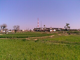
Amalgaon is an average sized village on the north side of the Indian city of Amalner.
It has a primary health centre and a telephone exchange tower. This village has educational facilities up to 12th grade. Population is around 6,000 (as of 2008).
The Chikhali River flows around the south west part of the village. People in this village speak Ahirani, Marathi and Hindi. Amalgaon has an active Gram Panchayat or local government. People in this village are very active in political activities and contribute in district politics. For example, Panchayat Samit, Zilha Parishad, Shetaki Sangh etc.
In this village there is a branch office of the Jalgaon District Central Co-operative Bank, which plays very important role in financial matters of the farmers. This village also has a post office. Amalgaon's zipcode is 425 420. Telephone area code is 02587.
Ninety percent of people are engaged in farming. Farming here is mostly dry and traditional but a few people have started drip irrigation. Most common crops here are cotton, mug, jawar, bajara and corn. There are many other small businesses which are closely related to farming. Amalgaon also has potteries that manufacture clay pots which are used for storing drinking water.
In June 2006, this village suffered a flood. The high school and some of the houses were destroyed. However, the people in this village rebuilt their high school by collecting money by contributing.[1][2] There is a dam near Amalgaon which has been under in construction for the last 25 to 27 years. Once this dam is completed all of the local farms will benefit. Local farmers and also other neighbouring villages' farmers have often protested at Tahashil Office in Taluka about the delays.
Nayagarh is a town and a municipality in Nayagarh district in the Indian state of Odisha. It is the headquarters of Nayagarh district.
Verkilambi is an interior rural area the district of Kanyakumari at the state of Tamil Nadu. This is a grade – I Town panchayat spread in a total area of 15.7 Sq. km and consists of 18 wards, represented by 18 councilors. The Executive officer is the administrative head and the elected Chairman is the political head of this Town Panchayat. This was constituted as Kumarankudy Village, Pathmanapapuram MLA Constituency, Nagercoil MP Constituency. The town is located at a distance of 5 km from Ponmanai Town Panchayat on the East, 5 km from Thiruvattar Town Panchayat on the west. 3 km from Kothanalloor Town Panchayat on the South. This town is located along the Kanyakumari, Thiruvananthapuram, National High way and Colachel – Kulasekaram state high way Road through this TP. This TP Constitutes its village component to talking an area of 3.25 Sq. km up graded as town Panchayat
Nayarambalam is a suburb of Cochin city and coastal village on Vypin island in Ernakulam District in the state of Kerala, India.
Parkala is a suburb of Udupi city located east of Manipal in Udupi district of Karnataka, India. It is administered in part by Udupi City Municipality and in part by the 80, Badagubettu Panchayat.
Nasriganj is a nagar panchayat town and corresponding community development block situated in Rohtas District of Bihar, India. Located on the banks of the Son River, the town was a vibrant economic hub in the late 19th century. The town of Nasriganj had a population of 23,819, according to the 2011 Census of India, while the total population of Nasriganj block was 115,117. Besides the town of Nasriganj itself, the block consisted of 53 villages, of which 50 were inhabited and 3 were uninhabited.
Kondivali is a small village in Khed Taluka of Ratnagiri district in Maharashtra, India. The village is also known as 'Kondvil'. The main languages spoken here are Marathi and Konkani.
Mallur is a village and Grama Panchayat in Sidlaghatta taluk, India. It is 20 km from the Chikkaballapur district and 20 km from Bengalooru International Airport Devanahalli. It is also about 45 km from the Majestic bus stand of Bengalooru city.
Shapur is a village in Vanthali taluk in Junagadh district in the Indian state of Gujarat. This region is known as "Sorath", after the former Princely State of Junagadh.
Dahiwad is a village in Amalner taluka and Jalgaon district in the state of Maharashtra, India. It is located around 17 kilometers from Amalner. Dahiwad is home to Navbharat Secondary & Higher Secondary High School. This village is for Khandoba's Yatra.
Badulia is a village in Khandaghosh CD Block in Bardhaman Sadar South subdivisionof the Purba Bardhaman district in the state of West Bengal in India.
Gulyana is a town in Gujar Khan Tehsil, Punjab, Pakistan. Gulyana is also chief town of Union Council Gulyana which is an administrative subdivision of the Tehsil.
Pugalur is a municipality in Karur district in Tamil Nadu, India. It is divided into two parts, Nanjai and Punjai. Nanjai refers to land with plenty of water usually with water bodies like rivers, canals, ponds etc. and Punjai refers to land with fewer water bodies and with facilities such as bore wells. In the Nanjai area it is known as Nanjai Pugalur and in the Punjai area is known as Punjai Pugalur.
Anakkara is a geographic area of around 50 square kilometres that spans across Vandanmedu, Chakkupallam Panchayats in the Udumbanchola Taluk of Idukki District. Anakkara is the administrative capital of Chakkupallam Grama Panchayat and Anakkara Revenue Village. Situated at about 18 Kilometers from Thekkady wildlife sanctuary on the Kumily-Munnar state highway, Anakkara is a fast-growing tourist destination for its unique spice gardens and many picnic spots in and around. It is one of the 36 distinct places identified by Government of India and United Nations Development Programme for exploring and promoting the unique tourism potential of these places.
Pimpalner, is a small town in Parner Taluka in Ahmednagar district of state of Maharashtra, India. It belongs to Nashik Division. It is located 49 km to the west of District headquarters Ahmednagar. 12 km from Parner. 189 km from State capital Mumbai. Pimpalner is surrounded by Parner Taluka to the north, Ahmednagar Taluka to the east, Shrigonda Taluka to the south, Khed Taluka to the west. Shirur, Ahmednagar, Shrigonda, Manchar are the nearby cities to Pimpalner.
Muttom is a rural area in Idukki district in the Indian state of Kerala. This place is 66 km away from Cochin. Geographically this place is part of Midland or Idanad region of Kerala. Hindus, Christians and Muslims are living peacefully in the area.
Mundaje is on the Mangalore-Tumkur National Highway, which is 14 km far from the Taluk headquarters Belthangady in Dakshina Kannada of Karnataka. The village spreads nearly 3608 acres.
Rajagiri is a panchayat village in the Papanasam taluk of Thanjavur district, Tamil Nadu, India.
Bhayavadar is a small village in the Kunkavav Vadia Taluka of the Amreli district in Gujarat, India. The Patels form the majority of the village 1539 village residents.
Khadakdeola or Khadakdeole is a village situated on the banks of a Hivra River of the Pachora Tehsil in Jalgaon district, Maharashtra, India. It is 6 km from Pachora Tehsil and 55 kilometres from Jalgaon city and is located within the productive, irrigated agricultural region of Khandesh. It lies on the border of Jalgaon and Aurangabad districts.
Edamalakkudy or Idamalakkudy is a remote tribal village and gram panchayat between the Idamalayar Reserve Forest and Mankulam Forest Division of the Anamalai hills in the Ernakulam district of the Kerala state of India.
This page is based on this Wikipedia article Text is available under the CC BY-SA 4.0 license; additional terms may apply. Images, videos and audio are available under their respective licenses.