
Gadchiroli district is an administrative district in Maharashtra, India. The city of Gadchiroli is the administrative headquarters of the district.

Sakti is a city and a district in the state of Chhattisgarh. The assembly constituency number of District Sakti is 33, Earlier it was the only Education District of Chhattisgarh. There are 245 panchayats and 458 villages under Sakti district. Sakti district was formed on 15 August 2021 And came into complete district existence on 9 September 2022 by Chief Minister Bhupesh Baghel. The current 2018 - 2023 MLA here is Shri Charan Das Mahant, who is the Speaker of the Chhattisgarh Legislative assembly. The First Collector and District Magistrate of Sakti is Nupur Rashi Panna I.A.S, First Superintendent of Police is M.R. Ahire I.P.S and First District Education Officer is B.L. Khare, who was also the last District Education Officer of Education District Sakti.
Garhwa is a town and a municipality in, and headquarters of, Garhwa district in the state of Jharkhand, India. Uttar Pradesh, Chhattisgarh and Bihar are nearby states. Garhwa Road (Rehla) is a major Railway Junction where thousands of passengers find this station most convenient to catch their train for Delhi and Kolkata. Bus services are available for Ranchi, Ambikapur, Gaya, etc.
Umaria district is a district of Madhya Pradesh. The town of Umaria is the district headquarters. The district is part of Shahdol Division.

Rajnandgaon is a district of the state of Chhattisgarh in central India. The administrative headquarters the district is Rajnandgaon town.

Durg is a city in the Indian state of Chhattisgarh, east of the Shivnath River and is part of the Durg-Bhilai urban agglomeration. With an urban population of 1,064,077, Durg-Bhilai is the second largest urban area in Chhattisgarh after Raipur. It is the headquarters of Durg District.
Khariar Road is a city in India. It is located at Odisha-Chhattisgarh border. It is 120 km (75 mi) from Raipur, capital of Chhattisgarh and is one of the fastest growing economic centers of India. It is also one of the key railway stations of the East Coast Railway.
Kumhari is located in Dhamdha tehsil of Durg district in the Indian state of Chhattisgarh. Kumhari is a Nagar Palika Parishad and situated at Durg district and Raipur district border beside Karun River. It is situated at 21°27'N 81°52' and has an average elevation of 284 meters above the sea level.
Shivrinarayan also known as Sheorinarayan is a town and a nagar panchayat located at the Triveni Dhara of Mahanadi, Shivnath and Jonk River in Janjgir-Champa district in the Indian state of Chhattisgarh.

Dhamtari is a district of the Indian state of Chhattisgarh. This district is situated at 20°42' N latitude and 81°33' E longitude. Dhamtari district was officially formed on 6 July 1998 by trifurcating Raipur district into Raipur, Dhamtari and Mahasamund districts.

Kapsi is a large marketplace village in the Kanker district of Chhattisgarh, India. It holds significance as a model village under two ambitious schemes of the Government of India, namely the Sansad Adarsh Gram Yojana and the Shyama Prasad Mukherjee National Rurban Mission. It is also the headquarters of the Kapsi forest range, the East Kapsi forest subdivision and the Kapsi water resource subdivision. Owing to its sizeable tribal population, it is defined as a Scheduled Area under the Fifth Schedule of the Constitution of India.

Janjgir is the headquarters of the Janjgir–Champa district in Chhattisgarh, India. It has been the district headquarters since 25 May 1998, when Janjgir–Champa was carved out of Bilaspur. Well known for its Vishnu Temple aka Nakta Mandir, Janjgir is undergoing rapid industrial development and will become home to various thermal power plants in the coming years. After several attempts made by the people to adopt the name Janjgir, the railway station name changed from Naila to Janjgir-Naila. Janjgir is well connected by railways and roads and is connected to major cities like Bilaspur and Raipur through National Highway 200.

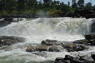
Shivnath River is the longest tributary of the Mahanadi River, which joins Changori in the Janjgir-Champa district in Chhattisgarh, India. It has a total course of 290 kilometres (180 mi). The name comes from the god Shiva in Hinduism.
Chowki Choura, Akhnoor, is a Sub-Division in Jammu district in Jammu and Kashmir, India.
Pakhanjur, also known as Pakhanjore, is a town, nagar panchayat, and the headquarters of the eponymous tehsil in the Kanker District of Chhattisgarh State in India. According to the 2011 Census of India, it is the second largest town in the district by population, only second to the district headquarters Kanker. It is located 120 km (75 mi) south-west of Kanker and 47 km (29 mi) west of the block headquarters Koyalibeda.

Kherkatta Dam is a medium irrigation project built across the Kotri River, about 10 km (6.2 mi) northwest of Kapsi in the Kanker district of Chhattisgarh, India. It is the largest dam of the district and gets its name from the neighbouring village of Kherkatta. The lake that the dam forms behind it is officially known as the Paralkot Reservoir, which extends in a northwest direction and partially into the Mohla-Manpur-Ambagarh Chowki district. The distance of the dam is approximately 20 km (12 mi) from Pakhanjur, 35 km (22 mi) from Manpur and 110 km (68 mi) from Kanker.

Mohla-Manpur-Ambagarh Chowki district is one of the four new district in the state of Chhattisgarh, India announced by Bhupesh Baghel on 15th August 2021. It is carved out from existing Rajnandgaon district.
Mohla is a census town in the Indian state of Chhattisgarh. It serves as the district headquarter of the newly created Mohla-Manpur-Ambagarh Chowki district.
Manpur is a village and a tehsil in the Mohla-Manpur-Ambagarh Chowki district of Chhattisgarh state in India.

