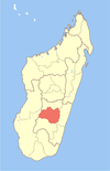
Ambohimahamasina

Last updated

Ambohimahamasina is a rural commune in the Ambalavao District in Haute Matsiatra Region in central Madagascar.

Ambalavao District

Ambalavao District is a district in central Madagascar. It covers an area of 4,798.47 km2, and had a population estimated at 209,417 in 2013. It is part of Haute Matsiatra Region. Its capital is Ambalavao. The district is further divided into 17 communes:

Haute Matsiatra Region in Madagascar

Haute Matsiatra is a region in Madagascar. It borders Amoron'i Mania region in north, Vatovavy-Fitovinany in east, Ihorombe in south and Atsimo-Andrefana in west. The capital of the region is Fianarantsoa, and the population was estimated to be 1,131,700 in 2014. The area is 21,080 km2 (8,139 sq mi).

Madagascar island nation off the coast of Southeast Africa, in the Indian Ocean

Madagascar, officially the Republic of Madagascar, and previously known as the Malagasy Republic, is an island country in the Indian Ocean, approximately 400 kilometres off the coast of East Africa. The nation comprises the island of Madagascar and numerous smaller peripheral islands. Following the prehistoric breakup of the supercontinent Gondwana, Madagascar split from the Indian subcontinent around 88 million years ago, allowing native plants and animals to evolve in relative isolation. Consequently, Madagascar is a biodiversity hotspot; over 90% of its wildlife is found nowhere else on Earth. The island's diverse ecosystems and unique wildlife are threatened by the encroachment of the rapidly growing human population and other environmental threats.

Climate

Ambohimahamasina has an oceanic climate (Köppen: Cfb).

Oceanic climate a type of climate characterised by cool summers and cool winters

An oceanic climate, also known as a marine or maritime climate, is the Köppen classification of climate typical of west coasts in higher middle latitudes of continents, and generally features mild summers and mild winters, with a relatively narrow annual temperature range and few extremes of temperature, with the exception for transitional areas to continental, subarctic and highland climates. Oceanic climates are defined as having a monthly mean temperature below 22 °C (72 °F) in the warmest month, and above 0 °C (32 °F) in the coldest month.

Köppen climate classification widely used climate classification system

The Köppen climate classification is one of the most widely used climate classification systems. It was first published by the Russian climatologist Wladimir Köppen (1846–1940) in 1884, with several later modifications by Köppen, notably in 1918 and 1936. Later, the climatologist Rudolf Geiger introduced some changes to the classification system, which is thus sometimes called the Köppen–Geiger climate classification system.

Climate data for Ambohimahamasina
MonthJanFebMarAprMayJunJulAugSepOctNovDecYear
Daily mean °C (°F) 21.7
(71.1)
21.6
(70.9)
21.0
(69.8)
19.9
(67.8)
17.7
(63.9)
15.6
(60.1)
14.8
(58.6)
15.4
(59.7)
17.2
(63)
19.6
(67.3)
21.1
(70)
21.5
(70.7)
18.9
(66)
Average precipitation mm (inches) 292
(11.5)
229
(9.02)
205
(8.07)
51
(2.01)
34
(1.34)
35
(1.38)
34
(1.34)
33
(1.3)
30
(1.18)
40
(1.57)
118
(4.65)
248
(9.76)
1,349
(53.12)
Source: Climate-Data.org [1]

Related Research Articles

Usarp Mountains

The Usarp Mountains is a major Antarctic mountain range, lying westward of the Rennick Glacier and trending N-S for about 190 kilometres (118 mi). The feature is bounded to the north by Pryor Glacier and the Wilson Hills. Its important constituent parts include Welcome Mountain, Mount Van der Hoeven, Mount Weihaupt, Mount Stuart, Mount Lorius, Smith Bench, Mount Roberts, Pomerantz Tableland, Daniels Range, Emlen Peaks, Helliwell Hills and Morozumi Range.

Janov, Prešov District municipality of Slovakia

Janov is a village and municipality in Prešov District in the Prešov Region of eastern Slovakia.

Napkor Place in Szabolcs-Szatmár-Bereg, Hungary

Napkor is a village in Szabolcs-Szatmár-Bereg county, in the Northern Great Plain region of eastern Hungary.

Kállósemjén Place in Szabolcs-Szatmár-Bereg, Hungary

Kállósemjén is a village in Szabolcs-Szatmár-Bereg county, in the Northern Great Plain region of eastern Hungary.

Magy Place in Szabolcs-Szatmár-Bereg, Hungary

Magy is a village in Szabolcs-Szatmár-Bereg county, in the Northern Great Plain region of eastern Hungary.

Nyőgér Place in Western Transdanubia, Hungary

Nyőgér is a village in Vas county, Hungary.

Chiscani Commune in Brăila County, Romania

Chiscani is a commune located in Brăila County, Romania. It is composed of three villages: Chiscani, Lacu Sărat and Vărsătura.

Mavorano Place in Vatovavy-Fitovinany, Madagascar

Mavorano is a town and commune in Madagascar. It belongs to the district of Manakara, which is a part of Vatovavy-Fitovinany Region. The population of the commune was estimated to be approximately 13,000 in 2001 commune census.

Căiuți Commune in Bacău County, Romania

Căiuți is a commune in Bacău County, Romania. It is composed of nine villages: Blidari, Boiștea, Căiuți, Florești, Heltiu, Mărcești, Popeni, Pralea and Vrânceni.

Dagâța Commune in Iași County, Romania

Dagâța is a commune in Iași County, Romania. It is composed of eight villages: Bălușești, Boatca, Buzdug, Dagâța, Mănăstirea, Piscu Rusului, Poienile, Tarnița and Zece Prăjini. The commune had 4809 people at the 2002 census; of these, 89.8% were ethnic Romanian and 10.2% were Roma. 98.9% of inhabitants were Romanian Orthodox.

Buceș Commune in Hunedoara County, Romania

Buceș is a commune in Hunedoara County, Romania. It is composed of seven villages: Buceș, Buceș-Vulcan, Dupăpiatră (Dupapiátra), Grohoțele, Mihăileni (Miheleny), Stănija (Sztanizsa) and Tarnița.

Warpuny Village in Warmian-Masurian, Poland

Warpuny is a village in the administrative district of Gmina Sorkwity, within Mrągowo County, Warmian-Masurian Voivodeship, in northern Poland. It lies approximately 11 kilometres (7 mi) north of Sorkwity, 11 km (7 mi) north-west of Mrągowo, and 48 km (30 mi) east of the regional capital Olsztyn.

Tijucas do Sul is a municipality in the state of Paraná in the Southern Region of Brazil. It is known for its horse ranches and attracts tourists all year round.

Nagygörbő is a village in Zala County, Hungary.

Dragievtsi is a village in Gabrovo Municipality, in Gabrovo Province, in northern central Bulgaria.

Blackwelder Glacier is a pocket glacier, 1 nautical mile (2 km) wide and 2 nautical miles (4 km) long, between Salmon Hill and Hobbs Glacier in Victoria Land. The glacier was studied during U.S. Navy Operation Deepfreeze, 1957–58, by Troy L. Pewe and was named by him for Eliot Blackwelder, former head of the Geology Department at Stanford University.

Mount Peter is a large dome-shaped rock outcrop with a flat, sheer north face, about 2 nautical miles (3.7 km) east of Mount Bechervaise in the Athos Range, Prince Charles Mountains in Antarctica. First visited in November 1955 by an ANARE party led by J.M. Bechervaise. Named by Antarctic Names Committee of Australia (ANCA) for Peter Crohn, geologist at Mawson Station, 1955-56.

Kovačevac is a village in the municipality of Jagodina, Serbia. According to the 2002 census, the village has a population of 235 people.

References

  1. "Climate:Ambohimahamasina". Climate-Data.org. Retrieved 11 April 2014.

Coordinates: 21°56′S47°11′E / 21.933°S 47.183°E / -21.933; 47.183

Geographic coordinate system Coordinate system

A geographic coordinate system is a coordinate system that enables every location on Earth to be specified by a set of numbers, letters or symbols. The coordinates are often chosen such that one of the numbers represents a vertical position and two or three of the numbers represent a horizontal position; alternatively, a geographic position may be expressed in a combined three-dimensional Cartesian vector. A common choice of coordinates is latitude, longitude and elevation. To specify a location on a plane requires a map projection.