Vohitsaoka | |
|---|---|
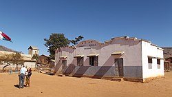 Vohitsaoka, town hall | |
 Vohitsaoka Location in Madagascar | |
| Coordinates: 22°2′S46°43′E / 22.033°S 46.717°E | |
| Country | |
| Region | Haute Matsiatra |
| District | Ambalavao |
| Elevation | 860 m (2,820 ft) |
| Population (2001) [2] | |
• Total | 10,000 |
| Time zone | UTC3 (EAT) |
Vohitsaoka is a rural commune in the Central Highlands of Madagascar. It belongs to the district of Ambalavao, which is a part of Haute Matsiatra Region. The population of the commune was estimated to be approximately 10,000 in 2001 commune census. [2]
Only primary schooling is available. The majority 85% of the population of the commune are farmers, while an additional 10% receives their livelihood from raising livestock. The most important crop is rice, while other important products are maize, cassava and bambara groundnut. Services provide employment for 5% of the population. [2]
