Talata Ampano | |
|---|---|
 Talata Ampano | |
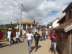
 Talata Ampano Location in Madagascar | |
| Coordinates: 21°33′S47°2′E / 21.550°S 47.033°E | |
| Country | |
| Region | Haute Matsiatra |
| District | Vohibato District |
| Government | |
| • Mayor | Fidèle Ramanantsalama [1] |
| Elevation | 1,124 m (3,688 ft) |
| Population (2001) [3] | |
• Total | 15,000 |
| Time zone | UTC3 (EAT) |
| Postal code | 305 |
Talata Ampano is a rural municipality in Madagascar. It belongs to the district of Vohibato District, which is a part of Haute Matsiatra Region. The population of the commune was estimated to be approximately 15,000 in 2001 commune census. [3]
Primary and junior level secondary education are available in town. The majority 86% of the population of the commune are farmers, while an additional 5% receives their livelihood from raising livestock. The most important crop is rice, while other important products are vegetables, cassava, sweet potatoes and tomato. Industry and services provide employment for 6% and 2% of the population, respectively. Additionally fishing employs 1% of the population. [3]

