
Amelia Court House is the county seat of Amelia County in the U.S. state of Virginia and a census-designated place (CDP). The population as of the 2010 census was 1,099. The town was named for Princess Amelia of Great Britain, the second daughter of Great Britain's King George II, in 1735.
Lakeville is an unincorporated community in northeastern Washington Township, Holmes County, Ohio, United States. It has a post office with the ZIP code 44638. It lies along State Route 226 west of Odell Lake and south of Bonnett and Round Lakes.
Chula is a mostly rural unincorporated community in the northeastern part of Amelia County just west of the Appomattox River in the U.S. state of Virginia. The town is centered around the T-intersection of SR 636 and SR 740 in Giles District. Chula is just west of SR 604, which includes a short bypass segment built around the town in the late 20th century. The area is served by the post office 7 miles southwest at Amelia Court House, ZIP code 23002. The nearest fire station to Chula is Amelia County Volunteer Fire Department Station 4, near Mattoax, 3 miles north.
Denaro is a rural unincorporated community in south-central Amelia County in the U.S. state of Virginia. It is located 0.4 mi (0.6 km) north of the Amelia–Nottoway county line at the split & curve junctions of SR 614 and SR 613.
Harris is an unincorporated community in Elkins Township, Washington County, Arkansas, United States. It is located east of Fayetteville and within the city limits of Elkins near Arkansas Highway 16.
Amelia is an unincorporated community in Kanawha County, West Virginia, united states.

Venetia is an unincorporated community in Peters Township, Washington County, Pennsylvania, United States. It has a post office with the ZIP code 15367, covering most of the area between McMurray and Gastonville. The population of this area was 8,731 at the 2010 census. It is part of the Pittsburgh metropolitan area.
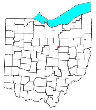
Equity is an unincorporated community in Washington County, in the U.S. state of Ohio.
Grandview is an unincorporated community in Washington County, in the U.S. state of Ohio.

Denison is an unincorporated community in Spokane County, in the U.S. state of Washington. The community is located on U.S. Route 395 19 miles due north of Downtown Spokane and about seven miles beyond that city's northern suburban developments. Denison lends its name to two roads in the area, Denison Road and Denison-Chattaroy Road, both of which intersect with Route 395 in the immediate vicinity of Denison. The city of Deer Park is four miles to the north.
Grays is an unincorporated community in Stevens County, in the U.S. state of Washington.

Hazard is an unincorporated community in Spokane County, in the U.S. state of Washington.
Johnson is an unincorporated community in Whitman County, in the U.S. state of Washington.
Kerriston is an extinct town in King County, in the U.S. state of Washington. The GNIS classifies it as a populated place.
Maud is an unincorporated community in Stevens County, in the U.S. state of Washington.
Orin is an unincorporated community in Stevens County, in the U.S. state of Washington. It is located on the Colville River. U.S. Route 395 passes through the community.
Telford is an unincorporated community in Lincoln County, in the U.S. state of Washington.
Ward is an unincorporated community in Stevens County, in the U.S. state of Washington. It is located a mile-and-a-half east of Kettle Falls on U.S. Route 395.
Waukon is an unincorporated community in Lincoln County, in the U.S. state of Washington.
Maryden is an unincorporated community in Washington County, in the U.S. state of Missouri.


