
Colonial Beach, Virginia (CBVA) is a river and beach town located in the northwestern part of Westmoreland County on Virginia's Northern Neck peninsula. It is bounded by the Potomac River, Monroe Bay and Monroe Creek. It is located 65 mi (105 km) from Washington, D.C.; 70 mi (110 km) from the state capital of Richmond; and 35 nautical miles from the Chesapeake Bay.
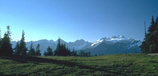
The Olympic Mountains are a mountain range on the Olympic Peninsula of the Pacific Northwest of the United States. The mountains, part of the Pacific Coast Ranges, are not especially high – Mount Olympus is the highest summit at 7,980 ft (2,432 m); however, the eastern slopes rise precipitously out of Puget Sound from sea level, and the western slopes are separated from the Pacific Ocean by the low-lying 20 to 35 km wide Pacific Ocean coastal plain. These densely forested western slopes are the wettest place in the 48 contiguous states. Most of the mountains are protected within the bounds of Olympic National Park and adjoining segments of the Olympic National Forest.

The Susquehanna River is a major river located in the Mid-Atlantic region of the United States, crossing three lower Northeast states. At 444 miles (715 km) long, it is the longest river on the East Coast of the United States. By watershed area, it is the 16th-largest river in the United States, and also the longest river in the early 21st-century continental United States without commercial boat traffic.

The Olympic Peninsula is a large arm of land in western Washington that lies across Puget Sound from Seattle, and contains Olympic National Park. It is bounded on the west by the Pacific Ocean, the north by the Strait of Juan de Fuca, and the east by Hood Canal. Cape Alava, the westernmost point in the contiguous United States, and Cape Flattery, the northwesternmost point, are on the peninsula. Comprising about 3,600 square miles (9,300 km2), the Olympic Peninsula contained many of the last unexplored places in the contiguous United States. It remained largely unmapped until Arthur Dodwell and Theodore Rixon mapped most of its topography and timber resources between 1898 and 1900.
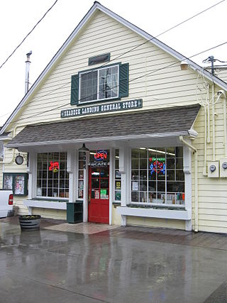
Seabeck is an unincorporated community and census-designated place (CDP) in Kitsap County, Washington, United States. The population was 1,105 at the 2010 census. Seabeck is a former mill town on Hood Canal.

The Skokomish River is a river in Mason County, Washington, United States. It is the largest river flowing into Hood Canal, a western arm of Puget Sound. From its source at the confluence of the North and South Forks the main stem Skokomish River is approximately 9 miles (14 km) long. The longer South Fork Skokomish River is 40 miles (64 km), making the length of the whole river via its longest tributary about 49 miles (79 km). The North Fork Skokomish River is approximately 34 miles (55 km) long. A significant part of the Skokomish River's watershed is within Olympic National Forest and Olympic National Park.

Lake Cushman is a 4,014.6-acre (16.247 km2) lake and reservoir on the north fork of the Skokomish River in Mason County, Washington. The lake originally was a long narrow broadening of the Skokomish River formed in a glacial trough and dammed by a terminal moraine from the Vashon Glaciation during the most recent ice age.
Union or Union City is a small census-designated place in Mason County, Washington, United States. The community lies along the southern shore of the Great Bend of the Hood Canal, near the mouth of the Skokomish River, which flows from the nearby Olympic Mountains. The U.S. Census reported a population of 631 inhabitants in the 2010 census. The ZIP Code for Union is 98592.

Belfair is a census-designated place in Mason County, Washington, United States. Located at the mouth of the Union River at Hood Canal, it serves as the commercial center of northern Mason County. The population of the surrounding area grows in the summertime, as the Canal and the Olympic Peninsula are popular with tourists. The population was 3,931 as of the 2010 census.

State Route 119 (SR 119) is a 10.93-mile-long (17.59 km) state highway in the U.S. state of Washington, serving Lake Cushman in Mason County within Olympic National Forest. The highway, known locally as Lake Cushman Road, travels northwest into the Olympic Mountains from U.S. Route 101 (US 101) in Hoodsport to Lake Cushman and ends at a gravel road east of the entrance to Olympic National Park on Forest Highway 24 (FFH-24). A gravel road connecting Lake Cushman to the state highway system has existed since the late 1950s and was codified into the current state highway system in 1991, prior to being completely paved by 1999.
Hoodsport is a census-designated place (CDP) in Mason County, Washington, United States. The population was 376 at the 2010 census. Hoodsport is located along the Hood Canal, at the intersection of U.S. Route 101 and State Route 119. Lake Cushman is 5 miles (8.0 km) up the road on State Route 119. Hoodsport is the gateway to the Staircase area of the Olympic National Park.
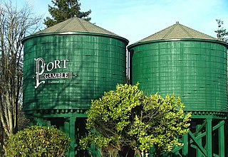
Port Gamble is an unincorporated community on the northwestern shore of the Kitsap Peninsula in Kitsap County, Washington, United States. It is also a small, eponymous bay, along which the community lies, near the entrance to Hood Canal. The unincorporated communities of Port Gamble and Little Boston, part of Kitsap County, lie on the west and the east side, respectively, of the mouth of this bay. The Port Gamble Historic District, a U.S. National Historic Landmark, covers one of the nation's best-preserved western lumber towns.
Potlatch is an unincorporated community in Mason County, Washington, United States. It is located on the western shore of the Great Bend of Hood Canal, near the mouth of the Skokomish River.
Tahuya is an unincorporated community in Mason County, Washington, United States. It is located on the Hood Canal at the mouth of the Tahuya River. Tahuya, whose name comes from a Twana term meaning "that done", features a number of recreational areas. The ZIP Code for Tahuya is 98588.

U.S. Route 101 (US 101) is a United States Numbered Highway that runs along the West Coast from Los Angeles, California to Tumwater, Washington. Within the state of Washington, US 101 connects cities on the coast of the Pacific Ocean and encircles the Olympic Peninsula around the Olympic Mountains. It also serves as the main access for Olympic National Park, several state parks, and other scenic and recreational areas.

Dode was a steamboat that ran on Hood Canal and Puget Sound from 1898 to 1900.
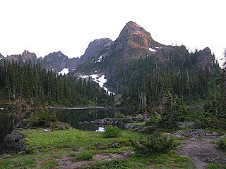
Mount Bretherton is a 5,960-foot-elevation (1,817-meter) mountain summit located in the Olympic Mountains, in Jefferson County of Washington state. It is situated within Olympic National Park, immediately south and 1,400 feet above the shore of Upper Lena Lake. Mount Lena lies across the lake to the north, Mount Stone is 2.8 miles to the west-southwest, and The Brothers approximately four miles to the northeast. Precipitation runoff from the mountain drains south to the Hamma Hamma River via Boulder, Delta, and Lena Creeks. Topographic relief is significant as it rises over 5,100 feet above the river in two miles. The non-technical ascent of Mount Bretherton involves hiking eight miles (one-way) and 5,300 feet elevation gain via the Upper Lena Lake Trail and cross-country above the lake, with most favorable conditions from July through September. There are pleasant campsites at the lake, and the ascent to the summit takes two hours from the lake. This mountain's name has been officially adopted by the United States Board on Geographic Names.

Mount Lincoln is a 5,868-foot (1,789-meter) mountain summit located in the Olympic Mountains, in Mason County of Washington state, United States. It is situated on the boundary shared by Daniel J. Evans Wilderness and Mount Skokomish Wilderness, as well as the shared common border of Olympic National Park with Olympic National Forest. Lincoln is the second-highest point on Sawtooth Ridge, and the nearest higher neighbor is Mount Cruiser, 1.1 mi (1.8 km) to the northeast. Lincoln has two sub-peaks: a North Peak, and a Southwest Peak. Flapjack Lakes lie immediately west below the north sub-peak. Topographic relief is significant as the summit rises over 5,100 feet (1,600 m) above the Staircase Ranger Station at Lake Cushman in approximately two miles. Precipitation runoff from the mountain drains into tributaries of the North Fork Skokomish River, and partly into Mildred Lakes, thence Hamma Hamma River.

O'Neil Peak is a 5,758-foot-elevation (1,755-meter) mountain summit located in the Olympic Mountains, in Jefferson County of Washington state. It is situated in Olympic National Park and the Daniel J. Evans Wilderness. The nearest higher neighbor is Mount Duckabush, 1.6 mi (2.6 km) to the east-northeast, and O'Neil Pass lies 1.5-mile to the northeast. Precipitation runoff from the mountain drains into tributaries of the Quinault River. Topographic relief is significant as the summit rises over 4,300 feet (1,310 m) above the Quinault River in approximately 1.5-mile, and 2,700 feet above O'Neil Creek in one-half-mile.
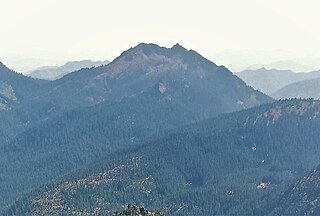
Copper Mountain is a 5,425-foot (1,654 m) mountain summit located in the southeast portion of the Olympic Mountains, in Mason County of Washington state. It is situated on the boundary shared by Daniel J. Evans Wilderness and Mount Skokomish Wilderness, as well as the shared common border of Olympic National Park with Olympic National Forest. The nearest higher neighbor is Mount Ellinor, 1.67 miles (2.69 km) to the east. Wagonwheel Lake lies immediately north of the peak. Topographic relief is significant as the summit rises nearly 4,700 feet (1,433 m) above the Staircase Ranger Station at Lake Cushman in approximately 1.5 miles (2.4 km). Precipitation runoff from the mountain drains north into the Hamma Hamma River, and south into the North Fork Skokomish River, thence Lake Cushman.


