Belfair, Washington

Last updated

Belfair
Belfair WA, September 2015.jpg
State Route 3 through Belfair
USA Washington location map.svg
Red pog.svg
Belfair
Location of Belfair, in Washington State
Coordinates: 47°27′02″N122°49′33″W / 47.45056°N 122.82583°W / 47.45056; -122.82583
CountryUnited States
State Washington
County Mason
Area
  Total44.9 sq mi (116 km2)
Population
 (2010)
  Total3,931
  Density88/sq mi (34/km2)
Time zone Pacific (PST) (UTC-8)
ZIP code
98528 [1]
Area code 360
GNIS feature ID1516383 [2]

Belfair is a census-designated place in Mason County, Washington, United States. Located at the mouth of the Union River at Hood Canal, it serves as the commercial center of northern Mason County. The population of the surrounding area grows in the summertime, as the Canal and the Olympic Peninsula are popular with tourists. The population was 3,931 as of the 2010 census.

Contents

History

Belfair was originally referred to as Clifton, as were several other towns in the state. To avoid confusion, it was renamed in 1925 by Mrs. Murray, then postmaster, who submitted the name Belfair from a book that she was then reading.[ citation needed ]

Geography

Belfair is located on an isthmus connecting the Kitsap and Olympic Peninsula. It receives an average rainfall of 60 inches (1,500 mm) yearly and has a growing season of 212 days with final spring frost around April 20 usually.

Mason Lake is 8 miles (13 km) southwest of Belfair.

Parks and recreation

Belfair serves as a gateway town for the Hood Canal region, and is the last town with services before visitors reach Tahuya State Forest.

The Theler Wetlands have walking trails meandering through 135 acres (0.55 km2) of tidal wetlands, offering boardwalks and well-groomed paths with views of Hood Canal, Union River, and a tidal estuary. Other nature trails can be found near Belfair Elementary.

Arts and culture

Belfair is home to "The Taste of Hood Canal", an annual event falling on the second Saturday in August. This festival features local artists, foods, a classic car show and is sponsored by the North Mason Rotary Club.

Belfair is also home to the Mary E. Theler Community Center.

Infrastructure

Health care

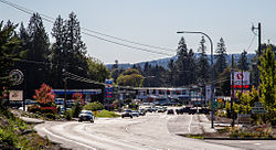
Belfair is the regional service hub for northern Mason County. Harrison Hospital operates an urgent care facility in Belfair, and local doctor offices are in the area along with other professional services. The area has local and chain restaurants, along with two major grocery stores. Local shopping includes gift stores. Timberland Regional Library has a local branch in Belfair. Several public golf courses are nearby, including McCormick Woods, Gold Mountain, Alderbrook, Trophy Lake, Horseshoe Lake, and Lakeland Village.

Roads

Washington State Route 3 is the main road leading into Belfair, from Bremerton and Gorst in the north, and Allyn in the south. Washington State Route 106 also starts at the south end of Belfair, leading toward Union, the next town along the south shore of Hood Canal. Washington State Route 300 begins in Belfair and runs along the north shore of Hood Canal, providing access to Tahuya and Dewatto Bay.

Education

Belfair has two high schools (North Mason High School and James A. Taylor High School, an alternative school), a middle school (Hawkins Middle School), two elementary schools (Sand Hill Elementary and Belfair Elementary), and a co-op preschool.

Notable people

Related Research Articles

<span class="mw-page-title-main">Belgium (town), Wisconsin</span> Town in Ozaukee County, Wisconsin

Belgium is a town in Ozaukee County, Wisconsin, United States. The population was 1,513 at the 2000 census. The Village of Belgium is surrounded on all sides by the town, and the unincorporated communities of Decker, Holy Cross, Lake Church, and Sauk Trail Beach are located in the town, as is the ghost town of Stonehaven. The unincorporated community of Dacada is also partially located in the town.

<span class="mw-page-title-main">Skokomish people</span> North American tribe

The Skokomish are one of nine tribes of the Twana, a Native American people of western Washington state in the United States. The tribe lives along Hood Canal, a fjord-like inlet on the west side of the Kitsap Peninsula and the Puget Sound basin. Historically the Twana were hunters, fishers, and gatherers who had a nomadic lifestyle during the warmer months, while living in more permanent homes during the winter months.

<span class="mw-page-title-main">Olympic Peninsula</span> Peninsula in Washington, United States

The Olympic Peninsula is a large arm of land in western Washington that lies across Puget Sound from Seattle, and contains Olympic National Park. It is bounded on the west by the Pacific Ocean, the north by the Strait of Juan de Fuca, and the east by Hood Canal. Cape Alava, the westernmost point in the contiguous United States, and Cape Flattery, the northwesternmost point, are on the peninsula. Comprising about 3,600 square miles (9,300 km2), the Olympic Peninsula contained many of the last unexplored places in the contiguous United States. It remained largely unmapped until Arthur Dodwell and Theodore Rixon mapped most of its topography and timber resources between 1898 and 1900.

<span class="mw-page-title-main">Hood Canal</span> Fjord in Washington state, United States

Hood Canal is a fjord forming the western lobe, and one of the four main basins of Puget Sound in the U.S. state of Washington. It is one of the minor bodies of water that constitute the Salish Sea. Hood Canal is not a canal in the sense of an artificial waterway—it is a natural feature.

<span class="mw-page-title-main">Seabeck, Washington</span> Census-designated place in Washington, United States

Seabeck is an unincorporated community and census-designated place (CDP) in Kitsap County, Washington, United States. The population was 1,105 at the 2010 census. Seabeck is a former mill town on Hood Canal.

<span class="mw-page-title-main">Washington State Route 3</span> State highway in the U.S. state of Washington

State Route 3 (SR 3) is a 59.81-mile-long (96.25 km) state highway in the U.S. state of Washington, serving the Kitsap Peninsula in Mason and Kitsap counties. The highway begins at U.S. Route 101 (US 101) south of Shelton and travels northeast onto the Kitsap Peninsula through Belfair to Gorst, where it intersects SR 16 and begins its freeway. SR 3 travels west of Bremerton, Silverdale and Poulsbo before it terminates at the eastern end of the Hood Canal Bridge, signed as SR 104. The highway is designated as a Strategic Highway Network (STRAHNET) corridor under the National Highway System as the main thoroughfare connecting both parts of Naval Base Kitsap and is also part of the Highways of Statewide Significance program.

Hazel Dell is an unincorporated area and census-designated place (CDP) in Clark County, Washington, United States, located north and west of Vancouver. As of the 2010 census the population was 19,435. Previous censuses divided the community into two areas, Hazel Dell North and Hazel Dell South.

Lilliwaup is a small unincorporated community in Mason County, Washington, United States. It is located on the west shore of Hood Canal at the mouth of Lilliwaup Creek. U.S. Route 101 passes through the town.

<span class="mw-page-title-main">Skokomish River</span> River in the United States

The Skokomish River is a river in Mason County, Washington, United States. It is the largest river flowing into Hood Canal, a western arm of Puget Sound. From its source at the confluence of the North and South Forks the main stem Skokomish River is approximately 9 miles (14 km) long. The longer South Fork Skokomish River is 40 miles (64 km), making the length of the whole river via its longest tributary about 49 miles (79 km). The North Fork Skokomish River is approximately 34 miles (55 km) long. A significant part of the Skokomish River's watershed is within Olympic National Forest and Olympic National Park.

Union or Union City is a small census-designated place in Mason County, Washington, United States. The community lies along the southern shore of the Great Bend of the Hood Canal, near the mouth of the Skokomish River, which flows from the nearby Olympic Mountains. The U.S. Census reported a population of 631 inhabitants in the 2010 census. The ZIP Code for Union is 98592.

<span class="mw-page-title-main">Washington State Route 302</span> State highway in the U.S. state of Washington

State Route 302 (SR 302) is a 16.87-mile-long (27.15 km) state highway in the U.S. state of Washington, connecting the communities of Allyn and Purdy on the Kitsap Peninsula, located in Mason and Pierce counties. The highway travels southeast from SR 3 in Allyn-Grapeview along North Bay and turns east along Henderson Bay to Purdy. SR 302 intersects its spur route and turns south, ending at an interchange with SR 16 at the north end of Gig Harbor. The highway was created during the 1964 highway renumbering to replace Secondary State Highway 14A (SSH 14A) between Allyn and Purdy.

<span class="mw-page-title-main">Washington State Route 119</span>

State Route 119 (SR 119) is a 10.93-mile-long (17.59 km) state highway in the U.S. state of Washington, serving Lake Cushman in Mason County within Olympic National Forest. The highway, known locally as Lake Cushman Road, travels northwest into the Olympic Mountains from U.S. Route 101 (US 101) in Hoodsport to Lake Cushman and ends at a gravel road east of the entrance to Olympic National Park on Forest Highway 24 (FFH-24). A gravel road connecting Lake Cushman to the state highway system has existed since the late 1950s and was codified into the current state highway system in 1991, prior to being completely paved by 1999.

<span class="mw-page-title-main">Washington State Route 106</span> Highway in Washington

State Route 106 (SR 106) is a Washington state highway in Mason County, extending 20.09 miles (32.33 km) from U.S. Route 101 (US 101) in Skokomish to SR 3 south of Belfair. The road was once a section of State Road 21 in 1915, which later became State Road 14 in 1923 and Primary State Highway 14 (PSH 14) in 1937 and PSH 21 in 1955. PSH 21 became SR 106 in 1964 and since, the Washington State Department of Transportation has arranged and completed minor projects to improve the roadway.

Eldon is an unincorporated community in Mason County, Washington, United States. Eldon is located along U.S. Route 101 on the scenic Hood Canal north of Lilliwaup and south of Brinnon. Eldon features a small store and several recreational areas and businesses catering to travelers and locals such as some Airbnb's. Some of the stores and Airbnb's include Eldon House (Airbnb), Eldon Store, and the Hama Hama Oyster Company (Restaurant).

Hoodsport is a census-designated place (CDP) in Mason County, Washington, United States. The population was 376 at the 2010 census. Hoodsport is located along the Hood Canal, at the intersection of U.S. Route 101 and State Route 119. Lake Cushman is 5 miles (8.0 km) up the road on State Route 119. Hoodsport is the gateway to the Staircase area of the Olympic National Park.

<span class="mw-page-title-main">Mason Lake</span>

Mason Lake is a natural elongated lake south of Belfair, Washington, United States in Mason County. Named for Charles H. Mason, the first secretary of Washington Territory, the lake is on the isthmus of the Kitsap Peninsula between the Hood Canal and Pickering Passage of the Case Inlet. The smaller Benson Lake is to its eastern side.

<span class="mw-page-title-main">Washington State Route 300</span>

State Route 300 (SR 300) is a short state highway in Mason County, in the U.S. state of Washington. It extends 3.35 miles (5.39 km) from Belfair State Park to SR 3 in the community of Belfair. The route serves as a connector from Belfair State Park to Belfair and SR 3. The highway was Secondary State Highway 21C (SSH 21C) from 1957 until 1964.

<span class="mw-page-title-main">Tahuya River</span> River in Washington, United States

The Tahuya River is a stream in the U.S. state of Washington. It originates at Tahuya Lake in western Kitsap Peninsula and flows south, emptying into Hood Canal near the Great Bend.

<span class="mw-page-title-main">Belfair State Park</span> State park in the U.S. state of Washington

Belfair State Park is a public recreation area located on Hood Canal three miles (4.8 km) southwest of Belfair in Mason County, Washington. The state park consists of 94 acres (38 ha) of tidal flats, wetlands, and beaches with a 3,720-foot (1,130 m) shoreline. Park activities include camping, fishing, swimming, clam digging, crabbing, birdwatching, and field sports.

<span class="mw-page-title-main">South Puget Sound</span> Region in Washington, United States

South Puget Sound is the southern reaches of Puget Sound in Southwest Washington, in the United States' Pacific Northwest. It is one of five major basins encompassing the entire Sound, and the shallowest basin, with a mean depth of 37 meters (121 ft). Exact definitions of the region vary: the state's Department of Fish and Wildlife counts all of Puget Sound south of the Tacoma Narrows for fishing regulatory purposes. The same agency counts Mason, Jefferson, Kitsap, Pierce and Thurston Counties for wildlife management. The state's Department of Ecology defines a similar area south of Colvos Passage.

References

  1. "Belfair WA ZIP Code". zipdatamaps.com. 2023. Retrieved June 16, 2023.
  2. "Belfair". Geographic Names Information System . United States Geological Survey, United States Department of the Interior.