Gorst, Washington

Last updated
Gorst, Washington
USA Washington location map.svg
Red pog.svg
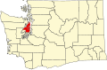
Gorst
Location in Washington and the United States
Usa edcp location map.svg
Red pog.svg
Gorst
Gorst (the United States)
Coordinates: 47°31′34″N122°42′14″W / 47.52611°N 122.70389°W / 47.52611; -122.70389 Coordinates: 47°31′34″N122°42′14″W / 47.52611°N 122.70389°W / 47.52611; -122.70389
Country United States
State Washington
County Kitsap
Area
  Total0.65 sq mi (1.69 km2)
  Land0.65 sq mi (1.69 km2)
  Water0.0 sq mi (0.0 km2)
Elevation
30 ft (9 m)
Population
 (2010)
  Total592
  Density910/sq mi (350/km2)
Time zone UTC-8 (Pacific (PST))
  Summer (DST) UTC-7 (PDT)
ZIP code
98337
Area code(s) 360
FIPS code 53-27680
GNIS feature ID1512247 [1]

Gorst is a census-designated place (CDP) at the head of Sinclair Inlet in Kitsap County, Washington, United States. The population was 592 at the 2010 census. [2] Gorst, located on the shores of Puget Sound, is primarily a town consisting of stores, auto dealerships and espresso stands. A residential area, located west of the water along State Route 3, also exists.

Gorst is named for the Gorst family who settled there in the 1890s. Famous residents of Gorst include Vern C. Gorst, "grandfather" of United Airlines, and Edward S. Curtis and Asahel Curtis, well-known photographers. The town has also been linked to the infamous Tree Octopus Hoax, which began on the internet in 1998.[ citation needed ]

Related Research Articles

Clinton, Maryland Census-designated place in Maryland, United States

Clinton is an unincorporated census-designated place (CDP) in Prince George's County, Maryland, United States. Clinton was formerly known as Surrattsville until after the time of the Civil War. The population of Clinton was 38,760 at the 2020 census. Clinton is historically known for its role in the American Civil War concerning the Abraham Lincoln assassination. Clinton is adjacent to Camp Springs, Rosaryville, Melwood, and Andrews Air Force Base.

Security-Widefield, Colorado Census Designated Place in Colorado, United States

Security-Widefield is a census-designated place (CDP) comprising the unincorporated communities of Security and Widefield located in and governed by El Paso County, Colorado, United States. The CDP is a part of the Colorado Springs, CO Metropolitan Statistical Area. The population of the Security-Widefield CDP was 32,882 at the United States Census 2010. El Paso County governs the unincorporated communities. Both the Colorado Springs post office and the Fountain post office serve the area.

Chantilly, Virginia CDP in Virginia, United States

Chantilly is a census-designated place (CDP) in western Fairfax County, Virginia, United States. The population was 23,039 at the 2010 census. Chantilly is named after an early-19th-century mansion and farm, which in turn took the name of an 18th-century plantation that was located in Westmoreland County, Virginia. The name "Chantilly" originated in France with the Château de Chantilly, about 28 miles north of Paris.

Dollars Corner, Washington Census-designated place in Washington, United States

Dollars Corner is a census-designated place (CDP) in Clark County, Washington, United States. The population was 1,108 at the 2010 census.

A census-designated place (CDP) is a concentration of population defined by the United States Census Bureau for statistical purposes only. CDPs have been used in each decennial census since 1980 as the counterparts of incorporated places, such as self-governing cities, towns, and villages, for the purposes of gathering and correlating statistical data. CDPs are populated areas that generally include one officially designated but currently unincorporated community, for which the CDP is named, plus surrounding inhabited countryside of varying dimensions and, occasionally, other, smaller unincorporated communities as well. CDPs include small rural communities, edge cities, colonias located along the Mexico–United States border, and unincorporated resort and retirement communities and their environs.

Seabrook is an unincorporated community and census-designated place (CDP) in Prince George's County, Maryland, United States, located approximately 12 miles (19 km) east of Washington. As of the 2010 census, the population of the CDP was 17,287. Prior to 2010, Seabrook was part of the Lanham-Seabrook census-designated place.

Landover is an unincorporated community and census-designated place in Prince George's County, Maryland, United States. As of the 2020 census it had a population of 25,998.

Glassmanor is an unincorporated community and census-designated place in Prince George's County, Maryland, United States. As of the 2010 census, it had a population of 17,295. Prior to 2010, the United States Census Bureau had placed Glassmanor and the adjacent community of Oxon Hill in the "Oxon Hill-Glassmanor" census-designated place for statistical purposes.

Tamuning, Guam Village in Guam, United States

Tamuning, also known as Tamuning-Tumon-Harmon is a village located on the western shore of the United States territory of Guam. The village of Tamuning is the economic center of Guam, containing tourist center Tumon, Harmon Industrial Park, and other commercial districts. Its central location along Marine Corps Drive, the island's main thoroughfare, has aided in its development.

Ashburn, Virginia Census-designated place in Virginia

Ashburn is a census-designated place (CDP) in Loudoun County, Virginia, United States. As of the 2010 United States Census, its population was 43,511, up from 3,393 twenty years earlier. It is 30 miles (48 km) northwest of Washington, D.C., and part of the Washington metropolitan area.

Ascutney, Vermont Census-designated place in Vermont, United States

Ascutney is an unincorporated village and census-designated place (CDP) in the town of Weathersfield, Windsor County, Vermont, United States. It is located in the northeastern section of Weathersfield, in the portion of that town adjacent to Mount Ascutney, after which the village is named. As of the 2010 census, the population of the CDP was 540.

Bethel is a census-designated place (CDP) in Kitsap County, Washington, United States. Located a few miles south of the city of Port Orchard, Bethel is a wooded residential area. Most residents commute to Port Orchard or nearby cities. It was first designated a place by the Census Bureau in the 2010 Census, at which time its population was 3,713.

Dranesville, Virginia Census-designated place in Virginia, United States

Dranesville is a census-designated place (CDP) in Fairfax County, Virginia, United States. Dranesville is located on the Leesburg Pike at its intersection with Georgetown Pike. The U.S. Census Bureau defines Dranesville as a census-designated place (CDP) with a population of 11,921 as of 2010.

Pacific Air Transport was an early US airline, formed in 1926 for carrying mail as well as passengers. It was acquired two years later by Boeing Air Transport.

Cope, Colorado Census Designated Place in Colorado, United States

Cope is an unincorporated town, a post office, and a census-designated place (CDP) located in and governed by Washington County, Colorado, United States. The Cope post office has the ZIP Code 80812. At the United States Census 2010, the population of the 80812 ZIP Code Tabulation Area was 275 including adjacent areas.

Queen Anne in Prince George's County, Maryland, United States, is a former seaport on the Patuxent River. It was delineated as a CDP for the 2010 census, at which time it had a population of 1,280.

Madison, Maryland Census-designated place in Maryland, United States

Madison is an unincorporated community and census-designated place (CDP) in Dorchester County, Maryland, United States. The population was 204 at the 2010 census.

Franklin Farm, Virginia Census-designated place in Virginia, United States

Franklin Farm refers to both a census-designated place (CDP) and a planned community located within the Oak Hill section of Fairfax County, Virginia, United States. It is a suburb of Washington, D.C., located about 20 miles west of the White House.

Summerfield is a census-designated place near Landover in Prince George's County, Maryland, United States. The population of the CDP was 10,898 at the 2010 census. It is a suburb of Washington, D.C.

Lofall is an unincorporated community and census-designated place (CDP) located in Kitsap County, Washington, United States. The population was 2,289 at the 2010 census.

References

  1. U.S. Geological Survey Geographic Names Information System: Gorst, Washington
  2. "Geographic Identifiers: 2010 Census Summary File 1 (G001), Gorst CDP, Washington". American FactFinder. U.S. Census Bureau. Archived from the original on February 13, 2020. Retrieved June 26, 2019.