Chico, Washington | |
|---|---|
 Chico Location in Washington and the United States  Chico Chico (the United States) | |
| Coordinates: 47°37′32″N122°43′10″W / 47.62556°N 122.71944°W | |
| Country | United States |
| State | Washington |
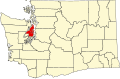
| County | Kitsap |
| Area | |
• Total | 2.29 sq mi (5.93 km2) |
| • Land | 2.29 sq mi (5.93 km2) |
| • Water | 0.0 sq mi (0.0 km2) |
| Elevation | 436 ft (133 m) |
| Population (2020) | |
• Total | 2,723 |
| • Density | 1,200/sq mi (460/km2) |
| Time zone | UTC-8 (Pacific (PST)) |
| • Summer (DST) | UTC-7 (PDT) |
| ZIP code | 98312 |
| Area code | 360 |
| FIPS code | 53-12175 [2] |
| GNIS feature ID | 2584958 [1] |
Chico is an unincorporated community and census-designated place (CDP) in Kitsap County, Washington, United States. Named in 1889 for a Suquamish head chief, [3] [4] Chico is located on the Dyes Inlet waterfront, south of Silverdale. At the 2020 census the community had a population of 2,723. [5]