North Amherst is a census-designated place (CDP) in the city of Amherst in Hampshire County, Massachusetts, United States. The population was 6,819 at the 2010 census, up from 6,019 at the 2000 census. It is part of the Springfield, Massachusetts Metropolitan Statistical Area.

Sunnyside is a former census-designated place in Clackamas County in the U.S. state of Oregon. Located in the Portland metropolitan area along Interstate 205, the population was 6,791 at the 2000 census. The area was not recorded as a distinct place for the 2010 census.

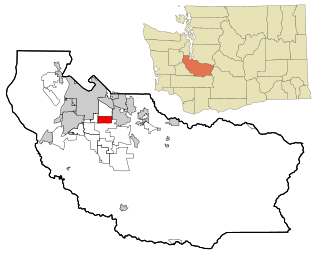
Cottage Lake is a census-designated place (CDP) in King County, Washington, United States. The population was 22,494 at the 2010 census. The lake itself falls within the 98072 ZIP code, while the developments east of the lake fall under the 98077 ZIP code.

East Hill-Meridian is a former census-designated place (CDP) in King County, Washington. The population was 29,878 at the time of the 2010 census. The majority of the census area is now within the limits of Kent and Renton.

East Renton Highlands is a census-designated place (CDP) in King County, Washington, United States, located between Issaquah and Renton. The population was 11,937 at the 2020 census.

Lake Morton-Berrydale is a census-designated place (CDP) in King County, Washington, United States. The population was 10,474 at the 2020 census.

Lakeland North is a census-designated place (CDP) in King County, Washington, United States. The population was 13,663 at the 2020 census. Part of the community was annexed into neighboring Auburn in 2008.

Lakeland South is a census-designated place (CDP) in King County, Washington, United States. The population was 13,169 at the 2020 census.

Maple Heights-Lake Desire is a census-designated place (CDP) in King County, Washington, United States. At the 2020 census, the population was 3,873.

Mirrormont is a census-designated place (CDP) in King County, Washington, United States, south of Issaquah. The population was 3,858 at the 2020 census. Within the last decade, the area has seen a shift in development as larger homes have been constructed in Cedar Grove, the Highlands at Tiger Mountain and Mirrormont.

Manchester is an unincorporated community and census-designated place (CDP) in Kitsap County, Washington, United States. The population was 5,714 at the 2020 census. Manchester is located on the Puget Sound approximately 10 miles from downtown Seattle, and is adjacent to county seat Port Orchard to its east. Today, Manchester labels itself as a village. It is small in size but is home to a Kitsap Regional Library (KRL) branch, a post office, an elementary school, and a beachfront park to serve its residents.

Navy Yard City is a census-designated place (CDP) in Kitsap County, Washington, United States. The population was 2,759 at the 2020 census.

Parkwood is a census-designated place (CDP) in Kitsap County, Washington, United States. The population was 7,635 at the 2020 census.

Suquamish is a census-designated place (CDP) in Kitsap County, Washington, United States. The population was 4,266 at the 2020 census. Comprising the Port Madison Indian Reservation, it is the burial site of Chief Seattle and was the site of the Suquamish tribe winter longhouse known as the Old Man House.

Tracyton is a census-designated place (CDP) in Kitsap County, Washington, United States. Its population was 5,967 at the 2020 census. It was named for 19th century Secretary of the Navy Benjamin F. Tracy.
Summit is a census-designated place (CDP) in Pierce County, Washington, United States. The population was 8,270 at the 2020 census.

Waller is a census-designated place (CDP) in Pierce County, Washington, United States. The population was 8,189 at the 2020 census. The population has seen significant growth in the last decade.

Lake Stickney is a census-designated place (CDP) in Snohomish County, Washington, United States. The population was 15,413 at the 2020 census. The CDP was known as Paine Field-Lake Stickney prior to 2010. The new Lake Stickney CDP no longer contains the Paine Field airport.
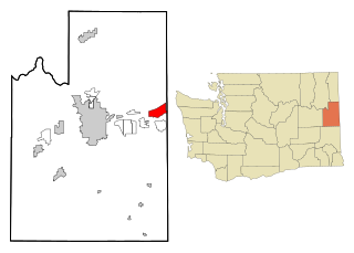
Otis Orchards-East Farms is a census-designated place (CDP) in Spokane County, Washington, United States, near the county's border with Idaho. The population was 6,299 at the 2020 census. The CDP includes the unincorporated communities of Otis Orchards and East Farms. Otis Orchards contains the bulk of the businesses of the community.

Fox Lake is a census-designated place (CDP) in Richland County, Montana, United States. The population was 158 at the 2010 census.

