Rocky Point, Washington | |
|---|---|
 Rocky Point  Rocky Point | |
| Coordinates: 47°35′19″N122°40′02″W / 47.58861°N 122.66722°W | |
| Country | United States |
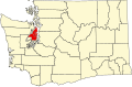
| State | Washington |
| County | Kitsap |
| Area | |
• Total | 0.76 sq mi (1.96 km2) |
| • Land | 0.75 sq mi (1.93 km2) |
| • Water | 0.008 sq mi (0.02 km2) |
| Elevation | 36 ft (11 m) |
| Population (2010) | |
• Total | 1,564 |
| • Density | 2,096/sq mi (809.4/km2) |
| Time zone | Pacific |
| Area code | 360 |
| FIPS code | 53-59390 |
| GNIS feature ID | 2585030 [1] |
Rocky Point is a census-designated place (CDP) in Kitsap County, Washington, United States. It is a suburb of Bremerton, Washington.