Southworth, Washington

Last updated

Southworth, Washington
USA Washington location map.svg
Red pog.svg
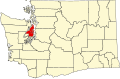
Southworth
Location in Washington and the United States
Usa edcp location map.svg
Red pog.svg
Southworth
Southworth (the United States)
Coordinates: 47°30′44″N122°30′02″W / 47.51222°N 122.50056°W / 47.51222; -122.50056
Country United States
State Washington
County Kitsap
Area
  Total3.39 sq mi (8.77 km2)
  Land3.37 sq mi (8.74 km2)
  Water0.008 sq mi (0.02 km2)
Elevation
49 ft (15 m)
Population
 (2010)
  Total2,185
  Density647/sq mi (250.0/km2)
Time zone UTC-8 (Pacific (PST))
  Summer (DST) UTC-7 (PDT)
ZIP code
98386
FIPS code 53-66220
GNIS feature ID1512679 [1]

Southworth is an unincorporated community and census-designated place (CDP) on Puget Sound in Kitsap County, Washington, United States. [1] It is best known for being the west end of the Fauntleroy-Vashon Island-Southworth Washington State Ferries run. Landmarks include Southworth Grocery, a US Post Office, ferry terminal, clay cliffs and a private beach on the point. Next to the ferry is a popular place to launch kayaks for trips to nearby Blake Island. The population of the Southworth CDP was 2,185 at the 2010 census. [2]

Contents

Geography

Southworth Ferry Terminal at low tide Southworth ferry terminal.jpg
Southworth Ferry Terminal at low tide

Southworth is in southeastern Kitsap County on the shore of Puget Sound, with the CDP limits extending southwest from Point Southworth 0.5 miles (0.80 km) along Colvos Passage and northwest from Point Southworth 2.5 miles (4.0 km) to Yukon Harbor. The CDP includes the communities of Southworth, Harper, and South Colby. Washington State Route 160 is the southern edge of the CDP and leads west 7 miles (11 km) to State Route 16 in the southern outskirts of Port Orchard.

Point Southworth was named by Charles Wilkes, during the Wilkes Expedition of 1838–1842, in honor of Edward Southworth, one of the expedition's quartermasters. [3]

According to the U.S. Census Bureau, the Southworth CDP has a total area of 3.39 square miles (8.77 km2), of which 0.01 square miles (0.02 km2), or 0.28%, are water. [2]

Related Research Articles

<span class="mw-page-title-main">Kitsap County, Washington</span> County in Washington, United States

Kitsap County is located in the U.S. state of Washington. As of the 2020 census, its population was 275,611. Its county seat is Port Orchard, and its largest city is Bremerton. The county was formed out of King County and Jefferson County on January 16, 1857, and is named for Chief Kitsap of the Suquamish Tribe. Originally named Slaughter County, it was soon renamed.

<span class="mw-page-title-main">Clinton, Washington</span> CDP in Washington, United States

Clinton is a community and census-designated place (CDP) located on southern Whidbey Island in Island County, Washington, United States. The town was named after Clinton, Michigan. As of the 2010 census, the village was 928. However, the post office serves at least 2,500 people.

<span class="mw-page-title-main">Port Ludlow, Washington</span> Census-designated place in Washington, United States

Port Ludlow is an unincorporated community and census-designated place (CDP) in Jefferson County, Washington, United States. It is also the name of the marine inlet on which the community is located. The CDP's population was 2,603 at the 2010 census, up from 1,968 at the 2000 census.

<span class="mw-page-title-main">Bainbridge Island, Washington</span> City in Washington, United States

Bainbridge Island is a city and island in Kitsap County, Washington. It is located in Puget Sound. The population was 23,025 at the 2010 census and an estimated 25,298 in 2019, making Bainbridge Island the second largest city in Kitsap County.

<span class="mw-page-title-main">Indianola, Washington</span> CDP in Washington, United States

Indianola is a census-designated place (CDP) in Kitsap County, Washington, United States, located on the north shore of Port Madison on the Port Madison Indian Reservation, home of the Suquamish Indian Tribe. The population was 3,500 at the 2010 census. It was originally established as a summer community and was a stop for Mosquito Fleet ferries until the 1950s.

<span class="mw-page-title-main">Kingston, Washington</span> Census-designated place in Washington, United States

Kingston is an unincorporated community and census-designated place (CDP) in Kitsap County, Washington, United States. The population was 2,099 at the 2010 census. Kingston is along the shores of Appletree Cove and Puget Sound, and is home to a major Washington State Ferry terminal linking it to Edmonds.

<span class="mw-page-title-main">Manchester, Washington</span> Census-designated place in Washington, United States

Manchester is an unincorporated community and census-designated place (CDP) in Kitsap County, Washington, United States. The population was 5,714 at the 2020 census. Manchester is located on the Puget Sound approximately 10 miles from downtown Seattle, and is adjacent to county seat Port Orchard to its east. Today, Manchester labels itself as a village. It is small in size but is home to a Kitsap Regional Library (KRL) branch, a post office, an elementary school, and a beachfront park to serve its residents.

<span class="mw-page-title-main">Port Orchard, Washington</span> City in Washington, United States

Port Orchard is a city in and the county seat of Kitsap County, Washington, United States. It is located 13 miles (21 km) due west of West Seattle and is connected to Seattle and Vashon Island via the Washington State Ferries run to Southworth. It is named after Port Orchard, the strait that separates Bainbridge Island from the Kitsap Peninsula.

<span class="mw-page-title-main">Poulsbo, Washington</span> City in Washington, United States

Poulsbo is a city on Liberty Bay in Kitsap County, Washington, United States. It is the smallest of the four cities in Kitsap County. The population was 9,200 at the 2010 census and an estimated 10,927 in 2018.

<span class="mw-page-title-main">Suquamish, Washington</span> Census-designated place in Washington, United States

Suquamish is a census-designated place (CDP) in Kitsap County, Washington, United States. The population was 4,140 at the 2010 census. Comprising the Port Madison Indian Reservation, it is the burial site of Chief Seattle and the site of the Suquamish tribe winter longhouse known as Old Man House.

<span class="mw-page-title-main">Fox Island, Washington</span> CDP in Washington, United States

Fox Island is an island and census-designated place (CDP) in Pierce County, Washington, United States, in Puget Sound. It is located approximately 5 miles (8 km) from Gig Harbor. The island was named Fox by Charles Wilkes during the United States Exploring Expedition, to honor J.L. Fox, an assistant surgeon on the expedition. The population was 3,633 at the 2010 census.

<span class="mw-page-title-main">Camano Island</span> CDP in Washington, United States

Camano Island is a large island in Possession Sound, a section of Puget Sound. It is part of Island County, Washington, and is located between Whidbey Island and the mainland by the Saratoga Passage to the west and Port Susan and Davis Slough to the east. The island has one road connection to the mainland, via State Route 532 over the Camano Gateway Bridge at the northeast end of the island, connecting to the city of Stanwood.

<span class="mw-page-title-main">Seabeck, Washington</span> Census-designated place in Washington, United States

Seabeck is an unincorporated community and census-designated place (CDP) in Kitsap County, Washington, United States. The population was 1,105 at the 2010 census. Seabeck is a former mill town on Hood Canal.

<span class="mw-page-title-main">Hansville, Washington</span> Census-designated place in Washington, United States

Hansville is an unincorporated community and census-designated place (CDP) in Kitsap County, Washington, United States. Its population was 3,858 as of the 2020 census. The coastal community is located at the northern end of the Kitsap Peninsula and is about 16 miles (26 km) northeast of Poulsbo, the nearest city.

Bethel is a census-designated place (CDP) in Kitsap County, Washington, United States. Located a few miles south of the city of Port Orchard, Bethel is a wooded residential area. Most residents commute to Port Orchard or nearby cities. It was first designated a place by the Census Bureau in the 2010 Census, at which time its population was 3,713.

Burley is an unincorporated community and census-designated place (CDP) in Kitsap County, Washington, United States. It is located just north of the boundary with Pierce County, about halfway between Gig Harbor to the south and Port Orchard to the north. It is located at the head of the Burley Lagoon in Henderson Bay. Burley is a residential area. The community's population stood at 2,057 at the 2010 census.

Chico is an unincorporated community and census-designated place (CDP) in Kitsap County, Washington, United States. Named in 1889 for a local Indian, Chico is located on the Dyes Inlet waterfront, south of Silverdale. At the 2010 census the community had a population of 2,259.

Herron Island is an island in central Case Inlet in the southern part of Puget Sound in the U.S. state of Washington. The Pierce County island has a land area of 1.2326 km² and a population of 151 persons as of the 2010 census.

<span class="mw-page-title-main">Ketron Island, Washington</span> CDP in Washington, United States

Ketron Island is an island and a census-designated place (CDP) in Pierce County, Washington, United States. The island had a population of 24 persons according to the 2000 census, and 17 persons at the 2010 census.

<span class="mw-page-title-main">Hat Island, Washington</span> CDP in Washington, United States

Hat Island is a census-designated place (CDP) in Snohomish County, Washington, United States. The population was 41 at the 2010 census. The CDP occupies an island in Possession Sound called Hat Island, also known as Gedney Island. The island lies in Possession Sound between the mainland city of Everett, Washington, and the southern part of Whidbey Island. Gedney Island has a land area of 1.768 km2 and a population of 13 people was reported as of the 2000 census.

References

  1. 1 2 "Southworth". Geographic Names Information System . United States Geological Survey, United States Department of the Interior.
  2. 1 2 "Geographic Identifiers: 2010 Census Summary File 1 (G001), Southworth CDP, Washington". American FactFinder. U.S. Census Bureau. Archived from the original on February 13, 2020. Retrieved July 5, 2019.
  3. Phillips, James W. (1971). Washington State Place Names . University of Washington Press. pp.  134. ISBN   0-295-95158-3.