Brownsville, Washington

Last updated

Brownsville, Washington
USA Washington location map.svg
Red pog.svg
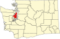
Brownsville
Location in Washington and the United States
Usa edcp location map.svg
Red pog.svg
Brownsville
Brownsville (the United States)
Coordinates: 47°39′20″N122°36′55″W / 47.65556°N 122.61528°W / 47.65556; -122.61528
Country United States
State Washington
County Kitsap
Time zone UTC-8 (Pacific (PST))
  Summer (DST) UTC-7 (PDT)
GNIS feature ID1510841 [1]

Brownsville is an unincorporated community in Kitsap County, Washington, United States. It is located north of Bremerton and due east of Silverdale and on the north side of Burke Bay on the Kitsap Peninsula.

Contents

Brownsville has a quiet and fairly remote harbor and marina. The community is primarily residential, but it has a locally famous deli, a convenience store called the Daily Stop, a meat market, and a kayak rental shop.[ citation needed ]

Brownsville Cemetery

In 2009, an incident of illegal tree cutting brought attention to the historic graveyard located at Roanoke and Roy Streets. [2]

Related Research Articles

<span class="mw-page-title-main">Kitsap County, Washington</span> County in Washington, United States

Kitsap County is located in the U.S. state of Washington. As of the 2020 census, its population was 275,611. Its county seat is Port Orchard, and its largest city is Bremerton. The county was formed out of King County and Jefferson County on January 16, 1857, and is named for Chief Kitsap of the Suquamish Tribe. Originally named Slaughter County, it was soon renamed.

<span class="mw-page-title-main">Kingston, Washington</span> Census-designated place in Washington, United States

Kingston is an unincorporated community and census-designated place (CDP) in Kitsap County, Washington, United States. The population was 2,099 at the 2010 census. Kingston is along the shores of Appletree Cove and Puget Sound, and is home to a major Washington State Ferry terminal linking it to Edmonds.

<span class="mw-page-title-main">Manchester, Washington</span> Census-designated place in Washington, United States

Manchester is an unincorporated community and census-designated place (CDP) in Kitsap County, Washington, United States. The population was 5,714 at the 2020 census. Manchester is located on the Puget Sound approximately 10 miles from downtown Seattle, and is adjacent to county seat Port Orchard to its east. Today, Manchester labels itself as a village. It is small in size but is home to a Kitsap Regional Library (KRL) branch, a post office, an elementary school, and a beachfront park to serve its residents.

<span class="mw-page-title-main">Navy Yard City, Washington</span> Census-designated place in Washington, United States

Navy Yard City is a census-designated place (CDP) in Kitsap County, Washington, United States. The population was 2,477 at the 2010 census.

<span class="mw-page-title-main">Port Orchard, Washington</span> City in Washington, United States

Port Orchard is a city in and the county seat of Kitsap County, Washington, United States. It is located 13 miles (21 km) due west of West Seattle and is connected to Seattle and Vashon Island via the Washington State Ferries run to Southworth. It is named after Port Orchard, the strait that separates Bainbridge Island from the Kitsap Peninsula.

<span class="mw-page-title-main">Poulsbo, Washington</span> City in Washington, United States

Poulsbo is a city on Liberty Bay in Kitsap County, Washington, United States. It is the smallest of the four cities in Kitsap County. The population was 9,200 at the 2010 census and an estimated 10,927 in 2018.

<span class="mw-page-title-main">Silverdale, Washington</span> Census-designated place in Washington, United States

Silverdale is a census-designated place (CDP) in Kitsap County, Washington, in the United States. The population was 20,733 at the 2020 census. Despite many attempts at incorporation, Silverdale remains an unincorporated community.

<span class="mw-page-title-main">Kitsap Peninsula</span> Peninsula in Puget Sound, Washington, United States

The Kitsap Peninsula lies west of Seattle across Puget Sound, in Washington state in the Pacific Northwest. Hood Canal separates the peninsula from the Olympic Peninsula on its west side. The peninsula, a.k.a. "Kitsap", encompasses all of Kitsap County except Bainbridge and Blake Islands, as well as the northeastern part of Mason County and the northwestern part of Pierce County. The highest point on the Kitsap Peninsula is Gold Mountain. The U.S. Navy's Puget Sound Naval Shipyard, and Naval Base Kitsap are on the peninsula. Its main city is Bremerton.

<span class="mw-page-title-main">Seabeck, Washington</span> Census-designated place in Washington, United States

Seabeck is an unincorporated community and census-designated place (CDP) in Kitsap County, Washington, United States. The population was 1,105 at the 2010 census. Seabeck is a former mill town on Hood Canal.

<span class="mw-page-title-main">Hansville, Washington</span> Census-designated place in Washington, United States

Hansville is an unincorporated community and census-designated place (CDP) in Kitsap County, Washington, United States. Its population was 3,858 as of the 2020 census. The coastal community is located at the northern end of the Kitsap Peninsula and is about 16 miles (26 km) northeast of Poulsbo, the nearest city.

Burley is an unincorporated community and census-designated place (CDP) in Kitsap County, Washington, United States. It is located just north of the boundary with Pierce County, about halfway between Gig Harbor to the south and Port Orchard to the north. It is located at the head of the Burley Lagoon in Henderson Bay. Burley is a residential area. The community's population stood at 2,057 at the 2010 census.

Chico is an unincorporated community and census-designated place (CDP) in Kitsap County, Washington, United States. Named in 1889 for a local Indian, Chico is located on the Dyes Inlet waterfront, south of Silverdale. At the 2010 census the community had a population of 2,259.

The Manette Peninsula is a headland that is part of the larger Kitsap Peninsula, located on the eastern flank of the Kitsap Peninsula, in western Washington, United States.

<span class="mw-page-title-main">Kingston High School (Washington)</span> Public secondary school in Kingston, Washington, United States

Kingston High School is a secondary school located in Kingston, Washington. It is one of two secondary schools in the North Kitsap School District. KHS educates grades 9–12. The school is located on the same site as the North Kitsap school bus barn and Spectrum Community School.

Burke Bay is a small bay in Kitsap County in Washington state. It is located on the Kitsap Peninsula of Puget Sound, west of Seattle and Bainbridge Island. Nearby communities include Brownsville, Illahee and Keyport. Close towns are Bremerton, Poulsbo and Silverdale. A strong military presence strengthens the county's economy.

<span class="mw-page-title-main">Washington State Route 303</span> Highway in Kitsap County, Washington

State Route 303 (SR 303) is a 9.27-mile (14.92 km) state highway in Kitsap County, located in the U.S. state of Washington. The highway connects SR 304 in Bremerton to an interchange with SR 3 in Silverdale. SR 303 crosses the Port Washington Narrows on the Warren Avenue Bridge in Bremerton and becomes a grade-separated freeway bypass of Silverdale. The route has existed as unpaved roads since the 1930s and was signed as Secondary State Highway 21B (SSH 21B) in 1937. SSH 21B connected Bremerton to Keyport and had a branch to Illahee State Park added in 1961. After the 1964 highway renumbering, SSH 21B became SR 303 from Bremerton to Keyport and SR 306 from Bremerton to Illahee State Park. SR 303 was shortened in 1971, to include SR 308, and in 1991, re-routing the highway onto the new Silverdale freeway. SR 303 also had a spur route in Bremerton that served the Manette Bridge until 1991.

<span class="mw-page-title-main">Kitsap Memorial State Park</span>

Kitsap Memorial State Park is a 63-acre (25 ha) public recreation area located on Hood Canal, seven miles (11 km) north of Poulsbo in Kitsap County, Washington. The state park offers 1,797 feet (548 m) of shoreline and activities that include picnicking, camping, hiking, scuba diving, fishing, swimming, clamming, crabbing, beachcombing, birdwatching, and field sports.

The Kitsap County Transportation Company was an important steamboat and ferry company that operated on Puget Sound. The company was founded in 1898 as the Hansen Transportation Company.

Central Kitsap School District 401 is a public school district in Kitsap County, Washington, United States. It serves unincorporated portions of the county, including the community of Silverdale, and portions of the City of Bremerton. As of June 2014, the district has an enrollment of 11,091 students. Approximately one-quarter of students are from military families, and one half are from families economically dependent on the US Navy. It consists of CK High and Middle school, Klahowya, and other schools like Ridgetop or Fairview

Kitsap Lake is an unincorporated community and census-designated place (CDP) in Kitsap County, Washington, United States. As of the 2020 census, it had a population of 1,997. Prior to 2020, it was part of the Erlands Point-Kitsap Lake CDP.

References

  1. "Brownsville". Geographic Names Information System . United States Geological Survey, United States Department of the Interior.
  2. Christopher Dunagan (July 9, 2011). "Brownsville Cemetery to be repaired". Kitsap Sun. Archived from the original on July 12, 2011. Retrieved September 6, 2011.