
Drenthe is a province of the Netherlands located in the northeastern part of the country. It is bordered by Overijssel to the south, Friesland to the west, Groningen to the north, and the German state of Lower Saxony to the east. As of November 2019, Drenthe had a population of 493,449 and a total area of 2,680 km2 (1,030 sq mi).

Ommen is a municipality and a Hanseatic city in the eastern Netherlands. It is located in the Vecht valley of the Salland region in Overijssel. Historical records first name Ommen in the early 12th century and it was officially founded as a city in 1248. The municipality had a population of 17,813 in 2019 and covers an area of 182.01 km2 (70.27 sq mi).
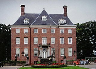
Amerongen is a village in the province of Utrecht, the Netherlands, on the border of the Utrecht Hill Ridge. It lies about 7 km south west of Veenendaal.
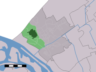
's-Gravenzande is a town in the province of South Holland, in the Netherlands. It is a part of the municipality of Westland, and lies about 12 kilometres (7.5 mi) southwest of The Hague. Until 2004 it was a separate municipality and covered an area of 20.77 km2.

Bourtange is a village with a population of 430 in the municipality of Westerwolde in the Netherlands. It is situated in the region Westerwolde in the east of the province of Groningen near the German border. Fort Bourtange was built in 1593 during the Dutch Revolt and was used until 1851. The star fort was gradually restored to its mid-18th-century state between 1967 and 1992 and it is currently an open-air museum.

Groot-Ammers is a town in the Dutch province of South Holland. It is a part of the municipality of Molenlanden, and is located about 13 km southeast of Gouda on the southside of the Lek River.

Arkel is a town in the province of South Holland, Netherlands. A part of the municipality of Molenlanden, it lies about 3 km north of Gorinchem. Arkel is a former municipality; in 1986 it became part of Giessenlanden.

Baambrugge is a village on the river Angstel in the Dutch province of Utrecht. It is a part of the municipality of De Ronde Venen and lies about 14 km southeast of Amsterdam. In 2001 the village of Baambrugge had 925 inhabitants. The built-up area of the town was 0.21 km² and contained 365 residences. The statistical area "Baambrugge", which also can include the peripheral parts of the village, as well as the surrounding countryside, has a population of around 1000.
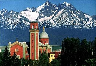
Kežmarok is a town in the Spiš region of eastern Slovakia, on the Poprad River.

Raphoe is a historical town in County Donegal, Ireland. It is the main town in the fertile district of East Donegal known as the Laggan, as well as giving its name to the Barony of Raphoe, which was later divided into the baronies of Raphoe North and Raphoe South, as well as to the Roman Catholic Diocese of Raphoe and the Church of Ireland (Anglican) Diocese of Derry and Raphoe.

Weeze is a municipality in the Lower Rhine (Niederrhein) region, in the northwestern part of North Rhine-Westphalia in the district of Kleve in the region of Düsseldorf.

Achterveld is a village in the central Netherlands. It is a part of the municipality of Leusden, Utrecht and is located about 8 km east of Amersfoort. A small part of the village is located in Barneveld.

Bruneck (German pronunciation: [ˈbrʊnɛk]; Italian: Brunico[bruˈniːko] or [ˈbruːniko] Ladin: Bornech or Burnech; Latin: Branecium or Brunopolis is the largest town in the Puster Valley in the Italian province of South Tyrol.
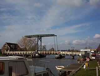
Vijfhuizen is a village in the Dutch province of North Holland. It is a part of the municipality of Haarlemmermeer, and lies about 4 km southeast of Haarlem. In January 2011, the town of Vijfhuizen had 4387 inhabitants. The built-up area of the town was 0.48 km2, and contained 728 residences. The wider statistical area of Vijfhuizen has a population of around 2800.

Meerkerk is a village in the Dutch province of Utrecht. It is a part of the municipality of Vijfheerenlanden, and lies about 9 km north of Gorinchem.

Gijbeland is a village in the Dutch province of South Holland. It is a part of the municipality of Molenlanden.
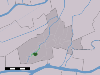
Giessenburg is a town in the Dutch province of South Holland. It is a part of the municipality of Molenlanden, and lies about 6 km west of Gorinchem.

Oostvoorne is a town in the Dutch province of South Holland. It is a part of the municipality of Westvoorne, and lies about 9 km (6 mi) north of Hellevoetsluis.

Ingen is a village in the Dutch province of Gelderland. It is a part of the municipality of Buren, and lies about 9 km south-west of Veenendaal. Before 1999 the town was part of the municipality of Lienden from 1818 till 1999. The houses are widely spread into a bowl form. The houses link to the townships De Ganzert and Eck en Wiel in the West.

Zuidbuurt is a village in the Dutch province of South Holland. It is a part of the municipality of Zoeterwoude, and lies about 6 km north of Zoetermeer.


