An-Nuway'imah

Last updated

Contents

an-Nuway'imah
Arabic transcription(s)
   Arabic النويعمه
   Latin an-Nuwei'ma (official)
al-Nuwayimah (unofficial)
Roman aquaduct near Jericho.jpg
Palestine location map wide.png
Red pog.svg
an-Nuway'imah
Location of an-Nuway'imah within Palestine
Coordinates: 31°53′23″N35°26′40″E / 31.88972°N 35.44444°E / 31.88972; 35.44444
Palestine grid 190/144
State State of Palestine
Governorate Jericho
Government
  Type Village council
Area
  Total
52,600  dunams (52.6 km2 or 20.3 sq mi)
Population
 (2017) [1]
  Total
1,794
  Density34/km2 (88/sq mi)
Name meaningAin en Nueiameh=The spring of the soft soil [2]

al-Nuway'imah (Arabic : النويعمه) is a Palestinian village in the Jericho Governorate in the eastern West Bank, located five kilometers north of Jericho. It is situated in a low elevation below sea level in the central Jordan Valley. The village contains one primary and secondary school. [3]

History

An-Nuway'imah, like the rest of Palestine, was incorporated into the Ottoman Empire in 1517, and in the census of 1596, the village was located in the Nahiya of Quds of the Liwa of Quds. The population was 33 households, all Muslim. The villagers paid a fixed tax rate of 33.3% on various agricultural products, such as wheat, barley, summer crops, goats and/or beehives, water buffaloes, in addition to "occasional revenues"; a total of 5,800 akçe. [4] [5]

In 1883, the PEF's Survey of Western Palestine noted the spring and the aqueduct at An-Nuway'imah. [6]

British Mandate era

In the 1922 census of Palestine conducted by the British Mandate authorities, Nweimeh, together with Al-Auja and ad-Duyuk had a population of 332; 322 Muslims and 10 Christians, [7] where the Christians were 7 Orthodox, and 3 Syrian Catholic. [8]

In the 1931 census Nu'eima had a population of 179 Muslims, in 43 houses. [9]

In the 1945 statistics, the village's population was 240 Muslims [10] and it had jurisdiction over 52,600 dunams of land. [11] Of this, 117 dunams were for citrus and bananas, 1,157 dunams were for plantations and irrigable land, 728 for cereals, [12] while a total of 50,614 dunams were non-cultivable areas. [13]

Jordanian era

In the wake of the 1948 Arab–Israeli War, and after the 1949 Armistice Agreements, An-Nuway'imah came under Jordanian rule. It was annexed by Jordan in 1950.

Post-1967

Since the Six-Day War in 1967, An-Nuway'imah has been under Israeli occupation.

In 1979, Israel confiscated 5,048 dunams of land from the village, in order to construct the Israeli settlement of Na'omi. [14]

After the 1995 accords, 12.5% of the land of An Nuwei’ma was classified as Area A, the remaining 87.5% as Area C. [14]

According to the Palestinian Central Bureau of Statistics, it had a population of approximately 1,170 in mid-year 2006. [15]

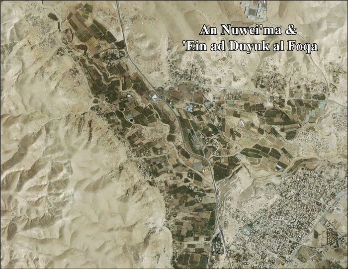
An-Nuway'imah is one of the few villages in the Jordan Valley that has access to spring water. The nearby spring is key to the economy of the village, as it relies on agriculture as a main source of income and food. The most widely-grown crops are bananas and vegetables. Previously, the water from Wadi Nuway'imah was channeled through open pipes which were vulnerable to contamination and water loss but the American Near East Refugee Aid has undergone a $233,000 project to protect the pipes. Today, the spring channels water to the village through enclosed and buried pipes and is used for multiple purposes. [16]

Related Research Articles

<span class="mw-page-title-main">Ein Yabrud</span> Municipality type C in Ramallah and al-Bireh, State of Palestine

Ein Yabrud is a Palestinian town in the Ramallah and al-Bireh Governorate in the central West Bank. It is located approximately 7 km northeast of the city of Ramallah and its elevation is 800 m. According to the Palestinian Central Bureau of Statistics (PCBS) the town had a population of 2,515 in 2017.

<span class="mw-page-title-main">Surif</span> Municipality type A in Hebron, State of Palestine

Surif is a Palestinian City in the Hebron Governorate located 25 km northwest of the city of Hebron. According to the Palestinian Central Bureau of Statistics census, Surif had a population of 17,287 in 2017. The population is entirely Muslim.

<span class="mw-page-title-main">Beit Fajjar</span> Municipality type B in Bethlehem, State of Palestine

Beit Fajjar is a Palestinian town located eight kilometers south of Bethlehem in the Bethlehem Governorate, in the central West Bank. According to the Palestinian Central Bureau of Statistics, the town had a population of over 13,520 in 2017.

'Aqqaba is a Palestinian town located on a slope in the Jordan Valley in the northern West Bank, 15 kilometers northeast of Jenin in the Tubas Governorate of the State of Palestine. According to the Palestinian Central Bureau of Statistics (PCBS), the town had a population of 8,239 inhabitants in the 2017 census.

Beit Ula, Beit Aula, is a Palestinian town in the Hebron Governorate of the State of Palestine, located ten kilometers northwest of Hebron, in the southern West Bank.

<span class="mw-page-title-main">Al-Auja, Jericho</span> Municipality type C in Jericho, State of Palestine

Al-Auja is a Palestinian town in the Jericho Governorate of the State of Palestine, in the eastern West Bank, located ten kilometers north of Jericho. The town has a total area of 107,905 dunams, however its built-up area comprises only 832 dunams. It is situated 230 meters below sea level.

<span class="mw-page-title-main">Qabalan</span> Municipality type C in Nablus, State of Palestine

Qabalan is a Palestinian town in the Nablus Governorate in the eastern West Bank, located 19 kilometers (12 mi) southeast of Nablus. According to the Palestinian Central Bureau of Statistics (PCBS), the town had a population of 8,195 inhabitants in 2017.

<span class="mw-page-title-main">Beit Iba</span> Municipality type C in Nablus, State of Palestine

Beit Iba is a Palestinian village in the Nablus Governorate in the North central West Bank, located 7 kilometers northwest of Nablus. According to the Palestinian Central Bureau of Statistics (PCBS), the village had a population of 4,079 inhabitants in 2017.

<span class="mw-page-title-main">Jab'a</span> Local Development Committee in Bethlehem, State of Palestine

Jab'a is a Palestinian village in the central West Bank, located 17 kilometers north of Hebron and 15 kilometers southwest of Bethlehem. Located three kilometers east of the Green Line, it is located in the Seam Zone, surrounded by the Israeli settlements in the Gush Etzion Regional Council and the Israeli West Bank barrier.

<span class="mw-page-title-main">Deir Sharaf</span> Municipality type D in Nablus, State of Palestine

Deir Sharaf is a Palestinian town in the Nablus Governorate of the State of Palestine, in the northern West Bank, located northwest of Nablus. According to the Palestinian Central Bureau of Statistics (PCBS), the town had a population of 2,949 inhabitants in 2017.

<span class="mw-page-title-main">Deir as-Sudan</span> Municipality type C in Ramallah and al-Bireh, State of Palestine

Deir as-Sudan is a Palestinian town in the Ramallah and al-Bireh Governorate, located 20 kilometers Northwest of Ramallah in the northern West Bank. According to the Palestinian Central Bureau of Statistics (PCBS), the town had a population of approximately 2,159 inhabitants in 2017.

<span class="mw-page-title-main">Al-Mazra'a ash-Sharqiya</span> Municipality type C in Ramallah and al-Bireh, State of Palestine

al-Mazra'a ash-Sharqiya is a Palestinian town in the Ramallah and al-Bireh Governorate, located northeast of Ramallah in the northern West Bank. According to the Palestinian Central Bureau of Statistics (PCBS), the town had a population of 4,063 inhabitants in 2017.

<span class="mw-page-title-main">Deir Ibzi</span> Municipality type C in Ramallah and al-Bireh, State of Palestine

Deir Ibzi is a Palestinian town in the Ramallah and al-Bireh Governorate, located west of Ramallah in the northern West Bank. According to the Palestinian Central Bureau of Statistics, the town had a population of 2,590 inhabitants in 2017.

<span class="mw-page-title-main">Al-Janiya</span> Municipality type D in Ramallah and al-Bireh, State of Palestine

Al-Janiya is a Palestinian village in the Ramallah and al-Bireh Governorate located 8 kilometers northwest of Ramallah in the northern West Bank. According to the Palestinian Central Bureau of Statistics (PCBS), the village had a population of 1,296 inhabitants by 2017.

Ar-Rihiya is a Palestinian town located six kilometers southwest of Hebron. The town is in the Hebron Governorate southern West Bank. According to the Palestinian Central Bureau of Statistics, the town had a population of over 5,754 in 2017.

<span class="mw-page-title-main">Ein Qiniya</span> Local Development Committee in Ramallah and al-Bireh, State of Palestine

Ein Qiniya or 'Ayn Kiniya is a Palestinian village in the northern West Bank, located 7 kilometers (4.3 mi) northwest of Ramallah and part of the Ramallah and al-Bireh Governorate of the State of Palestine. Ein Qiniya has existed since the Roman-era of rule in Palestine. The village is very small with no public structures or institutions and is governed by a local development committee. Ein Qiniya is regionally notable for being a spring and autumn time picnic resort.

Ein ad-Duyuk al-Foqa, also called Duyuk, is a Palestinian village in the Jericho Governorate in the eastern West Bank situated in the Jordan Valley, located 3 kilometers (1.9 mi) northwest of Jericho. According to the Palestinian Central Bureau of Statistics, Ein ad-Duyuk al-Foqa had a population of 885 inhabitants in 2017. In 1997, refugees constituted 27.9% of the population. The primary health care for the village is through contributions from the Ministry of Health and Medical Relief Committee.

<span class="mw-page-title-main">Na'omi</span> Israeli settlement in the West Bank

Na'omi is an Israeli settlement organized as a moshav shitufi in the West Bank. Located in the Jordan Valley three kilometres north of Hisham's Palace, it falls under the jurisdiction of Bik'at HaYarden Regional Council. In 2022 it had a population of 247.

<span class="mw-page-title-main">Burham, Ramallah</span> Local Development Committee in Ramallah and al-Bireh, State of Palestine

Burham is a Palestinian village in the Ramallah and al-Bireh Governorate located twelve kilometers north of Ramallah. The largest nearby town is Bir Zeit located to the southeast. The average elevation of Burham is 680 meters above sea level. The village was established during the Byzantine Empire rule over Palestine.

<span class="mw-page-title-main">Nisf Jubeil</span> Local Development Committee in Nablus, State of Palestine

Nisf Jubeil is a Palestinian village in the Nablus Governorate in the northern West Bank, located northwest of Nablus. According to the Palestinian Central Bureau of Statistics (PCBS) census, it had a population of 394 in 2007. There were a total of 83 households and 17 business establishments. By 2017, the population was 471.

References

  1. Preliminary Results of the Population, Housing and Establishments Census, 2017 (PDF). Palestinian Central Bureau of Statistics (PCBS) (Report). State of Palestine. February 2018. pp. 64–82. Retrieved 2023-10-24.
  2. Palmer, 1881, p. 339
  3. al-Nuway'imah (in Arabic)
  4. Hütteroth and Abdulfattah, 1977, p. 121
  5. Toledano, 1984, p. 297, has Nuway'ima at location 31°53′50″N 35°24′45″E
  6. Conder and Kitchener, 1883, SWP III, pp. 171, 179, 206
  7. Barron, 1923, Table VII, Sub-district of Jericho, p. 19
  8. Barron, 1923, Table XIV, p. 45
  9. Mills, 1932, p. 45
  10. Government of Palestine, Department of Statistics, 1945, p. 25
  11. Government of Palestine, Department of Statistics. Village Statistics, April, 1945. Quoted in Hadawi, 1970, p. 57 Archived 2011-06-04 at the Wayback Machine
  12. Government of Palestine, Department of Statistics. Village Statistics, April, 1945. Quoted in Hadawi, 1970, p. 103 Archived 2016-03-03 at the Wayback Machine
  13. Government of Palestine, Department of Statistics. Village Statistics, April, 1945. Quoted in Hadawi, 1970, p. 153 Archived 2016-03-03 at the Wayback Machine
  14. 1 2 An Nuwei'ma & 'Ein ad Duyuk al Foqa Town Profile, ARIJ, p. 18
  15. Projected Mid -Year Population for Jericho Governorate by Locality 2004- 2006 Archived 2012-02-07 at the Wayback Machine Palestinian Central Bureau of Statistics.
  16. Water in the Desert Archived 2008-05-16 at the Wayback Machine American Near East Refugee Aid.

Bibliography