Related Research Articles

Signy Island is a small subantarctic island in the South Orkney Islands of Antarctica. It was named by the Norwegian whaler Petter Sørlle (1884–1933) after his wife, Signy Therese.

Mount Terror is a large shield volcano that forms the eastern part of Ross Island, Antarctica. It has numerous cinder cones and domes on the flanks of the shield and is mostly under snow and ice. It is the second largest of the four volcanoes that make up Ross Island and is somewhat overshadowed by its neighbour, Mount Erebus, 30 km (19 mi) to the west. Mount Terror was named in 1841 by Sir James Clark Ross for his second ship, HMS Terror. The captain of Terror was Francis Crozier, a close friend of Ross for whom the nearby Cape Crozier is named.
The Queen Elizabeth Range is a rugged mountain range of the Transantarctic Mountains System, located in the Ross Dependency region of Antarctica.
The Ohio Range is a mountain range in the Transantarctic Mountains of Antarctica. It is about 48 km (30 mi) long and 16 km (10 mi) wide, extending WSW-ENE from Eldridge Peak to Mirsky Ledge. The range forms the northeast end of the Horlick Mountains and consists primarily of a large snow-topped plateau with steep northern cliffs and several flat-topped ridges and mountains. The highest point is the summit of Mount Schopf.
The Trojan Range is a mountain range rising to 2,760 metres (9,055 ft), extending northward from Mount Francais along the east side of Iliad Glacier, Anvers Island, in the Palmer Archipelago of the British Antarctic Territory. It was surveyed by the Falkland Islands Dependencies Survey (FIDS) in 1955 and named by the UK Antarctic Place-Names Committee (UK-APC) for the Trojans, one of the opposing sides in the Trojan War in Homer's Iliad.
Borge Bay is a large, irregularly-shaped bay that dominates the east side of Signy Island, in the South Orkney Islands of Antarctica. It was charted in 1912 by Norwegian whaling captain Petter Sorlle, and named for Captain Hans Borge of the Polynesia, who undertook additional mapping of the bay during the following year. It was charted in more detail in 1927 and 1933 by Discovery Investigations personnel, who named many of its features. It was surveyed further in 1947 by the Falkland Islands Dependencies Survey (FIDS), which named several other features.

Mount Bradley is a pyramidal peak, 835 metres (2,740 ft) high, at the southeast end of a ridge descending from Detroit Plateau, surmounting Znepole Ice Piedmont to the east and Dreatin Glacier to the southwest. The peak is 4 nautical miles (7 km) southwest of Mount Reece in the southern Trinity Peninsula. It was charted in 1945 by the Falkland Islands Dependencies Survey, who named it for K.G. Bradley, Colonial Secretary in the Falkland Islands at the time.

Cruyt Spur is a rocky spur 4 nautical miles (7 km) northeast of Ruth Ridge and 3.85 miles (6.20 km) north-northeast of Papiya Nunatak, extending 2 nautical miles (4 km) southeast from the south wall of Detroit Plateau, on the Nordenskjöld Coast of Graham Land, Antarctica. It is surmounting Aleksiev Glacier to the northeast and Kladorub Glacier to the southwest. The spur was mapped from surveys by the Falkland Islands Dependencies Survey (1960–61), and named by the UK Antarctic Place-Names Committee for William Cruyt, a Belgian army engineer who designed the first "auto-polaire" in 1907.

Johnson Spur is a rocky spur located 5.67 miles (9.1 km) south-southeast of Taylor Spur, 8.26 miles (13.3 km) southwest of Batil Spur and 8.65 miles (13.9 km) north-northwest of Long Peak, on the east side of the Sentinel Range in the Ellsworth Mountains of Antarctica. It forms the southeastern extremity of the Doyran Heights, and overlooks Rutford Ice Stream to the east and Obelya Glacier to the west.
Jensen Ridge is a curving ridge running eastward from Foca Point toward Jane Col on Signy Island in the South Orkney Islands. It was named in 1991 by the UK Antarctic Place-Names Committee after Captain Gullik Jensen, of the whaling ship Strombus from Tønsberg, Norway, who made the last whaling expedition to Signy Island in 1935–36.
Paternoster Valley is a valley extending southwestward from Stygian Cove in northern Signy Island. So named by United Kingdom Antarctic Place-Names Committee (UK-APC) from the occurrence of three small paternoster lakes, at different levels in the valley.
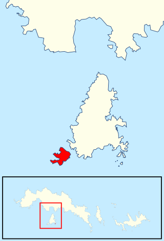
Moe Island is an island 2 km (1.2 mi) long in the South Orkney Islands off Antarctica, separated from the south-west end of Signy Island by Fyr Channel. It was charted by Captain Petter Sørlle in 1912–13, and named after M. Thoralf Moe of Sandefjord, Norway, a contemporary whaling captain who worked in this area. The northernmost point of the island is Spaull Point, named by United Kingdom Antarctic Place-Names Committee (UK-APC) after Vaughan W. Spaull, British Antarctic Survey (BAS) biologist on Signy Island, 1969.
Moraine Valley is a valley filled with morainic debris, 0.75 nautical miles (1.4 km) long, which drains north into Elephant Flats on the east side of Signy Island, in the South Orkney Islands off Antarctica. In summer a stream, fed by the ice slopes at its south end, runs in this valley. It was named by the Falkland Islands Dependencies Survey following their survey of 1947.
The Moss Braes are west-facing slopes situated west of Robin Peak on Signy Island, in the South Orkney Islands off Antarctica. They were named by the UK Antarctic Place-Names Committee in 1990 from the extensive moss banks on the dissected rocky slopes.
Sandefjord Peaks is a set of three conical peaks, the highest 635 m, marking the southwest end of Pomona Plateau at the west end of Coronation Island, in the South Orkney Islands. The southernmost of these peaks was named Sandefjord Peak after nearby Sandefjord Bay by DI personnel in 1933. The collective name, Sandefjord Peaks, was recommended by the United Kingdom Antarctic Place-Names Committee (UK-APC) following a survey of the peaks by the Falkland Islands Dependencies Survey (FIDS) in 1950. They were first climbed in September 1969 by John Edwards, Martin Pinder, Dave Rinning and Eliot Wright after 11 days man-hauling a sledge across from Signy Island
Mount Slaughter is an ice-free peak, rising to 3,444 metres (11,299 ft) on a spur trending southwest from Opalchenie Peak on Vinson Plateau, Sentinel Range, in the Ellsworth Mountains, Antarctica. It is surmounting the head of Donnellan Glacier to the northwest and Gildea Glacier to the south. It was mapped by the United States Geological Survey (USGS) from surveys and U.S. Navy aerial photographs from 1957 to 1960. It was named by the Advisory Committee on Antarctic Names (US-ACAN) in 1982, after John B. Slaughter, the director of the National Science Foundation from 1980 to 1982.
Spindrift Col is a col between hills in north-central Signy Island, 0.5 nautical miles (0.9 km) southeast of Spindrift Rocks. Named by United Kingdom Antarctic Place-Names Committee (UK-APC) in association with Spindrift Rocks.
Robin Peak is a sharply defined rocky summit which is the northernmost peak on Signy Island in the South Orkney Islands. It was named by the United Kingdom Antarctic Place-Names Committee (UK-APC) in 1954 for Gordon de Quetteville Robin of the Falkland Islands Dependencies Survey (FIDS), the leader at Signy Island base in 1947, who made the first detailed survey of the island.
Three Lakes Valley is a low valley containing three freshwater lakes, extending from the vicinity of Elephant Flats northward to Stygian Cove on Signy Island, in the South Orkney Islands. The three lakes, from north to south, are Heywood Lake, Knob Lake, and Pumphouse Lake. The valley was surveyed and given this descriptive name by the Falkland Islands Dependencies Survey (FIDS) in 1947.
Sandefjord Bay is a narrow body of water on the west coast of Coronation Island in the South Orkney Islands of Antarctica. It is 2 mi (3.2 km) long and extends in a northeast-southwest direction between Coronation Island and Monroe Island.
References
- ↑ "Andreaea Plateau". Geographic Names Information System. United States Geological Survey. Retrieved 5 May 2020.
- ↑ "Springtail Spur". Geographic Names Information System. United States Geological Survey. Retrieved 5 May 2020.
![]() This article incorporates public domain material from websites or documents of the United States Geological Survey .
This article incorporates public domain material from websites or documents of the United States Geological Survey .
| | This South Orkney Islands location article is a stub. You can help Wikipedia by expanding it. |